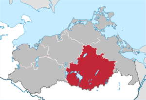
Mecklenburgische Seenplatte District (Q2502618): Difference between revisions
Jump to navigation
Jump to search
(Changed an Item: Adding this statements since they where added in Wikidata) |
(Changed an Item: Adding this statements since they where added in Wikidata) |
||||||||||||||
| Property / GeoNames ID | |||||||||||||||
| Property / GeoNames ID: 8648413 / rank | |||||||||||||||
Normal rank | |||||||||||||||
| Property / GeoNames ID: 8648413 / reference | |||||||||||||||
| Property / NUTS code | |||||||||||||||
| Property / NUTS code: DE80J / rank | |||||||||||||||
Normal rank | |||||||||||||||
| Property / VIAF ID | |||||||||||||||
| Property / VIAF ID: 232489091 / rank | |||||||||||||||
Normal rank | |||||||||||||||
| Property / VIAF ID: 232489091 / reference | |||||||||||||||
| Property / VIAF ID: 232489091 / reference | |||||||||||||||
retrieved: 2 August 2015
| |||||||||||||||
| Property / list of monuments | |||||||||||||||
| Property / list of monuments: Cultural heritage monuments in Landkreis Mecklenburgische Seenplatte / rank | |||||||||||||||
Normal rank | |||||||||||||||
| Property / inception | |||||||||||||||
2011
| |||||||||||||||
| Property / inception: 2011 / rank | |||||||||||||||
Normal rank | |||||||||||||||
| Property / coat of arms image | |||||||||||||||
| Property / coat of arms image: Wappen Mecklenburgische Seenplatte.svg / rank | |||||||||||||||
Normal rank | |||||||||||||||
| Property / population | |||||||||||||||
261,733
| |||||||||||||||
| Property / population: 261,733 / rank | |||||||||||||||
Normal rank | |||||||||||||||
| Property / population: 261,733 / qualifier | |||||||||||||||
point in time: 31 December 2014
| |||||||||||||||
| Property / population: 261,733 / reference | |||||||||||||||
| Property / shares border with | |||||||||||||||
| Property / shares border with: Vorpommern-Greifswald District / rank | |||||||||||||||
Normal rank | |||||||||||||||
| Property / shares border with | |||||||||||||||
| Property / shares border with: Vorpommern-Rügen District / rank | |||||||||||||||
Normal rank | |||||||||||||||
| Property / shares border with | |||||||||||||||
| Property / shares border with: Rostock District / rank | |||||||||||||||
Normal rank | |||||||||||||||
| Property / shares border with | |||||||||||||||
| Property / shares border with: Ludwigslust-Parchim District / rank | |||||||||||||||
Normal rank | |||||||||||||||
| Property / shares border with | |||||||||||||||
| Property / shares border with: Uckermark District / rank | |||||||||||||||
Normal rank | |||||||||||||||
| Property / shares border with | |||||||||||||||
| Property / shares border with: Ostprignitz-Ruppin District / rank | |||||||||||||||
Normal rank | |||||||||||||||
| Property / shares border with | |||||||||||||||
| Property / shares border with: Oberhavel District / rank | |||||||||||||||
Normal rank | |||||||||||||||
| Property / locator map image | |||||||||||||||
| Property / locator map image: Mecklenburg-Vorpommern NB 2011.svg / rank | |||||||||||||||
Normal rank | |||||||||||||||
| Property / official website | |||||||||||||||
| Property / official website: http://www.lk-mecklenburgische-seenplatte.de / rank | |||||||||||||||
Normal rank | |||||||||||||||
| Property / located in time zone | |||||||||||||||
| Property / located in time zone: UTC+01:00 / rank | |||||||||||||||
Normal rank | |||||||||||||||
| Property / located in time zone: UTC+01:00 / qualifier | |||||||||||||||
| Property / located in time zone: UTC+01:00 / reference | |||||||||||||||
| Property / located in time zone: UTC+01:00 / reference | |||||||||||||||
| Property / located in time zone | |||||||||||||||
| Property / located in time zone: UTC+02:00 / rank | |||||||||||||||
Normal rank | |||||||||||||||
| Property / located in time zone: UTC+02:00 / qualifier | |||||||||||||||
| Property / elevation above sea level | |||||||||||||||
57 metre
| |||||||||||||||
| Property / elevation above sea level: 57 metre / rank | |||||||||||||||
Normal rank | |||||||||||||||
| Property / elevation above sea level: 57 metre / reference | |||||||||||||||
| Property / elevation above sea level: 57 metre / reference | |||||||||||||||
| Property / area | |||||||||||||||
5,468.00 square kilometre
| |||||||||||||||
| Property / area: 5,468.00 square kilometre / rank | |||||||||||||||
Normal rank | |||||||||||||||
| Property / area: 5,468.00 square kilometre / reference | |||||||||||||||
| Property / area: 5,468.00 square kilometre / reference | |||||||||||||||
Revision as of 20:23, 3 July 2020
German district
| Language | Label | Description | Also known as |
|---|---|---|---|
| English | Mecklenburgische Seenplatte District |
German district |
Statements
P169 (Deleted Property)
2--43172 Property P169 not found, cannot determine the data type to use.
0 references
Landkreis Mecklenburgische Seenplatte
0 references
2011
0 references


