Landkreis Heidenheim (Q2564776): Difference between revisions
Jump to navigation
Jump to search
(Changed an Item: Adding this statements since they where added in Wikidata) |
(Changed an Item: Adding this statements since they where added in Wikidata) |
||||||||||||||
| Property / contains administrative territorial entity | |||||||||||||||
| Property / contains administrative territorial entity: Sontheim an der Brenz / rank | |||||||||||||||
Normal rank | |||||||||||||||
| Property / contains administrative territorial entity | |||||||||||||||
| Property / contains administrative territorial entity: Steinheim am Albuch / rank | |||||||||||||||
Normal rank | |||||||||||||||
| Property / instance of | |||||||||||||||
| Property / instance of: rural district of Baden-Württemberg / rank | |||||||||||||||
Normal rank | |||||||||||||||
| Property / Freebase ID | |||||||||||||||
| Property / Freebase ID: /m/01k2qf / rank | |||||||||||||||
Normal rank | |||||||||||||||
| Property / Freebase ID: /m/01k2qf / reference | |||||||||||||||
| Property / Freebase ID: /m/01k2qf / reference | |||||||||||||||
publication date: 28 October 2013
| |||||||||||||||
| Property / licence plate code | |||||||||||||||
HDH | |||||||||||||||
| Property / licence plate code: HDH / rank | |||||||||||||||
Normal rank | |||||||||||||||
| Property / licence plate code: HDH / reference | |||||||||||||||
| Property / GeoNames ID | |||||||||||||||
| Property / GeoNames ID: 3220738 / rank | |||||||||||||||
Normal rank | |||||||||||||||
| Property / GeoNames ID: 3220738 / reference | |||||||||||||||
| Property / shares border with | |||||||||||||||
| Property / shares border with: Günzburg / rank | |||||||||||||||
Normal rank | |||||||||||||||
| Property / shares border with | |||||||||||||||
| Property / shares border with: Dillingen / rank | |||||||||||||||
Normal rank | |||||||||||||||
| Property / shares border with | |||||||||||||||
| Property / shares border with: Donau-Ries / rank | |||||||||||||||
Normal rank | |||||||||||||||
| Property / shares border with | |||||||||||||||
| Property / shares border with: Alb-Donau-Kreis / rank | |||||||||||||||
Normal rank | |||||||||||||||
| Property / shares border with | |||||||||||||||
| Property / shares border with: Göppingen / rank | |||||||||||||||
Normal rank | |||||||||||||||
| Property / shares border with | |||||||||||||||
| Property / shares border with: Ostalbkreis / rank | |||||||||||||||
Normal rank | |||||||||||||||
| Property / NUTS code | |||||||||||||||
| Property / NUTS code: DE11C / rank | |||||||||||||||
Normal rank | |||||||||||||||
| Property / official website | |||||||||||||||
| Property / official website: http://www.landkreis-heidenheim.de / rank | |||||||||||||||
Normal rank | |||||||||||||||
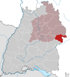
| Property / locator map image | |||||||||||||||
| Property / locator map image: Baden-Württemberg HDH.svg / rank | |||||||||||||||
Normal rank | |||||||||||||||
| Property / locator map image: Baden-Württemberg HDH.svg / reference | |||||||||||||||
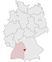
| Property / locator map image | |||||||||||||||
| Property / locator map image: Lage des Landkreises Heidenheim in Deutschland.png / rank | |||||||||||||||
Normal rank | |||||||||||||||
| Property / located in time zone | |||||||||||||||
| Property / located in time zone: UTC+01:00 / rank | |||||||||||||||
Normal rank | |||||||||||||||
| Property / located in time zone: UTC+01:00 / qualifier | |||||||||||||||
| Property / located in time zone: UTC+01:00 / reference | |||||||||||||||
| Property / located in time zone: UTC+01:00 / reference | |||||||||||||||
| Property / located in time zone | |||||||||||||||
| Property / located in time zone: UTC+02:00 / rank | |||||||||||||||
Normal rank | |||||||||||||||
| Property / located in time zone: UTC+02:00 / qualifier | |||||||||||||||
| Property / elevation above sea level | |||||||||||||||
599 metre
| |||||||||||||||
| Property / elevation above sea level: 599 metre / rank | |||||||||||||||
Normal rank | |||||||||||||||
| Property / elevation above sea level: 599 metre / reference | |||||||||||||||
| Property / elevation above sea level: 599 metre / reference | |||||||||||||||
| Property / area | |||||||||||||||
627.19 square kilometre
| |||||||||||||||
| Property / area: 627.19 square kilometre / rank | |||||||||||||||
Normal rank | |||||||||||||||
| Property / area: 627.19 square kilometre / reference | |||||||||||||||
| Property / area: 627.19 square kilometre / reference | |||||||||||||||
Revision as of 16:28, 3 July 2020
district in Baden-Württemberg, Germany
| Language | Label | Description | Also known as |
|---|---|---|---|
| English | Landkreis Heidenheim |
district in Baden-Württemberg, Germany |
Statements
P169 (Deleted Property)
2--4347197 Property P169 not found, cannot determine the data type to use.
0 references


