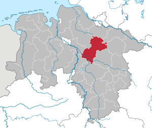
Heidekreis (Q2502730): Difference between revisions
Jump to navigation
Jump to search
(Changed an Item: Adding this statements since they where added in Wikidata) |
(Changed an Item: Adding this statements since they where added in Wikidata) |
||||||||||||||
| Property / contains administrative territorial entity | |||||||||||||||
| Property / contains administrative territorial entity: Neuenkirchen / rank | |||||||||||||||
Normal rank | |||||||||||||||
| Property / contains administrative territorial entity | |||||||||||||||
| Property / contains administrative territorial entity: Bomlitz / rank | |||||||||||||||
Normal rank | |||||||||||||||
| Property / contains administrative territorial entity | |||||||||||||||
| Property / contains administrative territorial entity: Osterheide / rank | |||||||||||||||
Normal rank | |||||||||||||||
| Property / official website | |||||||||||||||
| Property / official website: http://www.heidekreis.de / rank | |||||||||||||||
Normal rank | |||||||||||||||
| Property / official website: http://www.heidekreis.de / reference | |||||||||||||||
| Property / OSM relation ID | |||||||||||||||
| Property / OSM relation ID: 62674 / rank | |||||||||||||||
Normal rank | |||||||||||||||
| Property / OSM relation ID: 62674 / reference | |||||||||||||||
| Property / OSM relation ID: 62674 / reference | |||||||||||||||
retrieved: 11 November 2016
| |||||||||||||||
| Property / TGN ID | |||||||||||||||
| Property / TGN ID: 7099586 / rank | |||||||||||||||
Normal rank | |||||||||||||||
| Property / located in time zone | |||||||||||||||
| Property / located in time zone: UTC+01:00 / rank | |||||||||||||||
Normal rank | |||||||||||||||
| Property / located in time zone: UTC+01:00 / qualifier | |||||||||||||||
| Property / located in time zone: UTC+01:00 / reference | |||||||||||||||
| Property / located in time zone: UTC+01:00 / reference | |||||||||||||||
| Property / located in time zone | |||||||||||||||
| Property / located in time zone: UTC+02:00 / rank | |||||||||||||||
Normal rank | |||||||||||||||
| Property / located in time zone: UTC+02:00 / qualifier | |||||||||||||||
| Property / elevation above sea level | |||||||||||||||
64 metre
| |||||||||||||||
| Property / elevation above sea level: 64 metre / rank | |||||||||||||||
Normal rank | |||||||||||||||
| Property / elevation above sea level: 64 metre / reference | |||||||||||||||
| Property / elevation above sea level: 64 metre / reference | |||||||||||||||
| Property / area | |||||||||||||||
1,873.50 square kilometre
| |||||||||||||||
| Property / area: 1,873.50 square kilometre / rank | |||||||||||||||
Normal rank | |||||||||||||||
| Property / area: 1,873.50 square kilometre / reference | |||||||||||||||
| Property / area: 1,873.50 square kilometre / reference | |||||||||||||||
| Property / population | |||||||||||||||
135,772
| |||||||||||||||
| Property / population: 135,772 / rank | |||||||||||||||
Normal rank | |||||||||||||||
| Property / population: 135,772 / qualifier | |||||||||||||||
point in time: 3 January 2014
| |||||||||||||||
| Property / population: 135,772 / reference | |||||||||||||||
| Property / population: 135,772 / reference | |||||||||||||||
| Property / population | |||||||||||||||
139,641
| |||||||||||||||
| Property / population: 139,641 / rank | |||||||||||||||
Preferred rank | |||||||||||||||
| Property / population: 139,641 / qualifier | |||||||||||||||
point in time: 31 December 2016
| |||||||||||||||
| Property / population: 139,641 / reference | |||||||||||||||
| Property / population | |||||||||||||||
139,755
| |||||||||||||||
| Property / population: 139,755 / rank | |||||||||||||||
Normal rank | |||||||||||||||
| Property / population: 139,755 / qualifier | |||||||||||||||
point in time: 31 October 2019
| |||||||||||||||
| Property / population: 139,755 / reference | |||||||||||||||
| Property / Historical Gazetteer (GOV) ID | |||||||||||||||
| Property / Historical Gazetteer (GOV) ID: adm_133358 / rank | |||||||||||||||
Normal rank | |||||||||||||||
| Property / image | |||||||||||||||
| Property / image: Wilseder Berg 006.jpg / rank | |||||||||||||||
Normal rank | |||||||||||||||
| Property / image: Wilseder Berg 006.jpg / qualifier | |||||||||||||||
| Property / highest point | |||||||||||||||
| Property / highest point: Wilseder Berg / rank | |||||||||||||||
Normal rank | |||||||||||||||
| Property / archINFORM location ID | |||||||||||||||
| Property / archINFORM location ID: 11065 / rank | |||||||||||||||
Normal rank | |||||||||||||||
| Property / archINFORM location ID: 11065 / reference | |||||||||||||||
| Property / archINFORM location ID: 11065 / reference | |||||||||||||||
| Property / archINFORM location ID: 11065 / reference | |||||||||||||||
retrieved: 5 August 2018
| |||||||||||||||
| Property / capital | |||||||||||||||
| Property / capital: Bad Fallingbostel / rank | |||||||||||||||
Normal rank | |||||||||||||||
| Property / capital: Bad Fallingbostel / reference | |||||||||||||||
| Property / category for people born here | |||||||||||||||
| Property / category for people born here: Q2572746 / rank | |||||||||||||||
Normal rank | |||||||||||||||
| Property / category for people who died here | |||||||||||||||
| Property / category for people who died here: Q2572747 / rank | |||||||||||||||
Normal rank | |||||||||||||||
Revision as of 20:11, 3 July 2020
district in Lower Saxony, Germany
| Language | Label | Description | Also known as |
|---|---|---|---|
| English | Heidekreis |
district in Lower Saxony, Germany |
Statements
P169 (Deleted Property)
2--435938 Property P169 not found, cannot determine the data type to use.
0 references
Landkreis Heidekreis
0 references
Landkreis Heidekreis
0 references
139,641
31 December 2016
139,755
31 October 2019
Identifiers
3 references


