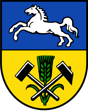
Helmstedt district (Q2502731): Difference between revisions
Jump to navigation
Jump to search
(Changed label, description and/or aliases in en: Aliases in wikidata changed) |
(Changed label, description and/or aliases in sl: The description in Wikidata changed) |
||||||||||
| (21 intermediate revisions by 2 users not shown) | |||||||||||
| label / tr | label / tr | ||||||||||
Landkreis Helmstedt | |||||||||||
| label / sl | label / sl | ||||||||||
Landkreis Helmstedt | |||||||||||
| aliases / en / 0 | aliases / en / 0 | ||||||||||
Helmstedt (district) | |||||||||||
| aliases / en / 1 | aliases / en / 1 | ||||||||||
Landkreis Helmstedt | |||||||||||
| aliases / sl / 0 | aliases / sl / 0 | ||||||||||
Deželno okrožje Helmstedt | |||||||||||
| description / cs | description / cs | ||||||||||
okres ve spolkové zemi Dolní Sasko v Německu | zemský okres ve spolkové zemi Dolní Sasko v Německu | ||||||||||
| description / tr | description / tr | ||||||||||
Aşağı Saksonya'da Landkreis (kırsal bölge) | |||||||||||
| description / sl | description / sl | ||||||||||
deželno okrožje na Spodnjem Saškem v Nemčiji | |||||||||||
| Property / coordinate location | |||||||||||
| |||||||||||
| Property / coordinate location: 52°N, 11°E / rank | |||||||||||
| Property / coordinate location: 52°N, 11°E / reference | |||||||||||
| Property / instance of: 2016 NUTS 3 statistical territorial entity / rank | Property / instance of: 2016 NUTS 3 statistical territorial entity / rank | ||||||||||
Normal rank | |||||||||||
| Property / official website | |||||||||||
| Property / official website: http://www.helmstedt.de/ / rank | |||||||||||
| Property / official website: http://www.helmstedt.de/ / reference | |||||||||||
| Property / ISNI | |||||||||||
| Property / ISNI: 0000 0004 0582 1705 / rank | |||||||||||
| Property / Ringgold ID | |||||||||||
| Property / Ringgold ID: 40725 / rank | |||||||||||
| Property / Ringgold ID: 40725 / reference | |||||||||||
| Property / instance of | |||||||||||
| Property / instance of: 2021 NUTS 3 statistical territorial entity / rank | |||||||||||
Preferred rank | |||||||||||
| Property / flag image | |||||||||||
| Property / flag image: Flagge Landkreis Helmstedt.svg / rank | |||||||||||
Normal rank | |||||||||||
| Property / National Library of Israel J9U ID | |||||||||||
987007555055605171 | |||||||||||
| Property / National Library of Israel J9U ID: 987007555055605171 / rank | |||||||||||
Normal rank | |||||||||||
| Property / museum-digital place ID | |||||||||||
6533 | |||||||||||
| Property / museum-digital place ID: 6533 / rank | |||||||||||
Normal rank | |||||||||||
| Property / museum-digital place ID: 6533 / reference | |||||||||||
| Property / EU Knowledge Graph item ID | |||||||||||
Q2502731 | |||||||||||
| Property / EU Knowledge Graph item ID: Q2502731 / rank | |||||||||||
Normal rank | |||||||||||
| Property / coordinate location | |||||||||||
52°15'0"N, 10°55'12"E
| |||||||||||
| Property / coordinate location: 52°15'0"N, 10°55'12"E / rank | |||||||||||
Normal rank | |||||||||||
| Property / coordinate location: 52°15'0"N, 10°55'12"E / reference | |||||||||||
| Property / Ringgold ID | |||||||||||
| Property / Ringgold ID: 40725 / rank | |||||||||||
Normal rank | |||||||||||
| Property / Ringgold ID: 40725 / reference | |||||||||||
| Property / official website | |||||||||||
| Property / official website: https://www.landkreis-helmstedt.de/ / rank | |||||||||||
Normal rank | |||||||||||
| Property / official website: https://www.landkreis-helmstedt.de/ / qualifier | |||||||||||
| Property / official website: https://www.landkreis-helmstedt.de/ / reference | |||||||||||
| Property / ISNI | |||||||||||
| Property / ISNI: 0000000405821705 / rank | |||||||||||
Normal rank | |||||||||||
| Property / logo image | |||||||||||
| Property / logo image: Landkreis Helmstedt logo (2024).svg / rank | |||||||||||
Normal rank | |||||||||||
Latest revision as of 22:15, 10 October 2024
district of Lower Saxony, Germany
- Helmstedt
- Helmstedt (district)
- Landkreis Helmstedt
| Language | Label | Description | Also known as |
|---|---|---|---|
| English | Helmstedt district |
district of Lower Saxony, Germany |
|
Statements
92,079
31 December 2016
46,066
31 October 2019
Identifiers
3 references
4 references
2--4359797
0 references
DE.NI.HL
0 references
DEU.9.19_1
0 references
987007555055605171
0 references
Q2502731
0 references


