Cham (Q2566708): Difference between revisions

From EU Knowledge Graph
Jump to navigation Jump to search
(‎Changed an Item: Adding this statements since they where added in Wikidata)
Property / licence plate code
 
CHA
Property / licence plate code: CHA / rank
 
Normal rank
Property / licence plate code: CHA / reference
 
Property / licence plate code
 
KÖZ
Property / licence plate code: KÖZ / rank
 
Normal rank
Property / licence plate code: KÖZ / reference
 
Property / licence plate code
 
ROD
Property / licence plate code: ROD / rank
 
Normal rank
Property / licence plate code: ROD / reference
 
Property / licence plate code
 
WÜM
Property / licence plate code: WÜM / rank
 
Normal rank
Property / licence plate code: WÜM / reference
 
Property / GND ID
 
Property / GND ID: 4009719-5 / rank
 
Normal rank
Property / GND ID: 4009719-5 / reference
 
Property / GeoNames ID
 
Property / GeoNames ID: 2940202 / rank
 
Normal rank
Property / GeoNames ID: 2940202 / reference
 
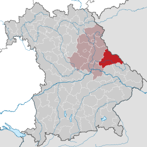
Property / locator map image
 
Property / locator map image: Bavaria CHA.svg / rank
 
Normal rank
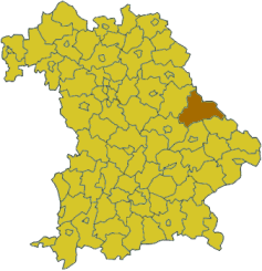
Property / locator map image
 
Property / locator map image: Bavaria cha.png / rank
 
Normal rank
Property / contains administrative territorial entity
 
Property / contains administrative territorial entity: Bad Kötzting / rank
 
Normal rank
Property / contains administrative territorial entity
 
Property / contains administrative territorial entity: Cham / rank
 
Normal rank
Property / contains administrative territorial entity
 
Property / contains administrative territorial entity: Furth im Wald / rank
 
Normal rank
Property / contains administrative territorial entity
 
Property / contains administrative territorial entity: Roding / rank
 
Normal rank
Property / contains administrative territorial entity
 
Property / contains administrative territorial entity: Rötz / rank
 
Normal rank
Property / contains administrative territorial entity
 
Property / contains administrative territorial entity: Waldmünchen / rank
 
Normal rank
Property / contains administrative territorial entity
 
Property / contains administrative territorial entity: Eschlkam / rank
 
Normal rank
Property / contains administrative territorial entity
 
Property / contains administrative territorial entity: Falkenstein / rank
 
Normal rank
Property / contains administrative territorial entity
 
Property / contains administrative territorial entity: Lam / rank
 
Normal rank
Property / contains administrative territorial entity
 
Property / contains administrative territorial entity: Neukirchen beim Heiligen Blut / rank
 
Normal rank
Property / contains administrative territorial entity
 
Property / contains administrative territorial entity: Stamsried / rank
 
Normal rank
Property / contains administrative territorial entity
 
Property / contains administrative territorial entity: Arnschwang / rank
 
Normal rank

Revision as of 15:09, 3 July 2020

district of Bavaria, Germany
Language Label Description Also known as
English
Cham
district of Bavaria, Germany

    Statements

    0 references
    P169 (Deleted Property)
    2--43349 Property P169 not found, cannot determine the data type to use.
    0 references
    Bavaria CHA.svg
    4,944 × 4,924; 1.1 MB
    0 references
    Bavaria cha.png
    237 × 245; 15 KB
    0 references
    0 references
    0 references
    0 references
    0 references
    0 references
    0 references
    0 references
    0 references
    0 references
    0 references
    0 references

    Identifiers