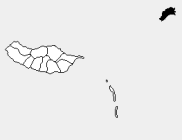
Porto Santo (Q2997002): Difference between revisions
Jump to navigation
Jump to search
(Changed an Item: Adding these statements since they where added in Wikidata) |
(Changed an Item: Adding these statements since they where added in Wikidata) |
||||||||||||||
| (12 intermediate revisions by 2 users not shown) | |||||||||||||||
| label / ga | label / ga | ||||||||||||||
Porto Santo | |||||||||||||||
| Property / Encyclopædia Britannica Online ID | |||||||||||||||
| Property / Encyclopædia Britannica Online ID: place/Porto-Santo-Island / rank | |||||||||||||||
| Property / NKCR AUT ID | |||||||||||||||
| Property / NKCR AUT ID: ge584258 / rank | |||||||||||||||
| Property / instance of | |||||||||||||||
| Property / instance of: Island / rank | |||||||||||||||
Normal rank | |||||||||||||||
| Property / locator map image | |||||||||||||||
| Property / locator map image: PT Porto Santo.PNG / rank | |||||||||||||||
Preferred rank | |||||||||||||||
| Property / population | |||||||||||||||
5,149
| |||||||||||||||
| Property / population: 5,149 / rank | |||||||||||||||
Preferred rank | |||||||||||||||
| Property / population: 5,149 / qualifier | |||||||||||||||
| Property / population: 5,149 / qualifier | |||||||||||||||
point in time: 2021
| |||||||||||||||
| Property / population: 5,149 / reference | |||||||||||||||
| Property / population: 5,149 / reference | |||||||||||||||
retrieved: 19 August 2023
| |||||||||||||||
| Property / described by source | |||||||||||||||
| Property / described by source: Meyers Konversations-Lexikon, 4th edition (1885 - 1890) / rank | |||||||||||||||
Normal rank | |||||||||||||||
| Property / described by source: Meyers Konversations-Lexikon, 4th edition (1885 - 1890) / qualifier | |||||||||||||||
| Property / FactGrid item ID | |||||||||||||||
Q359758 | |||||||||||||||
| Property / FactGrid item ID: Q359758 / rank | |||||||||||||||
Normal rank | |||||||||||||||
| Property / EU Knowledge Graph item ID | |||||||||||||||
Q2997002 | |||||||||||||||
| Property / EU Knowledge Graph item ID: Q2997002 / rank | |||||||||||||||
Normal rank | |||||||||||||||
| Property / NKCR AUT ID | |||||||||||||||
| Property / NKCR AUT ID: ge584258 / rank | |||||||||||||||
Normal rank | |||||||||||||||
| Property / NKCR AUT ID: ge584258 / qualifier | |||||||||||||||
named as: Porto Santo (ostrov) | |||||||||||||||
| Property / Portuguese Registration ID | |||||||||||||||
511236425 | |||||||||||||||
| Property / Portuguese Registration ID: 511236425 / rank | |||||||||||||||
Normal rank | |||||||||||||||
| Property / highest point | |||||||||||||||
| Property / highest point: Pico do Facho / rank | |||||||||||||||
Normal rank | |||||||||||||||
| Property / highest point: Pico do Facho / qualifier | |||||||||||||||
elevation above sea level: 516 metre
| |||||||||||||||
| Property / detail map | |||||||||||||||
| Property / detail map: Mapa Porto Santo pt.JPG / rank | |||||||||||||||
Normal rank | |||||||||||||||
| Property / WorldCat Entities ID | |||||||||||||||
E39PBJpdMyHjk8brHXbGwXQ8YP | |||||||||||||||
| Property / WorldCat Entities ID: E39PBJpdMyHjk8brHXbGwXQ8YP / rank | |||||||||||||||
Normal rank | |||||||||||||||
| Property / Encyclopædia Britannica Online ID | |||||||||||||||
| Property / Encyclopædia Britannica Online ID: place/Porto-Santo-Island / rank | |||||||||||||||
Normal rank | |||||||||||||||
| Property / Encyclopædia Britannica Online ID: place/Porto-Santo-Island / qualifier | |||||||||||||||
named as: Porto Santo Island | |||||||||||||||
Latest revision as of 12:37, 11 October 2023
No description defined
- Porto Santo Island Municipality
- Porto Santo municipality
| Language | Label | Description | Also known as |
|---|---|---|---|
| English | Porto Santo |
No description defined |
|
Statements
Porto Santo
0 references
43.01 square kilometre
5,483
2011
3 references
5,149
2 references
Identifiers
2--4698
0 references
3 references
Porto_Santo
0 references
Q359758
0 references
Q2997002
0 references
511236425
0 references
E39PBJpdMyHjk8brHXbGwXQ8YP
0 references


