Bulzi (Q289453): Difference between revisions
Jump to navigation
Jump to search
(Changed an Item: Adding this statements since they where added in Wikidata) |
(Changed an Item: Adding these statements since they where added in Wikidata) |
||||||||||||||
| (16 intermediate revisions by 2 users not shown) | |||||||||||||||
| label / ga | label / ga | ||||||||||||||
Bulzi | |||||||||||||||
| description / tr | description / tr | ||||||||||||||
İtalya | Sassari iline bağlı komün (Sardinya, İtalya) | ||||||||||||||
| Property / instance of | |||||||||||||||
| Property / instance of: beneficiary / rank | |||||||||||||||
| Property / located in the administrative territorial entity | |||||||||||||||
| Property / located in the administrative territorial entity: Province of Sassari / rank | |||||||||||||||
| Property / located in the administrative territorial entity: Province of Sassari / reference | |||||||||||||||
| Property / instance of | |||||||||||||||
| Property / instance of: beneficiary / rank | |||||||||||||||
Preferred rank | |||||||||||||||
| Property / instance of | |||||||||||||||
| Property / instance of: public beneficiary / rank | |||||||||||||||
Normal rank | |||||||||||||||
| Property / instance of: public beneficiary / qualifier | |||||||||||||||
| Property / VIAF ID | |||||||||||||||
| Property / VIAF ID: 132980430 / rank | |||||||||||||||
Normal rank | |||||||||||||||
| Property / VIAF ID: 132980430 / reference | |||||||||||||||
| Property / VIAF ID: 132980430 / reference | |||||||||||||||
retrieved: 3 August 2015
| |||||||||||||||
| Property / coordinate location | |||||||||||||||
40°50'49"N, 8°49'49"E
| |||||||||||||||
| Property / coordinate location: 40°50'49"N, 8°49'49"E / rank | |||||||||||||||
Normal rank | |||||||||||||||
| Property / coordinate location: 40°50'49"N, 8°49'49"E / reference | |||||||||||||||
| Property / coordinates of northernmost point | |||||||||||||||
40°52'47.964"N, 8°51'54.652"E
| |||||||||||||||
| Property / coordinates of northernmost point: 40°52'47.964"N, 8°51'54.652"E / rank | |||||||||||||||
Normal rank | |||||||||||||||
| Property / coordinates of northernmost point: 40°52'47.964"N, 8°51'54.652"E / reference | |||||||||||||||
| Property / coordinates of southernmost point | |||||||||||||||
40°49'29.356"N, 8°51'47.412"E
| |||||||||||||||
| Property / coordinates of southernmost point: 40°49'29.356"N, 8°51'47.412"E / rank | |||||||||||||||
Normal rank | |||||||||||||||
| Property / coordinates of southernmost point: 40°49'29.356"N, 8°51'47.412"E / reference | |||||||||||||||
| Property / coordinates of easternmost point | |||||||||||||||
40°51'25.128"N, 8°53'14.266"E
| |||||||||||||||
| Property / coordinates of easternmost point: 40°51'25.128"N, 8°53'14.266"E / rank | |||||||||||||||
Normal rank | |||||||||||||||
| Property / coordinates of easternmost point: 40°51'25.128"N, 8°53'14.266"E / reference | |||||||||||||||
| Property / coordinates of westernmost point | |||||||||||||||
40°51'48.625"N, 8°48'52.283"E
| |||||||||||||||
| Property / coordinates of westernmost point: 40°51'48.625"N, 8°48'52.283"E / rank | |||||||||||||||
Normal rank | |||||||||||||||
| Property / coordinates of westernmost point: 40°51'48.625"N, 8°48'52.283"E / reference | |||||||||||||||
| Property / OSM relation ID | |||||||||||||||
| Property / OSM relation ID: 40806 / rank | |||||||||||||||
Normal rank | |||||||||||||||
| Property / TGN ID | |||||||||||||||
| Property / TGN ID: 5002748 / rank | |||||||||||||||
Normal rank | |||||||||||||||
| Property / elevation above sea level | |||||||||||||||
250 metre
| |||||||||||||||
| Property / elevation above sea level: 250 metre / rank | |||||||||||||||
Normal rank | |||||||||||||||
| Property / elevation above sea level: 250 metre / reference | |||||||||||||||
| Property / capital | |||||||||||||||
| Property / capital: Bulzi / rank | |||||||||||||||
Normal rank | |||||||||||||||
| Property / area | |||||||||||||||
21.67 square kilometre
| |||||||||||||||
| Property / area: 21.67 square kilometre / rank | |||||||||||||||
Normal rank | |||||||||||||||
| Property / area: 21.67 square kilometre / qualifier | |||||||||||||||
point in time: 9 October 2011
| |||||||||||||||
| Property / area: 21.67 square kilometre / reference | |||||||||||||||
| Property / area: 21.67 square kilometre / reference | |||||||||||||||
| Property / area: 21.67 square kilometre / reference | |||||||||||||||
title: Superficie di Comuni Province e Regioni italiane al 9 ottobre 2011 (Italian) | |||||||||||||||
| Property / area: 21.67 square kilometre / reference | |||||||||||||||
retrieved: 16 March 2019
| |||||||||||||||
| Property / area: 21.67 square kilometre / reference | |||||||||||||||
| Property / population | |||||||||||||||
512
| |||||||||||||||
| Property / population: 512 / rank | |||||||||||||||
Normal rank | |||||||||||||||
| Property / population: 512 / qualifier | |||||||||||||||
point in time: 1 January 2017
| |||||||||||||||
| Property / population: 512 / qualifier | |||||||||||||||
| Property / population: 512 / reference | |||||||||||||||
| Property / population | |||||||||||||||
507
| |||||||||||||||
| Property / population: 507 / rank | |||||||||||||||
Preferred rank | |||||||||||||||
| Property / population: 507 / qualifier | |||||||||||||||
point in time: 1 January 2018
| |||||||||||||||
| Property / population: 507 / qualifier | |||||||||||||||
| Property / population: 507 / reference | |||||||||||||||
| Property / population: 507 / reference | |||||||||||||||
title: Popolazione Residente al 1° Gennaio 2018 (Italian) | |||||||||||||||
| Property / population: 507 / reference | |||||||||||||||
retrieved: 16 March 2019
| |||||||||||||||
| Property / population: 507 / reference | |||||||||||||||
| Property / population | |||||||||||||||
453
| |||||||||||||||
| Property / population: 453 / rank | |||||||||||||||
Preferred rank | |||||||||||||||
| Property / population: 453 / qualifier | |||||||||||||||
point in time: 1 January 2023
| |||||||||||||||
| Property / population: 453 / reference | |||||||||||||||
| Property / population | |||||||||||||||
507
| |||||||||||||||
| Property / population: 507 / rank | |||||||||||||||
Normal rank | |||||||||||||||
| Property / population: 507 / qualifier | |||||||||||||||
point in time: 1 January 2018
| |||||||||||||||
| Property / population: 507 / qualifier | |||||||||||||||
| Property / population: 507 / reference | |||||||||||||||
| Property / population: 507 / reference | |||||||||||||||
title: Popolazione Residente al 1° Gennaio 2018 (Italian) | |||||||||||||||
| Property / population: 507 / reference | |||||||||||||||
retrieved: 16 March 2019
| |||||||||||||||
| Property / population: 507 / reference | |||||||||||||||
| Property / licence plate code | |||||||||||||||
SS | |||||||||||||||
| Property / licence plate code: SS / rank | |||||||||||||||
Normal rank | |||||||||||||||
| Property / IndicePA ID | |||||||||||||||
| Property / IndicePA ID: c_b265 / rank | |||||||||||||||
Normal rank | |||||||||||||||
| Property / Who's on First ID | |||||||||||||||
| Property / Who's on First ID: 101777407 / rank | |||||||||||||||
Normal rank | |||||||||||||||
| Property / Wiki Loves Monuments ID | |||||||||||||||
20B2650000 | |||||||||||||||
| Property / Wiki Loves Monuments ID: 20B2650000 / rank | |||||||||||||||
Normal rank | |||||||||||||||
| Property / Wiki Loves Monuments ID: 20B2650000 / qualifier | |||||||||||||||
start time: 1 September 2020
| |||||||||||||||
| Property / Wiki Loves Monuments ID: 20B2650000 / reference | |||||||||||||||
| Property / located in the administrative territorial entity | |||||||||||||||
| Property / located in the administrative territorial entity: Province of Sassari / rank | |||||||||||||||
Normal rank | |||||||||||||||
| Property / located in the administrative territorial entity: Province of Sassari / reference | |||||||||||||||
| Property / De Agostini ID | |||||||||||||||
| Property / De Agostini ID: Bulzi / rank | |||||||||||||||
Normal rank | |||||||||||||||
| Property / De Agostini ID: Bulzi / qualifier | |||||||||||||||
named as: Bulzi | |||||||||||||||
| Property / seismic classification | |||||||||||||||
| Property / seismic classification: 4 / rank | |||||||||||||||
Normal rank | |||||||||||||||
| Property / seismic classification: 4 / reference | |||||||||||||||
| Property / seismic classification: 4 / reference | |||||||||||||||
| Property / seismic classification: 4 / reference | |||||||||||||||
retrieved: 27 August 2022
| |||||||||||||||
| Property / EU Knowledge Graph item ID | |||||||||||||||
Q289453 | |||||||||||||||
| Property / EU Knowledge Graph item ID: Q289453 / rank | |||||||||||||||
Normal rank | |||||||||||||||
| Property / patron saint | |||||||||||||||
| Property / patron saint: Saint Sebastian / rank | |||||||||||||||
Normal rank | |||||||||||||||
| Property / patron saint: Saint Sebastian / qualifier | |||||||||||||||
| Property / patron saint: Saint Sebastian / reference | |||||||||||||||
Latest revision as of 10:14, 11 December 2023
Italian comune
| Language | Label | Description | Also known as |
|---|---|---|---|
| English | Bulzi |
Italian comune |
Statements

07030
0 references
Bulzi
0 references
079
0 references
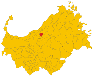
_-_2016.svg)
Map of comune of Bulzi (province of Sassari, region Sardinia, Italy) - 2016.svg
8,800 × 7,300; 248 KB
8,800 × 7,300; 248 KB
0 references


21.67 square kilometre
9 October 2011
5 references
Superficie di Comuni Province e Regioni italiane al 9 ottobre 2011 (Italian)
16 March 2019
512
1 January 2017
1 reference
507
1 January 2018
4 references
Popolazione Residente al 1° Gennaio 2018 (Italian)
16 March 2019
507
1 January 2018
4 references
Popolazione Residente al 1° Gennaio 2018 (Italian)
16 March 2019
SS
0 references
Identifiers
80003620905
0 references
Q289453
0 references