Dolo (Q262346): Difference between revisions
Jump to navigation
Jump to search
(Changed an Item: Adding this statements since they where added in Wikidata) |
(Changed an Item: Adding this statements since they where added in Wikidata) |
||||||||||||||
| Property / instance of | |||||||||||||||
| Property / instance of: commune of Italy / rank | |||||||||||||||
Normal rank | |||||||||||||||
| Property / official website | |||||||||||||||
| Property / official website: http://www.comune.dolo.ve.it/ / rank | |||||||||||||||
Normal rank | |||||||||||||||
| Property / official website: http://www.comune.dolo.ve.it/ / reference | |||||||||||||||
| Property / Freebase ID | |||||||||||||||
| Property / Freebase ID: /m/0g9f56 / rank | |||||||||||||||
Normal rank | |||||||||||||||
| Property / Freebase ID: /m/0g9f56 / reference | |||||||||||||||
| Property / Freebase ID: /m/0g9f56 / reference | |||||||||||||||
publication date: 28 October 2013
| |||||||||||||||
| Property / GeoNames ID | |||||||||||||||
| Property / GeoNames ID: 6536660 / rank | |||||||||||||||
Normal rank | |||||||||||||||
| Property / GeoNames ID: 6536660 / reference | |||||||||||||||
| Property / category for people who died here | |||||||||||||||
| Property / category for people who died here: Category:Deaths in Dolo / rank | |||||||||||||||
Normal rank | |||||||||||||||
| Property / category for people who died here: Category:Deaths in Dolo / reference | |||||||||||||||
| Property / category for people born here | |||||||||||||||
| Property / category for people born here: Q2601780 / rank | |||||||||||||||
Normal rank | |||||||||||||||
| Property / category for people born here: Q2601780 / reference | |||||||||||||||
| Property / MusicBrainz area ID | |||||||||||||||
| Property / MusicBrainz area ID: cb880f96-0229-482f-9cb2-5908c30c45ac / rank | |||||||||||||||
Normal rank | |||||||||||||||
| Property / MusicBrainz area ID: cb880f96-0229-482f-9cb2-5908c30c45ac / reference | |||||||||||||||
| Property / topic's main category | |||||||||||||||
| Property / topic's main category: Category:Dolo (Italy) / rank | |||||||||||||||
Normal rank | |||||||||||||||
| Property / topic's main category: Category:Dolo (Italy) / reference | |||||||||||||||
| Property / Digital Atlas of the Roman Empire ID | |||||||||||||||
| Property / Digital Atlas of the Roman Empire ID: 17836 / rank | |||||||||||||||
Normal rank | |||||||||||||||
| Property / elevation above sea level | |||||||||||||||
7±1 metre
| |||||||||||||||
| Property / elevation above sea level: 7±1 metre / rank | |||||||||||||||
Normal rank | |||||||||||||||
| Property / elevation above sea level: 7±1 metre / reference | |||||||||||||||
| Property / category of associated people | |||||||||||||||
| Property / category of associated people: Category:People of Dolo / rank | |||||||||||||||
Normal rank | |||||||||||||||
| Property / coordinates of northernmost point | |||||||||||||||
45°27'2.138"N, 12°2'32.082"E
| |||||||||||||||
| Property / coordinates of northernmost point: 45°27'2.138"N, 12°2'32.082"E / rank | |||||||||||||||
Normal rank | |||||||||||||||
| Property / coordinates of northernmost point: 45°27'2.138"N, 12°2'32.082"E / reference | |||||||||||||||
| Property / coordinates of southernmost point | |||||||||||||||
45°23'29.576"N, 12°7'27.199"E
| |||||||||||||||
| Property / coordinates of southernmost point: 45°23'29.576"N, 12°7'27.199"E / rank | |||||||||||||||
Normal rank | |||||||||||||||
| Property / coordinates of southernmost point: 45°23'29.576"N, 12°7'27.199"E / reference | |||||||||||||||
| Property / coordinates of easternmost point | |||||||||||||||
45°24'47.336"N, 12°7'54.538"E
| |||||||||||||||
| Property / coordinates of easternmost point: 45°24'47.336"N, 12°7'54.538"E / rank | |||||||||||||||
Normal rank | |||||||||||||||
| Property / coordinates of easternmost point: 45°24'47.336"N, 12°7'54.538"E / reference | |||||||||||||||
| Property / coordinates of westernmost point | |||||||||||||||
45°26'1.666"N, 12°2'9.089"E
| |||||||||||||||
| Property / coordinates of westernmost point: 45°26'1.666"N, 12°2'9.089"E / rank | |||||||||||||||
Normal rank | |||||||||||||||
| Property / coordinates of westernmost point: 45°26'1.666"N, 12°2'9.089"E / reference | |||||||||||||||
| Property / OSM relation ID | |||||||||||||||
| Property / OSM relation ID: 44922 / rank | |||||||||||||||
Normal rank | |||||||||||||||
| Property / area | |||||||||||||||
24.28 square kilometre
| |||||||||||||||
| Property / area: 24.28 square kilometre / rank | |||||||||||||||
Normal rank | |||||||||||||||
| Property / area: 24.28 square kilometre / qualifier | |||||||||||||||
point in time: 9 October 2011
| |||||||||||||||
| Property / area: 24.28 square kilometre / reference | |||||||||||||||
| Property / area: 24.28 square kilometre / reference | |||||||||||||||
| Property / area: 24.28 square kilometre / reference | |||||||||||||||
title: Superficie di Comuni Province e Regioni italiane al 9 ottobre 2011 (Italian) | |||||||||||||||
| Property / area: 24.28 square kilometre / reference | |||||||||||||||
retrieved: 16 March 2019
| |||||||||||||||
| Property / area: 24.28 square kilometre / reference | |||||||||||||||
| Property / population | |||||||||||||||
14,953
| |||||||||||||||
| Property / population: 14,953 / rank | |||||||||||||||
Normal rank | |||||||||||||||
| Property / population: 14,953 / qualifier | |||||||||||||||
point in time: 1 January 2017
| |||||||||||||||
| Property / population: 14,953 / qualifier | |||||||||||||||
| Property / population: 14,953 / reference | |||||||||||||||
| Property / population | |||||||||||||||
15,022
| |||||||||||||||
| Property / population: 15,022 / rank | |||||||||||||||
Preferred rank | |||||||||||||||
| Property / population: 15,022 / qualifier | |||||||||||||||
point in time: 1 January 2018
| |||||||||||||||
| Property / population: 15,022 / qualifier | |||||||||||||||
| Property / population: 15,022 / reference | |||||||||||||||
| Property / population: 15,022 / reference | |||||||||||||||
title: Popolazione Residente al 1° Gennaio 2018 (Italian) | |||||||||||||||
| Property / population: 15,022 / reference | |||||||||||||||
retrieved: 16 March 2019
| |||||||||||||||
| Property / population: 15,022 / reference | |||||||||||||||
| Property / UN/LOCODE | |||||||||||||||
| Property / UN/LOCODE: ITDOL / rank | |||||||||||||||
Normal rank | |||||||||||||||
Revision as of 19:14, 5 August 2020
Italian comune
| Language | Label | Description | Also known as |
|---|---|---|---|
| English | Dolo |
Italian comune |
Statements

45°25'29.57"N, 12°4'32.92"E
0 references
30031
0 references
Dolo, Veneto
0 references
30 August 2015
1 reference

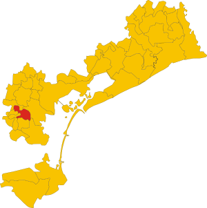
.svg)
Map of comune of Dolo (province of Venice, region Veneto, Italy).svg
4,120 × 4,131; 126 KB
4,120 × 4,131; 126 KB
1 reference


24.28 square kilometre
9 October 2011
5 references
Superficie di Comuni Province e Regioni italiane al 9 ottobre 2011 (Italian)
16 March 2019
14,953
1 January 2017
1 reference
15,022
1 January 2018
4 references
Popolazione Residente al 1° Gennaio 2018 (Italian)
16 March 2019
Identifiers
82001910270
0 references