Cadorago (Q260653): Difference between revisions
Jump to navigation
Jump to search
(Removed claim: instance of (P35): beneficiary (Q196899), Removing claim) |
(Changed an Item: Adding these statements since they where added in Wikidata) |
||||||||||||||
| (13 intermediate revisions by 2 users not shown) | |||||||||||||||
| label / it | label / it | ||||||||||||||
CADORAGO | |||||||||||||||
| label / tr | label / tr | ||||||||||||||
Cadorago | |||||||||||||||
| label / ga | label / ga | ||||||||||||||
Cadorago | |||||||||||||||
| label / el | label / el | ||||||||||||||
Καντοράγκο | |||||||||||||||
| description / tr | description / tr | ||||||||||||||
İtalya | Como iline bağlı komün (Lombardiya, İtalya) | ||||||||||||||
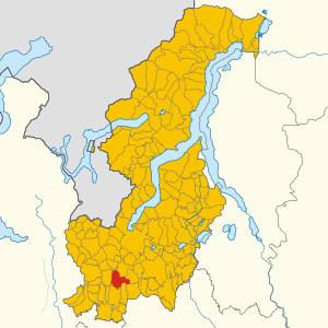
| Property / locator map image | |||||||||||||||
| Property / locator map image: Map of comune of Cadorago (province of Como, region Lombardy, Italy).svg / rank | |||||||||||||||
| Property / instance of | |||||||||||||||
| Property / instance of: beneficiary / rank | |||||||||||||||
Preferred rank | |||||||||||||||
| Property / instance of | |||||||||||||||
| Property / instance of: public beneficiary / rank | |||||||||||||||
Normal rank | |||||||||||||||
| Property / instance of: public beneficiary / qualifier | |||||||||||||||
| Property / seismic classification | |||||||||||||||
| Property / seismic classification: 4 / rank | |||||||||||||||
Normal rank | |||||||||||||||
| Property / seismic classification: 4 / reference | |||||||||||||||
| Property / seismic classification: 4 / reference | |||||||||||||||
| Property / seismic classification: 4 / reference | |||||||||||||||
retrieved: 27 August 2022
| |||||||||||||||
| Property / EU Knowledge Graph item ID | |||||||||||||||
Q260653 | |||||||||||||||
| Property / EU Knowledge Graph item ID: Q260653 / rank | |||||||||||||||
Normal rank | |||||||||||||||
| Property / image | |||||||||||||||
| Property / image: Cadorago - frazione Caslino al Piano - santuario di Sant’Anna.jpg / rank | |||||||||||||||
Normal rank | |||||||||||||||
| Property / locator map image | |||||||||||||||
| Property / locator map image: Map of Cadorago (Province of Como, region Lombardy, Italy 2023).svg / rank | |||||||||||||||
Normal rank | |||||||||||||||
| links / trwiki / name | links / trwiki / name | ||||||||||||||
Latest revision as of 17:13, 19 November 2023
Italian comune
| Language | Label | Description | Also known as |
|---|---|---|---|
| English | Cadorago |
Italian comune |
Statements

22071
0 references
Cadorago
0 references
031
0 references
CO
0 references


7.19 square kilometre
9 October 2011
5 references
Superficie di Comuni Province e Regioni italiane al 9 ottobre 2011 (Italian)
16 March 2019
7,919
1 January 2017
1 reference
7,979
1 January 2018
4 references
Popolazione Residente al 1° Gennaio 2018 (Italian)
16 March 2019

.svg)
.svg)
.svg)
Map of Cadorago (Province of Como, region Lombardy, Italy 2023).svg
1,250 × 1,250; 1.72 MB
1,250 × 1,250; 1.72 MB
0 references
Identifiers
696750132
0 references
3000068
0 references
Q260653
0 references