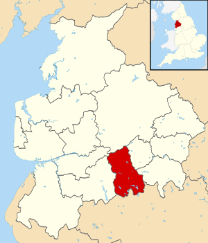
Blackburn with Darwen (Q2555152): Difference between revisions
Jump to navigation
Jump to search
(Removed claims: Removing this statements since they changed in Wikidata) |
(Changed an Item: Adding these statements since they where added in Wikidata) |
||
| Property / Encyclopædia Britannica Online ID | |||
| Property / Encyclopædia Britannica Online ID: place/Blackburn-with-Darwen / rank | |||
Normal rank | |||
| Property / Encyclopædia Britannica Online ID: place/Blackburn-with-Darwen / qualifier | |||
named as: Blackburn with Darwen | |||
| Property / legislative body | |||
| Property / legislative body: council of Blackburn with Darwen Borough Council / rank | |||
Normal rank | |||
| Property / authority | |||
| Property / authority: Blackburn with Darwen Borough Council / rank | |||
Normal rank | |||
Revision as of 11:11, 23 December 2023
unitary authority area in Lancashire, North West England
- Borough of Blackburn with Darwen
- Blackburn
| Language | Label | Description | Also known as |
|---|---|---|---|
| English | Blackburn with Darwen |
unitary authority area in Lancashire, North West England |
|
Statements
146,800
148,942
154,739
21 March 2021
5 references
1 July 2023
1 July 2023
Blackburn with Darwen (Unitary District, Blackburn with Darwen, United Kingdom) - Population Statistics, Charts, Map and Location (English)
137.0 square kilometre
2021
5 references
1 July 2023
1 July 2023
Blackburn with Darwen (Unitary District, Blackburn with Darwen, United Kingdom) - Population Statistics, Charts, Map and Location (English)
Identifiers
UKA8
5 references
30 December 2013
List of FIPS region codes (S-U) (English)
7000000000038840
0 references
GB.BW
0 references
3 references
3 references
987007496496805171
Q2555152
0 references


