Kurdějov (Q227744): Difference between revisions
Jump to navigation
Jump to search
(Removed claim: image (P147): Kurdějov, kostel sv. Jana Křtitele (6).jpg, Removing this statements since they changed in Wikidata) |
(Changed an Item: Adding this statements since they where added in Wikidata) |
||||||||||||||
| Property / population | |||||||||||||||
421
| |||||||||||||||
| Property / population: 421 / rank | |||||||||||||||
Normal rank | |||||||||||||||
| Property / population: 421 / qualifier | |||||||||||||||
point in time: 1 January 2019
| |||||||||||||||
| Property / population: 421 / qualifier | |||||||||||||||
| Property / population: 421 / qualifier | |||||||||||||||
male population: 220
| |||||||||||||||
| Property / population: 421 / qualifier | |||||||||||||||
female population: 201
| |||||||||||||||
| Property / population: 421 / reference | |||||||||||||||
| Property / population: 421 / reference | |||||||||||||||
retrieved: 4 May 2019
| |||||||||||||||
| Property / population | |||||||||||||||
439
| |||||||||||||||
| Property / population: 439 / rank | |||||||||||||||
Preferred rank | |||||||||||||||
| Property / population: 439 / qualifier | |||||||||||||||
point in time: 1 January 2020
| |||||||||||||||
| Property / population: 439 / qualifier | |||||||||||||||
| Property / population: 439 / qualifier | |||||||||||||||
male population: 231
| |||||||||||||||
| Property / population: 439 / qualifier | |||||||||||||||
female population: 208
| |||||||||||||||
| Property / population: 439 / reference | |||||||||||||||
| Property / population: 439 / reference | |||||||||||||||
retrieved: 1 May 2020
| |||||||||||||||
| Property / located in the administrative territorial entity | |||||||||||||||
| Property / located in the administrative territorial entity: Břeclav District / rank | |||||||||||||||
Normal rank | |||||||||||||||
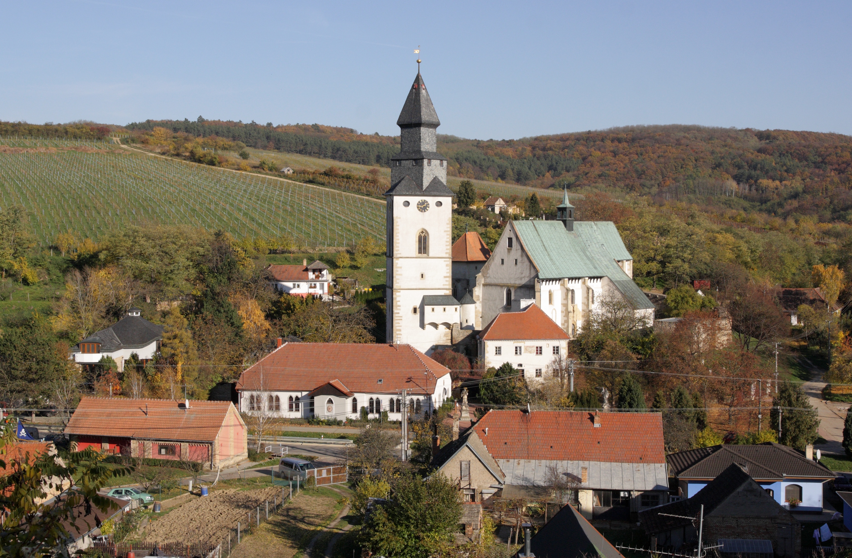
| Property / image | |||||||||||||||
| Property / image: Kurdějov - kostel svatého Jana Křtitele, pohled od západu obr5.jpg / rank | |||||||||||||||
Normal rank | |||||||||||||||
| Property / geoshape | |||||||||||||||
| Property / geoshape: Data:Map of Kurdějov, Břeclav District.map / rank | |||||||||||||||
Normal rank | |||||||||||||||
| Property / geoshape: Data:Map of Kurdějov, Břeclav District.map / reference | |||||||||||||||
Revision as of 05:48, 6 August 2020
Village in Břeclav District of South Moravian region
| Language | Label | Description | Also known as |
|---|---|---|---|
| English | Kurdějov |
Village in Břeclav District of South Moravian region |
Statements
2 references
Kurdějov
0 references
413
1 January 2014
347
298
347
370
412
524
965
916
945
993
1,010
1,060
978
429
2 references
3 September 2016
420
2 references
426
2 references
421
2 references
421
2 references
439
2 references
9.264468 square kilometre
2 references
28 August 2018
Kurdějov - kostel svatého Jana Křtitele, pohled od západu obr5.jpg
3,469 × 2,272; 2.91 MB
3,469 × 2,272; 2.91 MB
0 references


