Agliana (Q263010): Difference between revisions
Jump to navigation
Jump to search
(Changed an Item: Adding this statements since they where added in Wikidata) |
(Changed an Item: Adding this statements since they where added in Wikidata) |
||||||||||||||
| Property / instance of | |||||||||||||||
| Property / instance of: commune of Italy / rank | |||||||||||||||
Normal rank | |||||||||||||||
| Property / Freebase ID | |||||||||||||||
| Property / Freebase ID: /m/0glbnk / rank | |||||||||||||||
Normal rank | |||||||||||||||
| Property / Freebase ID: /m/0glbnk / reference | |||||||||||||||
| Property / Freebase ID: /m/0glbnk / reference | |||||||||||||||
publication date: 28 October 2013
| |||||||||||||||
| Property / Dewey Decimal Classification | |||||||||||||||
2--4552 | |||||||||||||||
| Property / Dewey Decimal Classification: 2--4552 / rank | |||||||||||||||
Deprecated rank | |||||||||||||||
| Property / GeoNames ID | |||||||||||||||
| Property / GeoNames ID: 6538551 / rank | |||||||||||||||
Normal rank | |||||||||||||||
| Property / GeoNames ID: 6538551 / reference | |||||||||||||||
| Property / image | |||||||||||||||
| Property / image: Agliana 13.jpg / rank | |||||||||||||||
Normal rank | |||||||||||||||
| Property / topic's main category | |||||||||||||||
| Property / topic's main category: Category:Agliana / rank | |||||||||||||||
Normal rank | |||||||||||||||
| Property / topic's main category: Category:Agliana / reference | |||||||||||||||
| Property / Digital Atlas of the Roman Empire ID | |||||||||||||||
| Property / Digital Atlas of the Roman Empire ID: 17201 / rank | |||||||||||||||
Normal rank | |||||||||||||||
| Property / VIAF ID | |||||||||||||||
| Property / VIAF ID: 130625575 / rank | |||||||||||||||
Normal rank | |||||||||||||||
| Property / VIAF ID: 130625575 / reference | |||||||||||||||
| Property / VIAF ID: 130625575 / reference | |||||||||||||||
retrieved: 2 August 2015
| |||||||||||||||
| Property / elevation above sea level | |||||||||||||||
42±1 metre
| |||||||||||||||
| Property / elevation above sea level: 42±1 metre / rank | |||||||||||||||
Normal rank | |||||||||||||||
| Property / elevation above sea level: 42±1 metre / reference | |||||||||||||||
| Property / licence plate code | |||||||||||||||
PT | |||||||||||||||
| Property / licence plate code: PT / rank | |||||||||||||||
Normal rank | |||||||||||||||
| Property / WOEID | |||||||||||||||
| Property / WOEID: 709838 / rank | |||||||||||||||
Normal rank | |||||||||||||||
| Property / WOEID: 709838 / reference | |||||||||||||||
| Property / UN/LOCODE | |||||||||||||||
| Property / UN/LOCODE: ITAGL / rank | |||||||||||||||
Normal rank | |||||||||||||||
| Property / coordinates of northernmost point | |||||||||||||||
43°55'18.552"N, 10°59'26.794"E
| |||||||||||||||
| Property / coordinates of northernmost point: 43°55'18.552"N, 10°59'26.794"E / rank | |||||||||||||||
Normal rank | |||||||||||||||
| Property / coordinates of northernmost point: 43°55'18.552"N, 10°59'26.794"E / reference | |||||||||||||||
| Property / coordinates of southernmost point | |||||||||||||||
43°52'10.265"N, 11°0'47.938"E
| |||||||||||||||
| Property / coordinates of southernmost point: 43°52'10.265"N, 11°0'47.938"E / rank | |||||||||||||||
Normal rank | |||||||||||||||
| Property / coordinates of southernmost point: 43°52'10.265"N, 11°0'47.938"E / reference | |||||||||||||||
| Property / coordinates of easternmost point | |||||||||||||||
43°53'47.062"N, 11°1'29.435"E
| |||||||||||||||
| Property / coordinates of easternmost point: 43°53'47.062"N, 11°1'29.435"E / rank | |||||||||||||||
Normal rank | |||||||||||||||
| Property / coordinates of easternmost point: 43°53'47.062"N, 11°1'29.435"E / reference | |||||||||||||||
| Property / coordinates of westernmost point | |||||||||||||||
43°54'32.119"N, 10°58'44.850"E
| |||||||||||||||
| Property / coordinates of westernmost point: 43°54'32.119"N, 10°58'44.850"E / rank | |||||||||||||||
Normal rank | |||||||||||||||
| Property / coordinates of westernmost point: 43°54'32.119"N, 10°58'44.850"E / reference | |||||||||||||||
| Property / OSM relation ID | |||||||||||||||
| Property / OSM relation ID: 42723 / rank | |||||||||||||||
Normal rank | |||||||||||||||
| Property / Commons gallery | |||||||||||||||
Agliana | |||||||||||||||
| Property / Commons gallery: Agliana / rank | |||||||||||||||
Normal rank | |||||||||||||||
| Property / category of associated people | |||||||||||||||
| Property / category of associated people: Category:People of Agliana / rank | |||||||||||||||
Normal rank | |||||||||||||||
| Property / capital | |||||||||||||||
| Property / capital: Agliana / rank | |||||||||||||||
Normal rank | |||||||||||||||
Revision as of 05:48, 6 August 2020
Italian comune
| Language | Label | Description | Also known as |
|---|---|---|---|
| English | Agliana |
Italian comune |
Statements
51031
0 references
Agliana
0 references
0574
0 references
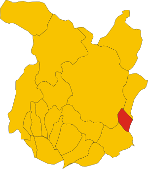
Map of comune of Agliana (province of Pistoia, region Tuscany, Italy).svg
6,282 × 7,179; 37 KB
6,282 × 7,179; 37 KB
0 references
PT
0 references
Agliana
0 references
Identifiers
315980474
0 references
2--4552
0 references


