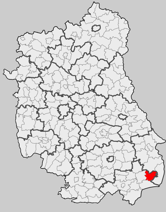
Gmina Telatyn (Q2521865): Difference between revisions
Jump to navigation
Jump to search
(Changed an Item: Sitelinks in wikidata changed) |
(Changed an Item: Adding this statements since they where added in Wikidata) |
||||||||||||||
| Property / instance of | |||||||||||||||
| Property / instance of: rural municipality of Poland / rank | |||||||||||||||
Normal rank | |||||||||||||||
| Property / located in the administrative territorial entity | |||||||||||||||
| Property / located in the administrative territorial entity: Tomaszów Lubelski County / rank | |||||||||||||||
Normal rank | |||||||||||||||
| Property / coordinate location | |||||||||||||||
50°32'N, 23°51'E
| |||||||||||||||
| Property / coordinate location: 50°32'N, 23°51'E / rank | |||||||||||||||
Normal rank | |||||||||||||||
| Property / coordinate location: 50°32'N, 23°51'E / reference | |||||||||||||||
| Property / Freebase ID | |||||||||||||||
| Property / Freebase ID: /m/03h1yxs / rank | |||||||||||||||
Normal rank | |||||||||||||||
| Property / Freebase ID: /m/03h1yxs / reference | |||||||||||||||
| Property / Freebase ID: /m/03h1yxs / reference | |||||||||||||||
publication date: 28 October 2013
| |||||||||||||||
| Property / GeoNames ID | |||||||||||||||
| Property / GeoNames ID: 7532551 / rank | |||||||||||||||
Normal rank | |||||||||||||||
| Property / GeoNames ID: 7532551 / reference | |||||||||||||||
| Property / topic's main category | |||||||||||||||
| Property / topic's main category: Category:Gmina Telatyn / rank | |||||||||||||||
Normal rank | |||||||||||||||
| Property / topic's main category: Category:Gmina Telatyn / reference | |||||||||||||||
| Property / TERYT municipality code | |||||||||||||||
0618102 | |||||||||||||||
| Property / TERYT municipality code: 0618102 / rank | |||||||||||||||
Normal rank | |||||||||||||||
| Property / TERYT municipality code: 0618102 / reference | |||||||||||||||
| Property / official website | |||||||||||||||
| Property / official website: http://www.telatyn.pl / rank | |||||||||||||||
Normal rank | |||||||||||||||
| Property / official website: http://www.telatyn.pl / reference | |||||||||||||||
| Property / shares border with | |||||||||||||||
| Property / shares border with: Gmina Dołhobyczów / rank | |||||||||||||||
Normal rank | |||||||||||||||
| Property / shares border with | |||||||||||||||
| Property / shares border with: Gmina Łaszczów / rank | |||||||||||||||
Normal rank | |||||||||||||||
| Property / shares border with | |||||||||||||||
| Property / shares border with: Gmina Mircze / rank | |||||||||||||||
Normal rank | |||||||||||||||
| Property / shares border with | |||||||||||||||
| Property / shares border with: Gmina Ulhówek / rank | |||||||||||||||
Normal rank | |||||||||||||||
| Property / coat of arms image | |||||||||||||||
| Property / coat of arms image: POL gmina Telatyn COA.png / rank | |||||||||||||||
Normal rank | |||||||||||||||
| Property / coat of arms image: POL gmina Telatyn COA.png / reference | |||||||||||||||
| Property / flag image | |||||||||||||||
| Property / flag image: POL gmina Telatyn flag.png / rank | |||||||||||||||
Normal rank | |||||||||||||||
| Property / flag image: POL gmina Telatyn flag.png / reference | |||||||||||||||
| Property / locator map image | |||||||||||||||
| Property / locator map image: Lub Tomaszowski Telatyn.png / rank | |||||||||||||||
Normal rank | |||||||||||||||
| Property / locator map image: Lub Tomaszowski Telatyn.png / reference | |||||||||||||||
| Property / licence plate code | |||||||||||||||
LTM | |||||||||||||||
| Property / licence plate code: LTM / rank | |||||||||||||||
Normal rank | |||||||||||||||
| Property / licence plate code: LTM / reference | |||||||||||||||
| Property / area | |||||||||||||||
109.66 square kilometre
| |||||||||||||||
| Property / area: 109.66 square kilometre / rank | |||||||||||||||
Normal rank | |||||||||||||||
| Property / area: 109.66 square kilometre / reference | |||||||||||||||
Revision as of 00:28, 6 August 2020
rural gmina of Poland
| Language | Label | Description | Also known as |
|---|---|---|---|
| English | Gmina Telatyn |
rural gmina of Poland |


