Cerda (Q290109): Difference between revisions
Jump to navigation
Jump to search
(Changed an Item: Adding this statements since they where added in Wikidata) |
(Changed an Item: Adding this statements since they where added in Wikidata) |
||||||||||||||
| Property / instance of | |||||||||||||||
| Property / instance of: commune of Italy / rank | |||||||||||||||
Normal rank | |||||||||||||||
| Property / official website | |||||||||||||||
| Property / official website: http://www.comune.cerda.pa.it/ / rank | |||||||||||||||
Normal rank | |||||||||||||||
| Property / official website: http://www.comune.cerda.pa.it/ / reference | |||||||||||||||
| Property / Freebase ID | |||||||||||||||
| Property / Freebase ID: /m/0gq9_w / rank | |||||||||||||||
Normal rank | |||||||||||||||
| Property / Freebase ID: /m/0gq9_w / reference | |||||||||||||||
| Property / Freebase ID: /m/0gq9_w / reference | |||||||||||||||
publication date: 28 October 2013
| |||||||||||||||
| Property / twinned administrative body | |||||||||||||||
| Property / twinned administrative body: Cerdà / rank | |||||||||||||||
Normal rank | |||||||||||||||
| Property / twinned administrative body: Cerdà / reference | |||||||||||||||
| Property / GeoNames ID | |||||||||||||||
| Property / GeoNames ID: 6539126 / rank | |||||||||||||||
Normal rank | |||||||||||||||
| Property / GeoNames ID: 6539126 / reference | |||||||||||||||
| Property / category for people born here | |||||||||||||||
| Property / category for people born here: Q2600964 / rank | |||||||||||||||
Normal rank | |||||||||||||||
| Property / category for people born here: Q2600964 / reference | |||||||||||||||
| Property / topic's main category | |||||||||||||||
| Property / topic's main category: Category:Cerda / rank | |||||||||||||||
Normal rank | |||||||||||||||
| Property / topic's main category: Category:Cerda / reference | |||||||||||||||
| Property / elevation above sea level | |||||||||||||||
272±1 metre
| |||||||||||||||
| Property / elevation above sea level: 272±1 metre / rank | |||||||||||||||
Normal rank | |||||||||||||||
| Property / elevation above sea level: 272±1 metre / reference | |||||||||||||||
| Property / licence plate code | |||||||||||||||
PA | |||||||||||||||
| Property / licence plate code: PA / rank | |||||||||||||||
Normal rank | |||||||||||||||
| Property / coordinates of northernmost point | |||||||||||||||
37°56'30.988"N, 13°50'33.666"E
| |||||||||||||||
| Property / coordinates of northernmost point: 37°56'30.988"N, 13°50'33.666"E / rank | |||||||||||||||
Normal rank | |||||||||||||||
| Property / coordinates of northernmost point: 37°56'30.988"N, 13°50'33.666"E / reference | |||||||||||||||
| Property / coordinates of southernmost point | |||||||||||||||
37°51'33.685"N, 13°48'54.940"E
| |||||||||||||||
| Property / coordinates of southernmost point: 37°51'33.685"N, 13°48'54.940"E / rank | |||||||||||||||
Normal rank | |||||||||||||||
| Property / coordinates of southernmost point: 37°51'33.685"N, 13°48'54.940"E / reference | |||||||||||||||
| Property / coordinates of easternmost point | |||||||||||||||
37°52'36.080"N, 13°52'5.588"E
| |||||||||||||||
| Property / coordinates of easternmost point: 37°52'36.080"N, 13°52'5.588"E / rank | |||||||||||||||
Normal rank | |||||||||||||||
| Property / coordinates of easternmost point: 37°52'36.080"N, 13°52'5.588"E / reference | |||||||||||||||
| Property / coordinates of westernmost point | |||||||||||||||
37°52'53.843"N, 13°45'36.148"E
| |||||||||||||||
| Property / coordinates of westernmost point: 37°52'53.843"N, 13°45'36.148"E / rank | |||||||||||||||
Normal rank | |||||||||||||||
| Property / coordinates of westernmost point: 37°52'53.843"N, 13°45'36.148"E / reference | |||||||||||||||
| Property / OSM relation ID | |||||||||||||||
| Property / OSM relation ID: 39391 / rank | |||||||||||||||
Normal rank | |||||||||||||||
| Property / capital | |||||||||||||||
| Property / capital: Cerda / rank | |||||||||||||||
Normal rank | |||||||||||||||
| Property / area | |||||||||||||||
43.83 square kilometre
| |||||||||||||||
| Property / area: 43.83 square kilometre / rank | |||||||||||||||
Normal rank | |||||||||||||||
| Property / area: 43.83 square kilometre / qualifier | |||||||||||||||
point in time: 9 October 2011
| |||||||||||||||
| Property / area: 43.83 square kilometre / reference | |||||||||||||||
| Property / area: 43.83 square kilometre / reference | |||||||||||||||
| Property / area: 43.83 square kilometre / reference | |||||||||||||||
title: Superficie di Comuni Province e Regioni italiane al 9 ottobre 2011 (Italian) | |||||||||||||||
| Property / area: 43.83 square kilometre / reference | |||||||||||||||
retrieved: 16 March 2019
| |||||||||||||||
| Property / area: 43.83 square kilometre / reference | |||||||||||||||
| Property / population | |||||||||||||||
5,235
| |||||||||||||||
| Property / population: 5,235 / rank | |||||||||||||||
Normal rank | |||||||||||||||
| Property / population: 5,235 / qualifier | |||||||||||||||
point in time: 1 January 2017
| |||||||||||||||
| Property / population: 5,235 / qualifier | |||||||||||||||
| Property / population: 5,235 / reference | |||||||||||||||
| Property / population | |||||||||||||||
5,176
| |||||||||||||||
| Property / population: 5,176 / rank | |||||||||||||||
Preferred rank | |||||||||||||||
| Property / population: 5,176 / qualifier | |||||||||||||||
point in time: 1 January 2018
| |||||||||||||||
| Property / population: 5,176 / qualifier | |||||||||||||||
| Property / population: 5,176 / reference | |||||||||||||||
| Property / population: 5,176 / reference | |||||||||||||||
title: Popolazione Residente al 1° Gennaio 2018 (Italian) | |||||||||||||||
| Property / population: 5,176 / reference | |||||||||||||||
retrieved: 16 March 2019
| |||||||||||||||
| Property / population: 5,176 / reference | |||||||||||||||
| Property / IndicePA ID | |||||||||||||||
| Property / IndicePA ID: c_c496 / rank | |||||||||||||||
Normal rank | |||||||||||||||
| Property / Who's on First ID | |||||||||||||||
| Property / Who's on First ID: 101802595 / rank | |||||||||||||||
Normal rank | |||||||||||||||
Revision as of 18:36, 5 August 2020
Italian comune
| Language | Label | Description | Also known as |
|---|---|---|---|
| English | Cerda |
Italian comune |
Statements

Cerda
0 references
3 January 2016
1 reference

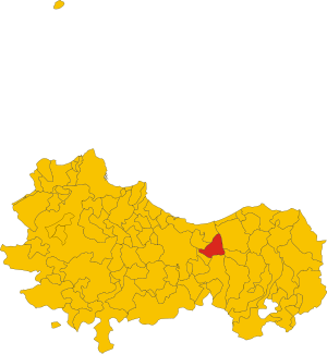
.svg)
Map of comune of Cerda (metropolitan city of Palermo, region Sicily, Italy).svg
3,516 × 3,808; 200 KB
3,516 × 3,808; 200 KB
1 reference
PA
0 references


43.83 square kilometre
9 October 2011
5 references
Superficie di Comuni Province e Regioni italiane al 9 ottobre 2011 (Italian)
16 March 2019
5,235
1 January 2017
1 reference
5,176
1 January 2018
4 references
Popolazione Residente al 1° Gennaio 2018 (Italian)
16 March 2019
Identifiers
621360825
0 references
2--45823
0 references