Schwalm-Eder-Kreis (Q2573357): Difference between revisions

From EU Knowledge Graph
Jump to navigation Jump to search
(‎Changed an Item: Adding this statements since they where added in Wikidata)
Property / contains administrative territorial entity
 
Property / contains administrative territorial entity: Jesberg / rank
 
Normal rank
Property / contains administrative territorial entity
 
Property / contains administrative territorial entity: Knüllwald / rank
 
Normal rank
Property / contains administrative territorial entity
 
Property / contains administrative territorial entity: Körle / rank
 
Normal rank
Property / contains administrative territorial entity
 
Property / contains administrative territorial entity: Malsfeld / rank
 
Normal rank
Property / contains administrative territorial entity
 
Property / contains administrative territorial entity: Melsungen / rank
 
Normal rank
Property / contains administrative territorial entity
 
Property / contains administrative territorial entity: Morschen / rank
 
Normal rank
Property / contains administrative territorial entity
 
Property / contains administrative territorial entity: Neuental / rank
 
Normal rank
Property / contains administrative territorial entity
 
Property / contains administrative territorial entity: Neukirchen / rank
 
Normal rank
Property / contains administrative territorial entity
 
Property / contains administrative territorial entity: Niedenstein / rank
 
Normal rank
Property / contains administrative territorial entity
 
Property / contains administrative territorial entity: Oberaula / rank
 
Normal rank
Property / contains administrative territorial entity
 
Property / contains administrative territorial entity: Ottrau / rank
 
Normal rank
Property / contains administrative territorial entity
 
Property / contains administrative territorial entity: Schrecksbach / rank
 
Normal rank
Property / contains administrative territorial entity
 
Property / contains administrative territorial entity: Schwalmstadt / rank
 
Normal rank
Property / contains administrative territorial entity
 
Property / contains administrative territorial entity: Schwarzenborn / rank
 
Normal rank
Property / contains administrative territorial entity
 
Property / contains administrative territorial entity: Spangenberg / rank
 
Normal rank
Property / contains administrative territorial entity
 
Property / contains administrative territorial entity: Wabern / rank
 
Normal rank
Property / contains administrative territorial entity
 
Property / contains administrative territorial entity: Willingshausen / rank
 
Normal rank
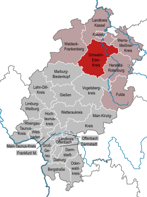
Property / locator map image
 
Property / locator map image: Hesse HR.svg / rank
 
Normal rank
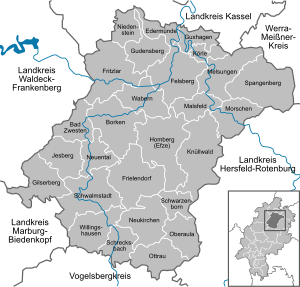
Property / locator map image
 
Property / locator map image: Gemeinden in HR.svg / rank
 
Normal rank
Property / German district key
 
06634
Property / German district key: 06634 / rank
 
Normal rank
Property / German district key: 06634 / reference
 

Revision as of 20:26, 3 July 2020

district in Hesse, Germany
Language Label Description Also known as
English
Schwalm-Eder-Kreis
district in Hesse, Germany

    Statements

    0 references
    0 references
    0 references
    P169 (Deleted Property)
    2--434127 Property P169 not found, cannot determine the data type to use.
    0 references
    Schwalm-Eder-Kreis
    0 references
    0 references
    0 references
    0 references
    0 references
    0 references
    0 references
    0 references
    0 references
    0 references
    0 references
    0 references
    0 references
    0 references
    0 references
    0 references
    0 references
    0 references
    0 references
    0 references
    0 references
    0 references
    0 references
    0 references
    0 references
    0 references
    0 references
    0 references
    0 references
    0 references
    Hesse HR.svg
    868 × 1,164; 693 KB
    0 references
    Gemeinden in HR.svg
    692 × 661; 386 KB
    0 references

    Identifiers