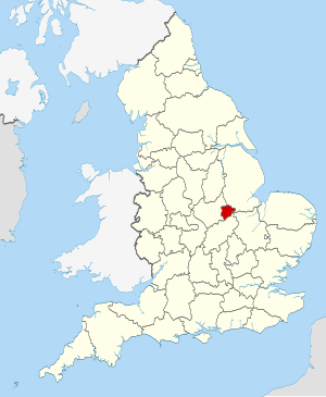
Rutland (Q2554917): Difference between revisions
Jump to navigation
Jump to search
(Changed an Item: Adding this statements since they where added in Wikidata) |
(Changed an Item: Adding this statements since they where added in Wikidata) |
||
| Property / VIAF ID | |||
| Property / VIAF ID: 141932575 / rank | |||
Normal rank | |||
| Property / GND ID | |||
| Property / GND ID: 4117154-8 / rank | |||
Normal rank | |||
| Property / GND ID: 4117154-8 / reference | |||
| Property / GND ID: 4117154-8 / reference | |||
| Property / category for maps | |||
| Property / category for maps: Category:Maps of Rutland / rank | |||
Normal rank | |||
| Property / different from | |||
| Property / different from: Rutland / rank | |||
Normal rank | |||
| Property / different from: Rutland / qualifier | |||
| Property / WorldCat Identities ID | |||
lccn-n83135435 | |||
| Property / WorldCat Identities ID: lccn-n83135435 / rank | |||
Normal rank | |||
| Property / WorldCat Identities ID: lccn-n83135435 / reference | |||
Revision as of 07:20, 3 July 2020
district in the East Midlands, United Kingdom
| Language | Label | Description | Also known as |
|---|---|---|---|
| English | Rutland |
district in the East Midlands, United Kingdom |
Statements
Rutland
0 references
381.8313 square kilometre
2016
Identifiers
UKL4
5 references
30 December 2013
List of FIPS region codes (S-U) (English)
7000000000037528
0 references
3 references

