Naestved Municipality (Q2529923): Difference between revisions
Jump to navigation
Jump to search
(Changed an Item: Adding this statements since they where added in Wikidata) |
(Changed an Item: Adding this statements since they where added in Wikidata) |
||||||||||||||
| Property / VIAF ID | |||||||||||||||
| Property / VIAF ID: 147884579 / rank | |||||||||||||||
Normal rank | |||||||||||||||
| Property / VIAF ID: 147884579 / reference | |||||||||||||||
| Property / VIAF ID: 147884579 / reference | |||||||||||||||
retrieved: 4 August 2015
| |||||||||||||||
| Property / inception | |||||||||||||||
2007
| |||||||||||||||
| Property / inception: 2007 / rank | |||||||||||||||
Normal rank | |||||||||||||||
| Property / inception: 2007 / reference | |||||||||||||||
| Property / population | |||||||||||||||
82,342
| |||||||||||||||
| Property / population: 82,342 / rank | |||||||||||||||
Normal rank | |||||||||||||||
| Property / population: 82,342 / qualifier | |||||||||||||||
point in time: 2016
| |||||||||||||||
| Property / capital | |||||||||||||||
| Property / capital: Næstved / rank | |||||||||||||||
Normal rank | |||||||||||||||
| Property / postal code | |||||||||||||||
4700 | |||||||||||||||
| Property / postal code: 4700 / rank | |||||||||||||||
Normal rank | |||||||||||||||
| Property / postal code: 4700 / reference | |||||||||||||||
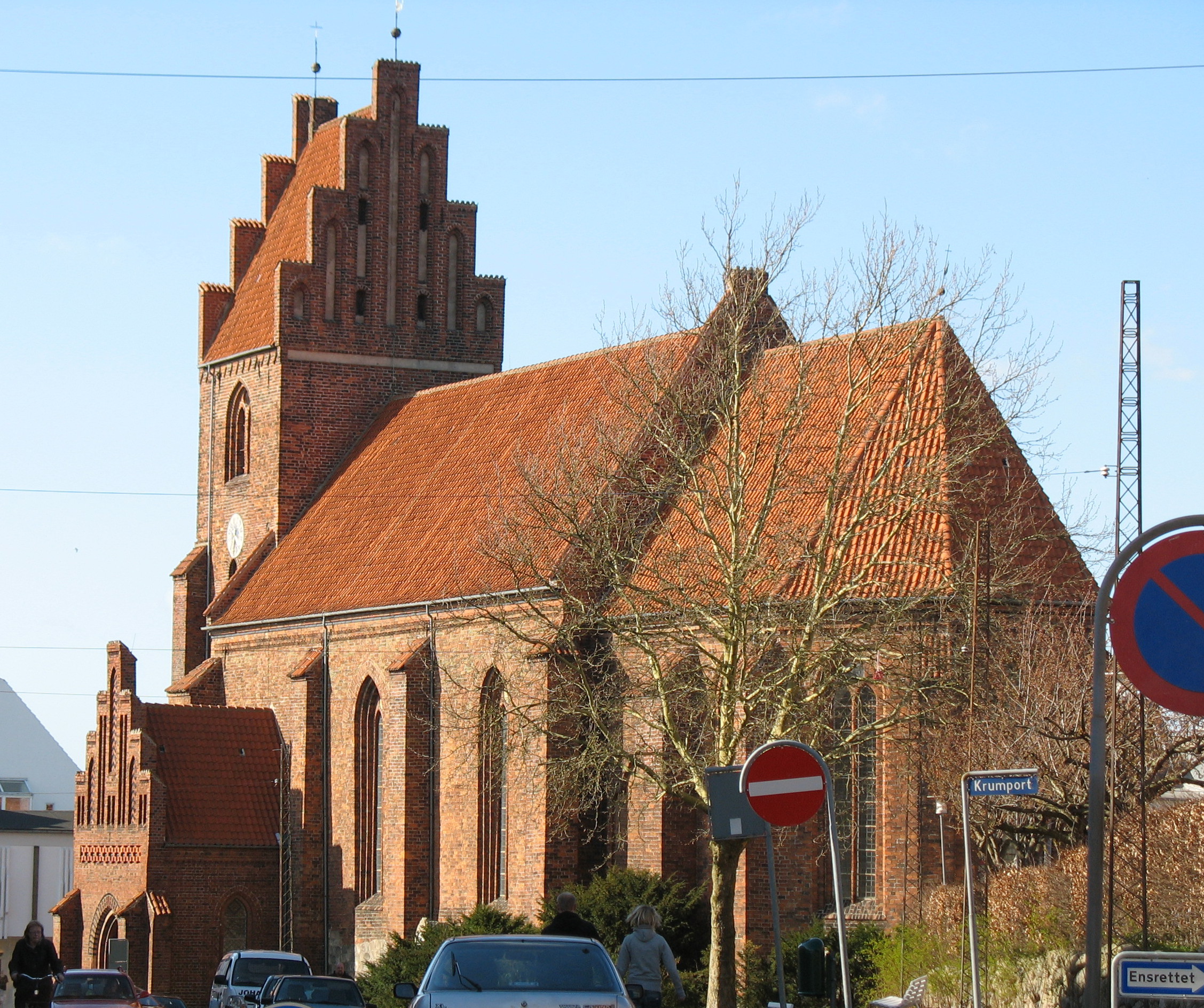
| Property / image | |||||||||||||||
| Property / image: Skt. Mortens Kirke - Næstved.jpg / rank | |||||||||||||||
Normal rank | |||||||||||||||
| Property / image: Skt. Mortens Kirke - Næstved.jpg / reference | |||||||||||||||
| Property / DigDag ID | |||||||||||||||
121046 | |||||||||||||||
| Property / DigDag ID: 121046 / rank | |||||||||||||||
Normal rank | |||||||||||||||
| Property / ISNI | |||||||||||||||
| Property / ISNI: 0000 0004 0379 1047 / rank | |||||||||||||||
Normal rank | |||||||||||||||
| Property / ISNI: 0000 0004 0379 1047 / reference | |||||||||||||||
| Property / Quora topic ID | |||||||||||||||
| Property / Quora topic ID: Næstved-Kommune / rank | |||||||||||||||
Normal rank | |||||||||||||||
| Property / Quora topic ID: Næstved-Kommune / reference | |||||||||||||||
| Property / elevation above sea level | |||||||||||||||
13 metre
| |||||||||||||||
| Property / elevation above sea level: 13 metre / rank | |||||||||||||||
Normal rank | |||||||||||||||
| Property / area | |||||||||||||||
676.4 square kilometre
| |||||||||||||||
| Property / area: 676.4 square kilometre / rank | |||||||||||||||
Normal rank | |||||||||||||||
| Property / area: 676.4 square kilometre / reference | |||||||||||||||
| Property / archINFORM location ID | |||||||||||||||
| Property / archINFORM location ID: 44835 / rank | |||||||||||||||
Normal rank | |||||||||||||||
| Property / archINFORM location ID: 44835 / reference | |||||||||||||||
| Property / archINFORM location ID: 44835 / reference | |||||||||||||||
| Property / archINFORM location ID: 44835 / reference | |||||||||||||||
retrieved: 5 August 2018
| |||||||||||||||
| Property / coat of arms image | |||||||||||||||
| Property / coat of arms image: Næstved Kommune coa.svg / rank | |||||||||||||||
Normal rank | |||||||||||||||
| Property / owner of | |||||||||||||||
| Property / owner of: Næstved Stadion / rank | |||||||||||||||
Normal rank | |||||||||||||||
| Property / Library of Congress authority ID | |||||||||||||||
| Property / Library of Congress authority ID: n91067165 / rank | |||||||||||||||
Normal rank | |||||||||||||||
| Property / category of associated people | |||||||||||||||
| Property / category of associated people: Category:People from Næstved Municipality / rank | |||||||||||||||
Normal rank | |||||||||||||||
| Property / DR topic ID | |||||||||||||||
| Property / DR topic ID: naestved-kommune / rank | |||||||||||||||
Normal rank | |||||||||||||||
| Property / WorldCat Identities ID | |||||||||||||||
lccn-n91067165 | |||||||||||||||
| Property / WorldCat Identities ID: lccn-n91067165 / rank | |||||||||||||||
Normal rank | |||||||||||||||
| Property / WorldCat Identities ID: lccn-n91067165 / reference | |||||||||||||||
Revision as of 20:53, 14 June 2020
No description defined
| Language | Label | Description | Also known as |
|---|---|---|---|
| English | Naestved Municipality |
No description defined |
Statements
Identifiers
121046
0 references
3 references


