Gambassi Terme (Q262875): Difference between revisions
Jump to navigation
Jump to search
(Removed claim: located in the administrative territorial entity (P323): Metropolitan City of Florence (Q2501122), Removing this statements since they changed in Wikidata) |
(Changed an Item: Adding these statements since they where added in Wikidata) |
||||||||||||||
| Property / located in the administrative territorial entity | |||||||||||||||
| Property / located in the administrative territorial entity: Metropolitan City of Florence / rank | |||||||||||||||
Preferred rank | |||||||||||||||
| Property / located in the administrative territorial entity: Metropolitan City of Florence / qualifier | |||||||||||||||
start time: 1 January 2015
| |||||||||||||||
| Property / located in the administrative territorial entity: Metropolitan City of Florence / qualifier | |||||||||||||||
| Property / population | |||||||||||||||
4,860
| |||||||||||||||
| Property / population: 4,860 / rank | |||||||||||||||
Preferred rank | |||||||||||||||
| Property / population: 4,860 / qualifier | |||||||||||||||
point in time: 1 January 2018
| |||||||||||||||
| Property / population: 4,860 / qualifier | |||||||||||||||
| Property / population: 4,860 / reference | |||||||||||||||
| Property / population: 4,860 / reference | |||||||||||||||
title: Popolazione Residente al 1° Gennaio 2018 (Italian) | |||||||||||||||
| Property / population: 4,860 / reference | |||||||||||||||
retrieved: 16 March 2019
| |||||||||||||||
| Property / population: 4,860 / reference | |||||||||||||||
Revision as of 01:52, 3 July 2023
Italian comune
| Language | Label | Description | Also known as |
|---|---|---|---|
| English | Gambassi Terme |
Italian comune |
Statements

Gambassi Terme
0 references
31 December 2014
1 reference
1 January 2015
0 references
.svg)
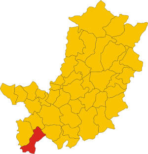
Map of comune of Gambassi Terme (province of Florence, region Tuscany, Italy).svg
3,665 × 3,805; 109 KB
3,665 × 3,805; 109 KB
1 reference


Gambassi Terme
0 references
FI
0 references
4,860
31 December 2013
1 January 2018
6 references
Popolazione Residente al 1° Gennaio 2018 (Italian)
16 March 2019
999
1 January 2018
4 references
Popolazione Residente al 1° Gennaio 2018 (Italian)
16 March 2019
4,860
31 December 2013
4 references
Popolazione Residente al 1° Gennaio 2017 (Italian)
9 September 2017
4,860
1 January 2018
4 references
Popolazione Residente al 1° Gennaio 2018 (Italian)
16 March 2019


83.15 square kilometre
9 October 2011
5 references
Superficie di Comuni Province e Regioni italiane al 9 ottobre 2011 (Italian)
16 March 2019
Identifiers
1141070480
0 references
Q262875
0 references