Lesotho (Q4143): Difference between revisions

From EU Knowledge Graph
Jump to navigation Jump to search
(‎Changed an Item: Adding these statements since they where added in Wikidata)
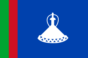
Property / flag image
 
Property / flag image: Flag of Lesotho (1966–1987).svg / rank
 
Normal rank
Property / anthem
 
Property / anthem: Lesotho Fatse La Bontata Rona / rank
 
Normal rank
Property / anthem: Lesotho Fatse La Bontata Rona / qualifier
 
Property / ISO 3166-1 alpha-2 code
 
LS
Property / ISO 3166-1 alpha-2 code: LS / rank
 
Normal rank
Property / ISO 3166-1 alpha-3 code
 
LSO
Property / ISO 3166-1 alpha-3 code: LSO / rank
 
Normal rank
Property / ISO 3166-1 numeric code
 
426
Property / ISO 3166-1 numeric code: 426 / rank
 
Normal rank
Property / flag
 
Property / flag: Flag of Lesotho / rank
 
Normal rank
Property / Commons category
 
Lesotho
Property / Commons category: Lesotho / rank
 
Normal rank
Property / enclave within
 
Property / enclave within: South Africa / rank
 
Normal rank
Property / coordinate location
 
29°33'S, 28°15'E
Latitude-29.55
Longitude28.25
Precision0.0166667
Globehttp://www.wikidata.org/entity/Q2
Property / coordinate location: 29°33'S, 28°15'E / rank
 
Normal rank
Property / coordinate location: 29°33'S, 28°15'E / reference
 
Property / contains administrative territorial entity
 
Property / contains administrative territorial entity: Berea District / rank
 
Normal rank
Property / contains administrative territorial entity
 
Property / contains administrative territorial entity: Butha-Buthe District / rank
 
Normal rank
Property / contains administrative territorial entity
 
Property / contains administrative territorial entity: Leribe District / rank
 
Normal rank
Property / contains administrative territorial entity
 
Property / contains administrative territorial entity: Mafeteng District / rank
 
Normal rank
Property / contains administrative territorial entity
 
Property / contains administrative territorial entity: Maseru District / rank
 
Normal rank
Property / contains administrative territorial entity
 
Property / contains administrative territorial entity: Mohale's Hoek District / rank
 
Normal rank
Property / contains administrative territorial entity
 
Property / contains administrative territorial entity: Mokhotlong District / rank
 
Normal rank
Property / contains administrative territorial entity
 
Property / contains administrative territorial entity: Qacha's Nek District / rank
 
Normal rank
Property / contains administrative territorial entity
 
Property / contains administrative territorial entity: Quthing District / rank
 
Normal rank
Property / contains administrative territorial entity
 
Property / contains administrative territorial entity: Thaba-Tseka District / rank
 
Normal rank
Property / named after
 
Property / named after: Sesotho / rank
 
Normal rank

Revision as of 10:46, 6 March 2021

sovereign state in southern Africa
  • Kingdom of Lesotho
  • ls
  • 🇱🇸
  • LES
Language Label Description Also known as
English
Lesotho
sovereign state in southern Africa
  • Kingdom of Lesotho
  • ls
  • 🇱🇸
  • LES

Statements

0 references
0 references
0 references
0 references
0 references
0 references
0 references
0 references
0 references
0 references
0 references
Coat of arms of Lesotho.svg
600 × 520; 241 KB
0 references
4 October 2006
2 January 1987
0 references
Flag of Lesotho.svg
900 × 600; 1 KB
4 October 2006
0 references
0 references
0 references
Lesotho
0 references
0 references

Identifiers

0 references
2--6885
0 references
LS
0 references
LSO
0 references
426
0 references