Rutland (Q2554917): Difference between revisions
Jump to navigation
Jump to search
(Changed label, description and/or aliases in 1 language: The description in Wikidata changed) |
(Removed claim: population (P9): 39,697, Removing this statements since they changed in Wikidata) |
||||||||||||||
| Property / population | |||||||||||||||
| |||||||||||||||
| Property / population: 39,697 / rank | |||||||||||||||
| Property / population: 39,697 / qualifier | |||||||||||||||
| |||||||||||||||
| Property / population: 39,697 / qualifier | |||||||||||||||
| Property / population: 39,697 / reference | |||||||||||||||
Revision as of 14:31, 30 November 2020
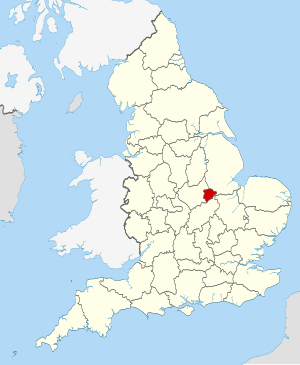
district in the East Midlands, United Kingdom
| Language | Label | Description | Also known as |
|---|---|---|---|
| English | Rutland |
district in the East Midlands, United Kingdom |
Statements
Rutland
0 references
381.8313 square kilometre
2016
Identifiers
UKL4
5 references
30 December 2013
List of FIPS region codes (S-U) (English)
7000000000037528
0 references
3 references
36942
0 references
GB.RL
0 references
70530
0 references


