Castrocielo (Q282137): Difference between revisions
Jump to navigation
Jump to search
(Changed an Item: Adding this statements since they where added in Wikidata) |
(Changed an Item: Adding this statements since they where added in Wikidata) |
||||||||||||||
| Property / official website | |||||||||||||||
| Property / official website: http://www.comune.castrocielo.fr.it / rank | |||||||||||||||
Normal rank | |||||||||||||||
| Property / official website: http://www.comune.castrocielo.fr.it / reference | |||||||||||||||
| Property / Digital Atlas of the Roman Empire ID | |||||||||||||||
| Property / Digital Atlas of the Roman Empire ID: 35117 / rank | |||||||||||||||
Normal rank | |||||||||||||||
| Property / VIAF ID | |||||||||||||||
| Property / VIAF ID: 124532666 / rank | |||||||||||||||
Normal rank | |||||||||||||||
| Property / VIAF ID: 124532666 / reference | |||||||||||||||
| Property / VIAF ID: 124532666 / reference | |||||||||||||||
retrieved: 2 August 2015
| |||||||||||||||
| Property / elevation above sea level | |||||||||||||||
250±1 metre
| |||||||||||||||
| Property / elevation above sea level: 250±1 metre / rank | |||||||||||||||
Normal rank | |||||||||||||||
| Property / elevation above sea level: 250±1 metre / reference | |||||||||||||||
| Property / topic's main category | |||||||||||||||
| Property / topic's main category: Category:Castrocielo / rank | |||||||||||||||
Normal rank | |||||||||||||||
| Property / licence plate code | |||||||||||||||
FR | |||||||||||||||
| Property / licence plate code: FR / rank | |||||||||||||||
Normal rank | |||||||||||||||
| Property / coordinates of northernmost point | |||||||||||||||
41°32'49.175"N, 13°41'15.979"E
| |||||||||||||||
| Property / coordinates of northernmost point: 41°32'49.175"N, 13°41'15.979"E / rank | |||||||||||||||
Normal rank | |||||||||||||||
| Property / coordinates of northernmost point: 41°32'49.175"N, 13°41'15.979"E / reference | |||||||||||||||
| Property / coordinates of southernmost point | |||||||||||||||
41°28'31.404"N, 13°40'54.707"E
| |||||||||||||||
| Property / coordinates of southernmost point: 41°28'31.404"N, 13°40'54.707"E / rank | |||||||||||||||
Normal rank | |||||||||||||||
| Property / coordinates of southernmost point: 41°28'31.404"N, 13°40'54.707"E / reference | |||||||||||||||
| Property / coordinates of easternmost point | |||||||||||||||
41°30'49.612"N, 13°44'38.904"E
| |||||||||||||||
| Property / coordinates of easternmost point: 41°30'49.612"N, 13°44'38.904"E / rank | |||||||||||||||
Normal rank | |||||||||||||||
| Property / coordinates of easternmost point: 41°30'49.612"N, 13°44'38.904"E / reference | |||||||||||||||
| Property / coordinates of westernmost point | |||||||||||||||
41°29'37.680"N, 13°38'37.644"E
| |||||||||||||||
| Property / coordinates of westernmost point: 41°29'37.680"N, 13°38'37.644"E / rank | |||||||||||||||
Normal rank | |||||||||||||||
| Property / coordinates of westernmost point: 41°29'37.680"N, 13°38'37.644"E / reference | |||||||||||||||
| Property / OSM relation ID | |||||||||||||||
| Property / OSM relation ID: 41329 / rank | |||||||||||||||
Normal rank | |||||||||||||||
| Property / capital | |||||||||||||||
| Property / capital: Castrocielo / rank | |||||||||||||||
Normal rank | |||||||||||||||
| Property / area | |||||||||||||||
27.92 square kilometre
| |||||||||||||||
| Property / area: 27.92 square kilometre / rank | |||||||||||||||
Normal rank | |||||||||||||||
| Property / area: 27.92 square kilometre / qualifier | |||||||||||||||
point in time: 9 October 2011
| |||||||||||||||
| Property / area: 27.92 square kilometre / reference | |||||||||||||||
| Property / area: 27.92 square kilometre / reference | |||||||||||||||
| Property / area: 27.92 square kilometre / reference | |||||||||||||||
title: Superficie di Comuni Province e Regioni italiane al 9 ottobre 2011 (Italian) | |||||||||||||||
| Property / area: 27.92 square kilometre / reference | |||||||||||||||
retrieved: 16 March 2019
| |||||||||||||||
| Property / area: 27.92 square kilometre / reference | |||||||||||||||
| Property / population | |||||||||||||||
4,001
| |||||||||||||||
| Property / population: 4,001 / rank | |||||||||||||||
Normal rank | |||||||||||||||
| Property / population: 4,001 / qualifier | |||||||||||||||
point in time: 1 January 2017
| |||||||||||||||
| Property / population: 4,001 / qualifier | |||||||||||||||
| Property / population: 4,001 / reference | |||||||||||||||
| Property / population | |||||||||||||||
3,978
| |||||||||||||||
| Property / population: 3,978 / rank | |||||||||||||||
Preferred rank | |||||||||||||||
| Property / population: 3,978 / qualifier | |||||||||||||||
point in time: 1 January 2018
| |||||||||||||||
| Property / population: 3,978 / qualifier | |||||||||||||||
| Property / population: 3,978 / reference | |||||||||||||||
| Property / population: 3,978 / reference | |||||||||||||||
title: Popolazione Residente al 1° Gennaio 2018 (Italian) | |||||||||||||||
| Property / population: 3,978 / reference | |||||||||||||||
retrieved: 16 March 2019
| |||||||||||||||
| Property / population: 3,978 / reference | |||||||||||||||
| Property / IndicePA ID | |||||||||||||||
| Property / IndicePA ID: c_c340 / rank | |||||||||||||||
Normal rank | |||||||||||||||
| Property / Who's on First ID | |||||||||||||||
| Property / Who's on First ID: 101850905 / rank | |||||||||||||||
Normal rank | |||||||||||||||
| Property / image | |||||||||||||||
| Property / image: Castrocielo-prova 006.jpg / rank | |||||||||||||||
Normal rank | |||||||||||||||
| Property / De Agostini ID | |||||||||||||||
| Property / De Agostini ID: Castrocièlo / rank | |||||||||||||||
Normal rank | |||||||||||||||
Revision as of 04:56, 6 August 2020
Italian comune
| Language | Label | Description | Also known as |
|---|---|---|---|
| English | Castrocielo |
Italian comune |
Statements

Castrocielo
0 references
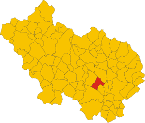
.svg)
Map of comune of Castrocielo (province of Frosinone, region Lazio, Italy).svg
6,262 × 5,295; 162 KB
6,262 × 5,295; 162 KB
1 reference
FR
0 references


27.92 square kilometre
9 October 2011
5 references
Superficie di Comuni Province e Regioni italiane al 9 ottobre 2011 (Italian)
16 March 2019
4,001
1 January 2017
1 reference
3,978
1 January 2018
4 references
Popolazione Residente al 1° Gennaio 2018 (Italian)
16 March 2019

Identifiers
81002090603
0 references