Cannara (Q294122): Difference between revisions
Jump to navigation
Jump to search
(Changed an Item: Adding this statements since they where added in Wikidata) |
(Changed an Item: Adding this statements since they where added in Wikidata) |
||||||||||||||
| Property / category for people born here | |||||||||||||||
| Property / category for people born here: Q2609121 / rank | |||||||||||||||
Normal rank | |||||||||||||||
| Property / category for people born here: Q2609121 / reference | |||||||||||||||
| Property / topic's main category | |||||||||||||||
| Property / topic's main category: Category:Cannara / rank | |||||||||||||||
Normal rank | |||||||||||||||
| Property / topic's main category: Category:Cannara / reference | |||||||||||||||
| Property / VIAF ID | |||||||||||||||
| Property / VIAF ID: 156212095 / rank | |||||||||||||||
Normal rank | |||||||||||||||
| Property / VIAF ID: 156212095 / reference | |||||||||||||||
| Property / VIAF ID: 156212095 / reference | |||||||||||||||
retrieved: 2 August 2015
| |||||||||||||||
| Property / elevation above sea level | |||||||||||||||
197±1 metre
| |||||||||||||||
| Property / elevation above sea level: 197±1 metre / rank | |||||||||||||||
Normal rank | |||||||||||||||
| Property / elevation above sea level: 197±1 metre / reference | |||||||||||||||
| Property / official website | |||||||||||||||
| Property / official website: http://www.comune.cannara.pg.it / rank | |||||||||||||||
Normal rank | |||||||||||||||
| Property / official website: http://www.comune.cannara.pg.it / reference | |||||||||||||||
| Property / population | |||||||||||||||
4,324
| |||||||||||||||
| Property / population: 4,324 / rank | |||||||||||||||
Normal rank | |||||||||||||||
| Property / population: 4,324 / qualifier | |||||||||||||||
point in time: 1 November 2015
| |||||||||||||||
| Property / population: 4,324 / reference | |||||||||||||||
| Property / population | |||||||||||||||
4,337
| |||||||||||||||
| Property / population: 4,337 / rank | |||||||||||||||
Preferred rank | |||||||||||||||
| Property / population: 4,337 / qualifier | |||||||||||||||
point in time: 1 January 2018
| |||||||||||||||
| Property / population: 4,337 / qualifier | |||||||||||||||
| Property / population: 4,337 / reference | |||||||||||||||
| Property / population: 4,337 / reference | |||||||||||||||
title: Popolazione Residente al 1° Gennaio 2018 (Italian) | |||||||||||||||
| Property / population: 4,337 / reference | |||||||||||||||
retrieved: 16 March 2019
| |||||||||||||||
| Property / population: 4,337 / reference | |||||||||||||||
| Property / licence plate code | |||||||||||||||
PG | |||||||||||||||
| Property / licence plate code: PG / rank | |||||||||||||||
Normal rank | |||||||||||||||
| Property / WOEID | |||||||||||||||
| Property / WOEID: 712018 / rank | |||||||||||||||
Normal rank | |||||||||||||||
| Property / WOEID: 712018 / reference | |||||||||||||||
| Property / coordinates of northernmost point | |||||||||||||||
43°1'16.990"N, 12°33'8.795"E
| |||||||||||||||
| Property / coordinates of northernmost point: 43°1'16.990"N, 12°33'8.795"E / rank | |||||||||||||||
Normal rank | |||||||||||||||
| Property / coordinates of northernmost point: 43°1'16.990"N, 12°33'8.795"E / reference | |||||||||||||||
| Property / coordinates of southernmost point | |||||||||||||||
42°56'47.058"N, 12°31'6.629"E
| |||||||||||||||
| Property / coordinates of southernmost point: 42°56'47.058"N, 12°31'6.629"E / rank | |||||||||||||||
Normal rank | |||||||||||||||
| Property / coordinates of southernmost point: 42°56'47.058"N, 12°31'6.629"E / reference | |||||||||||||||
| Property / coordinates of easternmost point | |||||||||||||||
42°58'50.833"N, 12°36'22.864"E
| |||||||||||||||
| Property / coordinates of easternmost point: 42°58'50.833"N, 12°36'22.864"E / rank | |||||||||||||||
Normal rank | |||||||||||||||
| Property / coordinates of easternmost point: 42°58'50.833"N, 12°36'22.864"E / reference | |||||||||||||||
| Property / coordinates of westernmost point | |||||||||||||||
42°58'41.992"N, 12°29'34.267"E
| |||||||||||||||
| Property / coordinates of westernmost point: 42°58'41.992"N, 12°29'34.267"E / rank | |||||||||||||||
Normal rank | |||||||||||||||
| Property / coordinates of westernmost point: 42°58'41.992"N, 12°29'34.267"E / reference | |||||||||||||||
| Property / OSM relation ID | |||||||||||||||
| Property / OSM relation ID: 42263 / rank | |||||||||||||||
Normal rank | |||||||||||||||
| Property / image | |||||||||||||||
| Property / image: Panoramica del ponte di Cannara 2008.jpg / rank | |||||||||||||||
Normal rank | |||||||||||||||
| Property / image: Panoramica del ponte di Cannara 2008.jpg / reference | |||||||||||||||
| Property / capital | |||||||||||||||
| Property / capital: Cannara / rank | |||||||||||||||
Normal rank | |||||||||||||||
| Property / area | |||||||||||||||
32.81 square kilometre
| |||||||||||||||
| Property / area: 32.81 square kilometre / rank | |||||||||||||||
Normal rank | |||||||||||||||
| Property / area: 32.81 square kilometre / qualifier | |||||||||||||||
point in time: 9 October 2011
| |||||||||||||||
| Property / area: 32.81 square kilometre / reference | |||||||||||||||
| Property / area: 32.81 square kilometre / reference | |||||||||||||||
| Property / area: 32.81 square kilometre / reference | |||||||||||||||
title: Superficie di Comuni Province e Regioni italiane al 9 ottobre 2011 (Italian) | |||||||||||||||
| Property / area: 32.81 square kilometre / reference | |||||||||||||||
retrieved: 16 March 2019
| |||||||||||||||
| Property / area: 32.81 square kilometre / reference | |||||||||||||||
| Property / twinned administrative body | |||||||||||||||
| Property / twinned administrative body: Montalto Dora / rank | |||||||||||||||
Normal rank | |||||||||||||||
| Property / twinned administrative body: Montalto Dora / reference | |||||||||||||||
| Property / IndicePA ID | |||||||||||||||
| Property / IndicePA ID: c_b609 / rank | |||||||||||||||
Normal rank | |||||||||||||||
| Property / GND ID | |||||||||||||||
| Property / GND ID: 4356833-6 / rank | |||||||||||||||
Normal rank | |||||||||||||||
| Property / GND ID: 4356833-6 / reference | |||||||||||||||
| Property / GND ID: 4356833-6 / reference | |||||||||||||||
Revision as of 01:46, 6 August 2020
Italian comune
| Language | Label | Description | Also known as |
|---|---|---|---|
| English | Cannara |
Italian comune |
Statements

06033
0 references
Cannara
0 references
0742
0 references
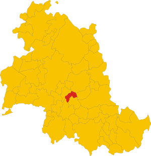
.svg)
Map of comune of Cannara (province of Perugia, region Umbria, Italy).svg
3,280 × 3,389; 167 KB
3,280 × 3,389; 167 KB
0 references
4,337
1 January 2018
4 references
Popolazione Residente al 1° Gennaio 2018 (Italian)
16 March 2019
PG
0 references


32.81 square kilometre
9 October 2011
5 references
Superficie di Comuni Province e Regioni italiane al 9 ottobre 2011 (Italian)
16 March 2019
Identifiers
407650548
0 references