Ponte San Nicolò (Q261969): Difference between revisions
Jump to navigation
Jump to search
(Changed an Item: Adding this statements since they where added in Wikidata) |
(Changed an Item: Adding this statements since they where added in Wikidata) |
||||||||||||||
| Property / twinned administrative body | |||||||||||||||
| Property / twinned administrative body: Crest / rank | |||||||||||||||
Normal rank | |||||||||||||||
| Property / twinned administrative body: Crest / reference | |||||||||||||||
| Property / twinned administrative body | |||||||||||||||
| Property / twinned administrative body: Gmina Dobra / rank | |||||||||||||||
Normal rank | |||||||||||||||
| Property / twinned administrative body: Gmina Dobra / reference | |||||||||||||||
| Property / GeoNames ID | |||||||||||||||
| Property / GeoNames ID: 6542290 / rank | |||||||||||||||
Normal rank | |||||||||||||||
| Property / GeoNames ID: 6542290 / reference | |||||||||||||||
| Property / image | |||||||||||||||
| Property / image: Ponte san Nicolò.jpg / rank | |||||||||||||||
Normal rank | |||||||||||||||
| Property / VIAF ID | |||||||||||||||
| Property / VIAF ID: 239685541 / rank | |||||||||||||||
Normal rank | |||||||||||||||
| Property / VIAF ID: 239685541 / reference | |||||||||||||||
| Property / VIAF ID: 239685541 / reference | |||||||||||||||
retrieved: 2 August 2015
| |||||||||||||||
| Property / topic's main category | |||||||||||||||
| Property / topic's main category: Category:Ponte San Nicolò / rank | |||||||||||||||
Normal rank | |||||||||||||||
| Property / licence plate code | |||||||||||||||
PD | |||||||||||||||
| Property / licence plate code: PD / rank | |||||||||||||||
Normal rank | |||||||||||||||
| Property / coordinates of northernmost point | |||||||||||||||
45°22'59.624"N, 11°54'42.944"E
| |||||||||||||||
| Property / coordinates of northernmost point: 45°22'59.624"N, 11°54'42.944"E / rank | |||||||||||||||
Normal rank | |||||||||||||||
| Property / coordinates of northernmost point: 45°22'59.624"N, 11°54'42.944"E / reference | |||||||||||||||
| Property / coordinates of southernmost point | |||||||||||||||
45°19'18.890"N, 11°56'2.472"E
| |||||||||||||||
| Property / coordinates of southernmost point: 45°19'18.890"N, 11°56'2.472"E / rank | |||||||||||||||
Normal rank | |||||||||||||||
| Property / coordinates of southernmost point: 45°19'18.890"N, 11°56'2.472"E / reference | |||||||||||||||
| Property / coordinates of easternmost point | |||||||||||||||
45°22'8.926"N, 11°56'56.540"E
| |||||||||||||||
| Property / coordinates of easternmost point: 45°22'8.926"N, 11°56'56.540"E / rank | |||||||||||||||
Normal rank | |||||||||||||||
| Property / coordinates of easternmost point: 45°22'8.926"N, 11°56'56.540"E / reference | |||||||||||||||
| Property / coordinates of westernmost point | |||||||||||||||
45°21'55.231"N, 11°53'37.370"E
| |||||||||||||||
| Property / coordinates of westernmost point: 45°21'55.231"N, 11°53'37.370"E / rank | |||||||||||||||
Normal rank | |||||||||||||||
| Property / coordinates of westernmost point: 45°21'55.231"N, 11°53'37.370"E / reference | |||||||||||||||
| Property / OSM relation ID | |||||||||||||||
| Property / OSM relation ID: 44745 / rank | |||||||||||||||
Normal rank | |||||||||||||||
| Property / elevation above sea level | |||||||||||||||
12 metre
| |||||||||||||||
| Property / elevation above sea level: 12 metre / rank | |||||||||||||||
Normal rank | |||||||||||||||
| Property / elevation above sea level: 12 metre / reference | |||||||||||||||
| Property / capital | |||||||||||||||
| Property / capital: Ponte San Nicolò / rank | |||||||||||||||
Normal rank | |||||||||||||||
| Property / area | |||||||||||||||
13.52 square kilometre
| |||||||||||||||
| Property / area: 13.52 square kilometre / rank | |||||||||||||||
Normal rank | |||||||||||||||
| Property / area: 13.52 square kilometre / qualifier | |||||||||||||||
point in time: 9 October 2011
| |||||||||||||||
| Property / area: 13.52 square kilometre / reference | |||||||||||||||
| Property / area: 13.52 square kilometre / reference | |||||||||||||||
| Property / area: 13.52 square kilometre / reference | |||||||||||||||
title: Superficie di Comuni Province e Regioni italiane al 9 ottobre 2011 (Italian) | |||||||||||||||
| Property / area: 13.52 square kilometre / reference | |||||||||||||||
retrieved: 16 March 2019
| |||||||||||||||
| Property / area: 13.52 square kilometre / reference | |||||||||||||||
| Property / population | |||||||||||||||
13,543
| |||||||||||||||
| Property / population: 13,543 / rank | |||||||||||||||
Normal rank | |||||||||||||||
| Property / population: 13,543 / qualifier | |||||||||||||||
point in time: 1 January 2017
| |||||||||||||||
| Property / population: 13,543 / qualifier | |||||||||||||||
| Property / population: 13,543 / reference | |||||||||||||||
| Property / population | |||||||||||||||
13,508
| |||||||||||||||
| Property / population: 13,508 / rank | |||||||||||||||
Preferred rank | |||||||||||||||
| Property / population: 13,508 / qualifier | |||||||||||||||
point in time: 1 January 2018
| |||||||||||||||
| Property / population: 13,508 / qualifier | |||||||||||||||
| Property / population: 13,508 / reference | |||||||||||||||
| Property / population: 13,508 / reference | |||||||||||||||
title: Popolazione Residente al 1° Gennaio 2018 (Italian) | |||||||||||||||
| Property / population: 13,508 / reference | |||||||||||||||
retrieved: 16 March 2019
| |||||||||||||||
| Property / population: 13,508 / reference | |||||||||||||||
| Property / UN/LOCODE | |||||||||||||||
| Property / UN/LOCODE: ITZRA / rank | |||||||||||||||
Normal rank | |||||||||||||||
| Property / IndicePA ID | |||||||||||||||
| Property / IndicePA ID: c_g855 / rank | |||||||||||||||
Normal rank | |||||||||||||||
| Property / Who's on First ID | |||||||||||||||
| Property / Who's on First ID: 101757859 / rank | |||||||||||||||
Normal rank | |||||||||||||||
Revision as of 21:19, 5 August 2020
Italian comune
- Ponte San Nicolo
| Language | Label | Description | Also known as |
|---|---|---|---|
| English | Ponte San Nicolò |
Italian comune |
|
Statements

Ponte San Nicolò
0 references
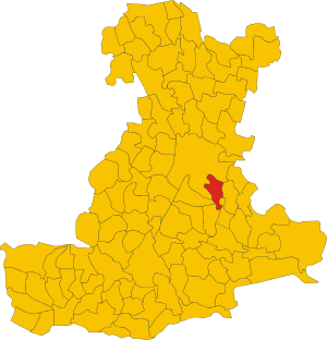
.svg)
Map of comune of Ponte San Nicolò (province of Padua, region Veneto, Italy).svg
3,144 × 3,265; 151 KB
3,144 × 3,265; 151 KB
1 reference

PD
0 references


13.52 square kilometre
9 October 2011
5 references
Superficie di Comuni Province e Regioni italiane al 9 ottobre 2011 (Italian)
16 March 2019
13,543
1 January 2017
1 reference
13,508
1 January 2018
4 references
Popolazione Residente al 1° Gennaio 2018 (Italian)
16 March 2019
Identifiers
673730289
0 references
2--4532
0 references