Montebello sul Sangro (Q278047): Difference between revisions
Jump to navigation
Jump to search
(Removed claim: country (P32): Italy (Q15), Removing this statements since they changed in Wikidata) |
(Changed an Item: Adding this statements since they where added in Wikidata) |
||||||||||
| Property / instance of | |||||||||||
| Property / instance of: commune of Italy / rank | |||||||||||
Normal rank | |||||||||||
| Property / Commons category | |||||||||||
Montebello sul Sangro | |||||||||||
| Property / Commons category: Montebello sul Sangro / rank | |||||||||||
Normal rank | |||||||||||
| Property / located in the administrative territorial entity | |||||||||||
| Property / located in the administrative territorial entity: Province of Chieti / rank | |||||||||||
Normal rank | |||||||||||
| Property / postal code | |||||||||||
66040 | |||||||||||
| Property / postal code: 66040 / rank | |||||||||||
Normal rank | |||||||||||
| Property / postal code: 66040 / reference | |||||||||||
| Property / shares border with | |||||||||||
| Property / shares border with: Civitaluparella / rank | |||||||||||
Normal rank | |||||||||||
| Property / shares border with: Civitaluparella / reference | |||||||||||
| Property / shares border with | |||||||||||
| Property / shares border with: Pennadomo / rank | |||||||||||
Normal rank | |||||||||||
| Property / shares border with: Pennadomo / reference | |||||||||||
| Property / shares border with | |||||||||||
| Property / shares border with: Montelapiano / rank | |||||||||||
Normal rank | |||||||||||
| Property / shares border with: Montelapiano / reference | |||||||||||
| Property / shares border with | |||||||||||
| Property / shares border with: Villa Santa Maria / rank | |||||||||||
Normal rank | |||||||||||
| Property / shares border with: Villa Santa Maria / reference | |||||||||||
| Property / located in time zone | |||||||||||
| Property / located in time zone: UTC+01:00 / rank | |||||||||||
Normal rank | |||||||||||
| Property / located in time zone: UTC+01:00 / qualifier | |||||||||||
| Property / located in time zone: UTC+01:00 / reference | |||||||||||
| Property / located in time zone | |||||||||||
| Property / located in time zone: UTC+02:00 / rank | |||||||||||
Normal rank | |||||||||||
| Property / located in time zone: UTC+02:00 / qualifier | |||||||||||
| Property / local dialing code | |||||||||||
0872 | |||||||||||
| Property / local dialing code: 0872 / rank | |||||||||||
Normal rank | |||||||||||
| Property / local dialing code: 0872 / reference | |||||||||||
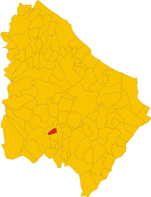
| Property / locator map image | |||||||||||
| Property / locator map image: Map of comune of Montebello sul Sangro (province of Chieti, region Abruzzo, Italy).svg / rank | |||||||||||
Normal rank | |||||||||||
| Property / locator map image: Map of comune of Montebello sul Sangro (province of Chieti, region Abruzzo, Italy).svg / reference | |||||||||||
| Property / ISTAT ID | |||||||||||
069009 | |||||||||||
| Property / ISTAT ID: 069009 / rank | |||||||||||
Normal rank | |||||||||||
| Property / ISTAT ID: 069009 / reference | |||||||||||
| Property / coordinate location | |||||||||||
41°59'0"N, 14°20'0"E
| |||||||||||
| Property / coordinate location: 41°59'0"N, 14°20'0"E / rank | |||||||||||
Normal rank | |||||||||||
| Property / coordinate location: 41°59'0"N, 14°20'0"E / reference | |||||||||||
| Property / country | |||||||||||
| Property / country: Italy / rank | |||||||||||
Normal rank | |||||||||||
| Property / country: Italy / reference | |||||||||||
| Property / Italian cadastre code | |||||||||||
B268 | |||||||||||
| Property / Italian cadastre code: B268 / rank | |||||||||||
Normal rank | |||||||||||
| Property / Italian cadastre code: B268 / reference | |||||||||||
| Property / GeoNames ID | |||||||||||
| Property / GeoNames ID: 6537472 / rank | |||||||||||
Normal rank | |||||||||||
| Property / GeoNames ID: 6537472 / reference | |||||||||||
| Property / elevation above sea level | |||||||||||
810±1 metre
| |||||||||||
| Property / elevation above sea level: 810±1 metre / rank | |||||||||||
Normal rank | |||||||||||
| Property / elevation above sea level: 810±1 metre / reference | |||||||||||
| Property / official website | |||||||||||
| Property / official website: http://digilander.libero.it/montebello.test/ / rank | |||||||||||
Normal rank | |||||||||||
| Property / official website: http://digilander.libero.it/montebello.test/ / reference | |||||||||||
| Property / Freebase ID | |||||||||||
| Property / Freebase ID: /m/0fg37g / rank | |||||||||||
Normal rank | |||||||||||
Revision as of 21:08, 5 August 2020
Italian comune
| Language | Label | Description | Also known as |
|---|---|---|---|
| English | Montebello sul Sangro |
Italian comune |
Statements
Montebello sul Sangro
0 references
1 reference
Identifiers
81001740695
0 references

