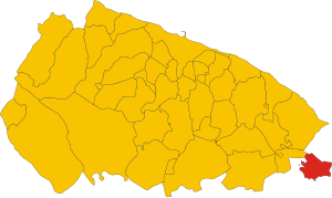
Locorotondo (Q274951): Difference between revisions
Jump to navigation
Jump to search
(Changed an Item: Adding this statements since they where added in Wikidata) |
(Changed an Item: Adding this statements since they where added in Wikidata) |
||||||||||||||
| Property / instance of | |||||||||||||||
| Property / instance of: commune of Italy / rank | |||||||||||||||
Normal rank | |||||||||||||||
| Property / Freebase ID | |||||||||||||||
| Property / Freebase ID: /m/0c82mq / rank | |||||||||||||||
Normal rank | |||||||||||||||
| Property / Freebase ID: /m/0c82mq / reference | |||||||||||||||
| Property / Freebase ID: /m/0c82mq / reference | |||||||||||||||
publication date: 28 October 2013
| |||||||||||||||
| Property / twinned administrative body | |||||||||||||||
| Property / twinned administrative body: Montpellier / rank | |||||||||||||||
Normal rank | |||||||||||||||
| Property / twinned administrative body: Montpellier / reference | |||||||||||||||
| Property / twinned administrative body | |||||||||||||||
| Property / twinned administrative body: Trzebnica / rank | |||||||||||||||
Normal rank | |||||||||||||||
| Property / GeoNames ID | |||||||||||||||
| Property / GeoNames ID: 6538944 / rank | |||||||||||||||
Normal rank | |||||||||||||||
| Property / GeoNames ID: 6538944 / reference | |||||||||||||||
| Property / category for people born here | |||||||||||||||
| Property / category for people born here: Q2600523 / rank | |||||||||||||||
Normal rank | |||||||||||||||
| Property / category for people born here: Q2600523 / reference | |||||||||||||||
| Property / VIAF ID | |||||||||||||||
| Property / VIAF ID: 137277858 / rank | |||||||||||||||
Normal rank | |||||||||||||||
| Property / VIAF ID: 137277858 / reference | |||||||||||||||
| Property / VIAF ID: 137277858 / reference | |||||||||||||||
retrieved: 2 August 2015
| |||||||||||||||
| Property / elevation above sea level | |||||||||||||||
410±1 metre
| |||||||||||||||
| Property / elevation above sea level: 410±1 metre / rank | |||||||||||||||
Normal rank | |||||||||||||||
| Property / elevation above sea level: 410±1 metre / reference | |||||||||||||||
| Property / topic's main category | |||||||||||||||
| Property / topic's main category: Category:Locorotondo / rank | |||||||||||||||
Normal rank | |||||||||||||||
| Property / licence plate code | |||||||||||||||
BA | |||||||||||||||
| Property / licence plate code: BA / rank | |||||||||||||||
Normal rank | |||||||||||||||
| Property / coordinates of northernmost point | |||||||||||||||
40°48'45.367"N, 17°19'42.485"E
| |||||||||||||||
| Property / coordinates of northernmost point: 40°48'45.367"N, 17°19'42.485"E / rank | |||||||||||||||
Normal rank | |||||||||||||||
| Property / coordinates of northernmost point: 40°48'45.367"N, 17°19'42.485"E / reference | |||||||||||||||
| Property / coordinates of southernmost point | |||||||||||||||
40°44'15.050"N, 17°20'18.190"E
| |||||||||||||||
| Property / coordinates of southernmost point: 40°44'15.050"N, 17°20'18.190"E / rank | |||||||||||||||
Normal rank | |||||||||||||||
| Property / coordinates of southernmost point: 40°44'15.050"N, 17°20'18.190"E / reference | |||||||||||||||
| Property / coordinates of easternmost point | |||||||||||||||
40°47'7.656"N, 17°24'1.994"E
| |||||||||||||||
| Property / coordinates of easternmost point: 40°47'7.656"N, 17°24'1.994"E / rank | |||||||||||||||
Normal rank | |||||||||||||||
| Property / coordinates of easternmost point: 40°47'7.656"N, 17°24'1.994"E / reference | |||||||||||||||
| Property / coordinates of westernmost point | |||||||||||||||
40°46'51.697"N, 17°16'51.334"E
| |||||||||||||||
| Property / coordinates of westernmost point: 40°46'51.697"N, 17°16'51.334"E / rank | |||||||||||||||
Normal rank | |||||||||||||||
| Property / coordinates of westernmost point: 40°46'51.697"N, 17°16'51.334"E / reference | |||||||||||||||
| Property / OSM relation ID | |||||||||||||||
| Property / OSM relation ID: 40761 / rank | |||||||||||||||
Normal rank | |||||||||||||||
| Property / UN/LOCODE | |||||||||||||||
| Property / UN/LOCODE: ITZRN / rank | |||||||||||||||
Normal rank | |||||||||||||||
| Property / capital | |||||||||||||||
| Property / capital: Locorotondo / rank | |||||||||||||||
Normal rank | |||||||||||||||
| Property / category of associated people | |||||||||||||||
| Property / category of associated people: Q2600526 / rank | |||||||||||||||
Normal rank | |||||||||||||||
| Property / area | |||||||||||||||
48.19 square kilometre
| |||||||||||||||
| Property / area: 48.19 square kilometre / rank | |||||||||||||||
Normal rank | |||||||||||||||
| Property / area: 48.19 square kilometre / qualifier | |||||||||||||||
point in time: 9 October 2011
| |||||||||||||||
| Property / area: 48.19 square kilometre / reference | |||||||||||||||
| Property / area: 48.19 square kilometre / reference | |||||||||||||||
| Property / area: 48.19 square kilometre / reference | |||||||||||||||
title: Superficie di Comuni Province e Regioni italiane al 9 ottobre 2011 (Italian) | |||||||||||||||
| Property / area: 48.19 square kilometre / reference | |||||||||||||||
retrieved: 16 March 2019
| |||||||||||||||
| Property / area: 48.19 square kilometre / reference | |||||||||||||||
| Property / population | |||||||||||||||
14,156
| |||||||||||||||
| Property / population: 14,156 / rank | |||||||||||||||
Normal rank | |||||||||||||||
| Property / population: 14,156 / qualifier | |||||||||||||||
point in time: 1 January 2017
| |||||||||||||||
| Property / population: 14,156 / qualifier | |||||||||||||||
| Property / population: 14,156 / reference | |||||||||||||||
Revision as of 18:06, 5 August 2020
Italian comune
| Language | Label | Description | Also known as |
|---|---|---|---|
| English | Locorotondo |
Italian comune |
Statements
70010
0 references
Locorotondo
0 references
080
0 references
1 reference
BA
0 references
48.19 square kilometre
9 October 2011
5 references
Superficie di Comuni Province e Regioni italiane al 9 ottobre 2011 (Italian)
16 March 2019
14,156
1 January 2017
1 reference
Identifiers
905560728
0 references
2--45751
0 references


