Kłodzko County (Q2518833): Difference between revisions
Jump to navigation
Jump to search
(Changed an Item: Adding this statements since they where added in Wikidata) |
(Changed an Item: Adding this statements since they where added in Wikidata) |
||||||||||||||
| Property / instance of | |||||||||||||||
| Property / instance of: powiat / rank | |||||||||||||||
Normal rank | |||||||||||||||
| Property / coordinate location | |||||||||||||||
50°N, 17°E
| |||||||||||||||
| Property / coordinate location: 50°N, 17°E / rank | |||||||||||||||
Normal rank | |||||||||||||||
| Property / topic's main category | |||||||||||||||
| Property / topic's main category: Category:Kłodzko County / rank | |||||||||||||||
Normal rank | |||||||||||||||
| Property / Freebase ID | |||||||||||||||
| Property / Freebase ID: /m/0237p5 / rank | |||||||||||||||
Normal rank | |||||||||||||||
| Property / Freebase ID: /m/0237p5 / reference | |||||||||||||||
| Property / Freebase ID: /m/0237p5 / reference | |||||||||||||||
publication date: 28 October 2013
| |||||||||||||||
| Property / GeoNames ID | |||||||||||||||
| Property / GeoNames ID: 7530821 / rank | |||||||||||||||
Normal rank | |||||||||||||||
| Property / GeoNames ID: 7530821 / reference | |||||||||||||||
| Property / official website | |||||||||||||||
| Property / official website: http://www.powiat.klodzko.pl / rank | |||||||||||||||
Normal rank | |||||||||||||||
| Property / official website: http://www.powiat.klodzko.pl / reference | |||||||||||||||
| Property / shares border with | |||||||||||||||
| Property / shares border with: Wałbrzych County / rank | |||||||||||||||
Normal rank | |||||||||||||||
| Property / shares border with | |||||||||||||||
| Property / shares border with: Dzierżoniów County / rank | |||||||||||||||
Normal rank | |||||||||||||||
| Property / shares border with | |||||||||||||||
| Property / shares border with: Ząbkowice Śląskie County / rank | |||||||||||||||
Normal rank | |||||||||||||||
| Property / image | |||||||||||||||
| Property / image: Goworówka. mit.JPG / rank | |||||||||||||||
Normal rank | |||||||||||||||
| Property / OSM relation ID | |||||||||||||||
| Property / OSM relation ID: 451361 / rank | |||||||||||||||
Normal rank | |||||||||||||||
| Property / licence plate code | |||||||||||||||
DKL | |||||||||||||||
| Property / licence plate code: DKL / rank | |||||||||||||||
Normal rank | |||||||||||||||
| Property / licence plate code: DKL / reference | |||||||||||||||
| Property / licence plate code: DKL / reference | |||||||||||||||
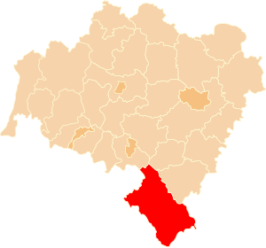
| Property / locator map image | |||||||||||||||
| Property / locator map image: POL powiat kłodzki map.svg / rank | |||||||||||||||
Normal rank | |||||||||||||||
| Property / locator map image: POL powiat kłodzki map.svg / reference | |||||||||||||||
| Property / locator map image: POL powiat kłodzki map.svg / reference | |||||||||||||||
| Property / area | |||||||||||||||
1,643.37 square kilometre
| |||||||||||||||
| Property / area: 1,643.37 square kilometre / rank | |||||||||||||||
Normal rank | |||||||||||||||
| Property / area: 1,643.37 square kilometre / reference | |||||||||||||||
| Property / area: 1,643.37 square kilometre / reference | |||||||||||||||
| Property / postal code | |||||||||||||||
57-300 | |||||||||||||||
| Property / postal code: 57-300 / rank | |||||||||||||||
Normal rank | |||||||||||||||
| Property / postal code: 57-300 / reference | |||||||||||||||
| Property / postal code: 57-300 / reference | |||||||||||||||
| Property / Library of Congress authority ID | |||||||||||||||
| Property / Library of Congress authority ID: n80139587 / rank | |||||||||||||||
Normal rank | |||||||||||||||
| Property / Library of Congress authority ID: n80139587 / reference | |||||||||||||||
| Property / Library of Congress authority ID: n80139587 / reference | |||||||||||||||
retrieved: 6 March 2019
| |||||||||||||||
| Property / VIAF ID | |||||||||||||||
| Property / VIAF ID: 137209153 / rank | |||||||||||||||
Normal rank | |||||||||||||||
Revision as of 16:15, 28 July 2020
No description defined
| Language | Label | Description | Also known as |
|---|---|---|---|
| English | Kłodzko County |
No description defined |
Statements
1,643.37 square kilometre


