Santa Marta de Penaguião (Q3001022): Difference between revisions
Jump to navigation
Jump to search
(Removed claim: country (P32): Portugal (Q18), Removing this statements since they changed in Wikidata) |
(Changed an Item: Adding these statements since they where added in Wikidata) |
||||||||||||||
| Property / instance of | |||||||||||||||
| Property / instance of: municipality of Portugal / rank | |||||||||||||||
Normal rank | |||||||||||||||
| Property / instance of | |||||||||||||||
| Property / instance of: town of Portugal / rank | |||||||||||||||
Normal rank | |||||||||||||||
| Property / instance of: town of Portugal / qualifier | |||||||||||||||
start time: 1202Gregorian
| |||||||||||||||
| Property / instance of: town of Portugal / reference | |||||||||||||||
| Property / Commons category | |||||||||||||||
Santa Marta de Penaguião | |||||||||||||||
| Property / Commons category: Santa Marta de Penaguião / rank | |||||||||||||||
Normal rank | |||||||||||||||
| Property / located in the administrative territorial entity | |||||||||||||||
| Property / located in the administrative territorial entity: Vila Real / rank | |||||||||||||||
Normal rank | |||||||||||||||
| Property / located in the administrative territorial entity: Vila Real / reference | |||||||||||||||
| Property / located in the administrative territorial entity | |||||||||||||||
| Property / located in the administrative territorial entity: Douro Subregion / rank | |||||||||||||||
Normal rank | |||||||||||||||
| Property / located in the administrative territorial entity | |||||||||||||||
| Property / located in the administrative territorial entity: Trás-os-Montes e Alto Douro / rank | |||||||||||||||
Normal rank | |||||||||||||||
| Property / located in the administrative territorial entity: Trás-os-Montes e Alto Douro / qualifier | |||||||||||||||
start time: 21 December 1936
| |||||||||||||||
| Property / located in the administrative territorial entity: Trás-os-Montes e Alto Douro / qualifier | |||||||||||||||
end time: 28 September 1959
| |||||||||||||||
| Property / located in the administrative territorial entity: Trás-os-Montes e Alto Douro / reference | |||||||||||||||
| Property / located in the administrative territorial entity: Trás-os-Montes e Alto Douro / reference | |||||||||||||||
| Property / located in the administrative territorial entity: Trás-os-Montes e Alto Douro / reference | |||||||||||||||
retrieved: 12 August 2021
| |||||||||||||||
| Property / coordinate location | |||||||||||||||
41°12'N, 7°47'W
| |||||||||||||||
| Property / coordinate location: 41°12'N, 7°47'W / rank | |||||||||||||||
Normal rank | |||||||||||||||
| Property / coordinate location: 41°12'N, 7°47'W / reference | |||||||||||||||
| Property / country | |||||||||||||||
| Property / country: Portugal / rank | |||||||||||||||
Normal rank | |||||||||||||||
| Property / country: Portugal / reference | |||||||||||||||
| Property / topic's main category | |||||||||||||||
| Property / topic's main category: Category:Santa Marta de Penaguião / rank | |||||||||||||||
Normal rank | |||||||||||||||
| Property / Freebase ID | |||||||||||||||
| Property / Freebase ID: /m/0521h8 / rank | |||||||||||||||
Normal rank | |||||||||||||||
| Property / Freebase ID: /m/0521h8 / reference | |||||||||||||||
| Property / Freebase ID: /m/0521h8 / reference | |||||||||||||||
publication date: 28 October 2013
| |||||||||||||||
| Property / GeoNames ID | |||||||||||||||
| Property / GeoNames ID: 2734667 / rank | |||||||||||||||
Normal rank | |||||||||||||||
| Property / GeoNames ID: 2734667 / reference | |||||||||||||||
| Property / official website | |||||||||||||||
| Property / official website: http://www.cm-smpenaguiao.pt/ / rank | |||||||||||||||
Normal rank | |||||||||||||||
| Property / official website: http://www.cm-smpenaguiao.pt/ / reference | |||||||||||||||
| Property / area | |||||||||||||||
70 square kilometre
| |||||||||||||||
| Property / area: 70 square kilometre / rank | |||||||||||||||
Normal rank | |||||||||||||||
| Property / area: 70 square kilometre / reference | |||||||||||||||
| Property / area | |||||||||||||||
69.28±0.010000000000005116 square kilometre
| |||||||||||||||
| Property / area: 69.28±0.010000000000005116 square kilometre / rank | |||||||||||||||
Normal rank | |||||||||||||||
| Property / area: 69.28±0.010000000000005116 square kilometre / reference | |||||||||||||||
| Property / area: 69.28±0.010000000000005116 square kilometre / reference | |||||||||||||||
retrieved: 19 September 2018
| |||||||||||||||
| Property / area: 69.28±0.010000000000005116 square kilometre / reference | |||||||||||||||
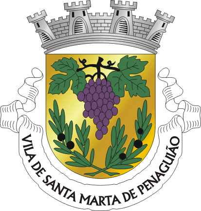
| Property / coat of arms image | |||||||||||||||
| Property / coat of arms image: SMP.png / rank | |||||||||||||||
Normal rank | |||||||||||||||
| Property / coat of arms image: SMP.png / reference | |||||||||||||||
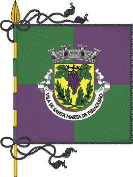
| Property / flag image | |||||||||||||||
| Property / flag image: Pt-smp1.png / rank | |||||||||||||||
Normal rank | |||||||||||||||
| Property / flag image: Pt-smp1.png / reference | |||||||||||||||
| Property / postal code | |||||||||||||||
5030 | |||||||||||||||
| Property / postal code: 5030 / rank | |||||||||||||||
Normal rank | |||||||||||||||
| Property / postal code: 5030 / reference | |||||||||||||||
| Property / contains administrative territorial entity | |||||||||||||||
| Property / contains administrative territorial entity: Louredo e Fornelos / rank | |||||||||||||||
Normal rank | |||||||||||||||
| Property / contains administrative territorial entity | |||||||||||||||
| Property / contains administrative territorial entity: Lobrigos (São Miguel e São João Baptista) e Sanhoane / rank | |||||||||||||||
Normal rank | |||||||||||||||
| Property / contains administrative territorial entity | |||||||||||||||
| Property / contains administrative territorial entity: Alvações do Corgo / rank | |||||||||||||||
Normal rank | |||||||||||||||
Revision as of 23:55, 7 October 2021
No description defined
- Santa Marta de Penaguião Municipality
| Language | Label | Description | Also known as |
|---|---|---|---|
| English | Santa Marta de Penaguião |
No description defined |
|
Statements
1202Gregorian
1 reference
Santa Marta de Penaguião
0 references
21 December 1936
28 September 1959
69.28±0.010000000000005116 square kilometre


