United States Minor Outlying Islands (Q2642712): Difference between revisions
Jump to navigation
Jump to search
(Changed an Item: Adding these statements since they where added in Wikidata) |
(Changed an Item: Adding these statements since they where added in Wikidata) |
||||||||||||||
| (44 intermediate revisions by the same user not shown) | |||||||||||||||
| label / fr | label / fr | ||||||||||||||
îles mineures éloignées des États-Unis | |||||||||||||||
| label / hu | label / hu | ||||||||||||||
az Amerikai Egyesült Államok lakatlan külbirtokai | |||||||||||||||
| label / sl | label / sl | ||||||||||||||
Manjši zunanji otoki Združenih držav | |||||||||||||||
| label / lb | label / lb | ||||||||||||||
Kleng entleeën Insele vun de Vereenegte Staaten | |||||||||||||||
| aliases / en / 0 | aliases / en / 0 | ||||||||||||||
USMOI | |||||||||||||||
| aliases / sk / 0 | aliases / sk / 0 | ||||||||||||||
Menšie odľahlé ostrovy Spojených štátov | |||||||||||||||
| aliases / lb / 0 | aliases / lb / 0 | ||||||||||||||
Kleng ofgeleeën Insele vun de Vereenegte Staaten | |||||||||||||||
| aliases / lb / 1 | aliases / lb / 1 | ||||||||||||||
U.S. Minor Outlying Islands | |||||||||||||||
| description / en | description / en | ||||||||||||||
statistical designation of small islands of the United States | |||||||||||||||
| description / es | description / es | ||||||||||||||
islas sin habitantes permanentes | islas sin habitantes permanentes de los Estados Unidos de América | ||||||||||||||
| description / fr | description / fr | ||||||||||||||
groupe de | groupe de territoires insulaires des États-Unis quasiment inhabités (défini à des fins statistiques) | ||||||||||||||
| description / sl | description / sl | ||||||||||||||
statistična oznaka majhnih otokov Združenih držav Amerike | |||||||||||||||
| description / lb | description / lb | ||||||||||||||
statistesch Bezeechnung fir néng onbewunnt Inselterritoiren vun den USA | |||||||||||||||
| Property / continent | |||||||||||||||
| Property / continent: Insular Oceania / rank | |||||||||||||||
| Property / continent | |||||||||||||||
| Property / continent: North America / rank | |||||||||||||||
| Property / population | |||||||||||||||
| |||||||||||||||
| Property / population: 300 / rank | |||||||||||||||
| Property / population: 300 / qualifier | |||||||||||||||
| |||||||||||||||
| Property / population: 300 / qualifier | |||||||||||||||
| Property / population | |||||||||||||||
| |||||||||||||||
| Property / population: 4,874 / rank | |||||||||||||||
| Property / population: 4,874 / qualifier | |||||||||||||||
| |||||||||||||||
| Property / population: 4,874 / qualifier | |||||||||||||||
| Property / population: 4,874 / reference | |||||||||||||||
| Property / population | |||||||||||||||
| |||||||||||||||
| Property / population: 3,609 / rank | |||||||||||||||
| Property / population: 3,609 / qualifier | |||||||||||||||
| |||||||||||||||
| Property / population: 3,609 / qualifier | |||||||||||||||
| Property / population: 3,609 / reference | |||||||||||||||
| Property / population | |||||||||||||||
| |||||||||||||||
| Property / population: 821 / rank | |||||||||||||||
| Property / population: 821 / qualifier | |||||||||||||||
| |||||||||||||||
| Property / population: 821 / qualifier | |||||||||||||||
| Property / population: 821 / reference | |||||||||||||||
| Property / population | |||||||||||||||
| |||||||||||||||
| Property / population: 190 / rank | |||||||||||||||
| Property / population: 190 / qualifier | |||||||||||||||
| |||||||||||||||
| Property / population: 190 / qualifier | |||||||||||||||
| Property / population: 190 / reference | |||||||||||||||
| Property / inception | |||||||||||||||
| |||||||||||||||
| Property / inception: 1986 / rank | |||||||||||||||
| Property / inception: 1986 / qualifier | |||||||||||||||
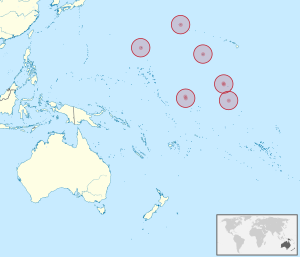
| Property / locator map image | |||||||||||||||
| Property / locator map image: United States Minor Outlying Islands.png / rank | |||||||||||||||
| Property / locator map image | |||||||||||||||
| Property / locator map image: United States Minor Outlying Islands in Oceania.svg / rank | |||||||||||||||
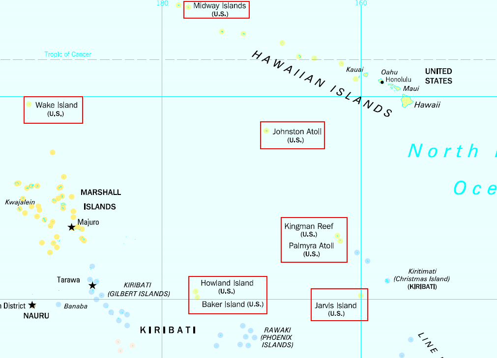
| Property / locator map image | |||||||||||||||
| Property / locator map image: United States Minor Outlying Island in Oceania (small islands magnified).svg / rank | |||||||||||||||
| Property / lowest point | |||||||||||||||
| Property / lowest point: Pacific Ocean / rank | |||||||||||||||
| Property / highest point | |||||||||||||||
| Property / highest point: Dunning Hill / rank | |||||||||||||||
| Property / coordinates of southernmost point | |||||||||||||||
| |||||||||||||||
| Property / coordinates of southernmost point: 5°53'2"N, 162°4'42"W / rank | |||||||||||||||
| Property / coordinates of easternmost point | |||||||||||||||
| |||||||||||||||
| Property / coordinates of easternmost point: 19°16'13.2"N, 166°39'26.3"E / rank | |||||||||||||||
| Property / coordinates of westernmost point | |||||||||||||||
| |||||||||||||||
| Property / coordinates of westernmost point: 13°26'51.0"N, 144°37'5.5"E / rank | |||||||||||||||
| Property / short name | |||||||||||||||
| Property / short name: 🇺🇲 (no linguistic content) / rank | |||||||||||||||
| Property / short name: 🇺🇲 (no linguistic content) / qualifier | |||||||||||||||
| Property / located in or next to body of water | |||||||||||||||
| Property / located in or next to body of water: Caribbean Sea / rank | |||||||||||||||
| Property / located in or next to body of water: Caribbean Sea / qualifier | |||||||||||||||
| Property / located in or next to body of water | |||||||||||||||
| Property / located in or next to body of water: Pacific Ocean / rank | |||||||||||||||
| Property / located in or next to body of water: Pacific Ocean / qualifier | |||||||||||||||
| Property / geography of topic | |||||||||||||||
| Property / geography of topic: geography of the United States Minor Outlying Islands / rank | |||||||||||||||
| Property / continent | |||||||||||||||
| Property / continent: North America / rank | |||||||||||||||
Normal rank | |||||||||||||||
| Property / continent | |||||||||||||||
| Property / continent: Insular Oceania / rank | |||||||||||||||
Normal rank | |||||||||||||||
| Property / contains administrative territorial entity | |||||||||||||||
| Property / contains administrative territorial entity: Serranilla Bank / rank | |||||||||||||||
Normal rank | |||||||||||||||
| Property / contains administrative territorial entity: Serranilla Bank / qualifier | |||||||||||||||
| Property / contains administrative territorial entity | |||||||||||||||
| Property / contains administrative territorial entity: Bajo Nuevo Bank / rank | |||||||||||||||
Normal rank | |||||||||||||||
| Property / contains administrative territorial entity: Bajo Nuevo Bank / qualifier | |||||||||||||||
| Property / contains administrative territorial entity: Bajo Nuevo Bank / qualifier | |||||||||||||||
| Property / contains administrative territorial entity: Bajo Nuevo Bank / qualifier | |||||||||||||||
| Property / population | |||||||||||||||
300
| |||||||||||||||
| Property / population: 300 / rank | |||||||||||||||
Normal rank | |||||||||||||||
| Property / population: 300 / qualifier | |||||||||||||||
point in time: 2008
| |||||||||||||||
| Property / population: 300 / qualifier | |||||||||||||||
| Property / population | |||||||||||||||
4,874
| |||||||||||||||
| Property / population: 4,874 / rank | |||||||||||||||
Normal rank | |||||||||||||||
| Property / population: 4,874 / qualifier | |||||||||||||||
point in time: 1970
| |||||||||||||||
| Property / population: 4,874 / qualifier | |||||||||||||||
| Property / population: 4,874 / reference | |||||||||||||||
| Property / population | |||||||||||||||
3,609
| |||||||||||||||
| Property / population: 3,609 / rank | |||||||||||||||
Normal rank | |||||||||||||||
| Property / population: 3,609 / qualifier | |||||||||||||||
point in time: 1960
| |||||||||||||||
| Property / population: 3,609 / qualifier | |||||||||||||||
| Property / population: 3,609 / reference | |||||||||||||||
| Property / population | |||||||||||||||
821
| |||||||||||||||
| Property / population: 821 / rank | |||||||||||||||
Normal rank | |||||||||||||||
| Property / population: 821 / qualifier | |||||||||||||||
point in time: 1950
| |||||||||||||||
| Property / population: 821 / qualifier | |||||||||||||||
| Property / population: 821 / reference | |||||||||||||||
| Property / population | |||||||||||||||
190
| |||||||||||||||
| Property / population: 190 / rank | |||||||||||||||
Preferred rank | |||||||||||||||
| Property / population: 190 / qualifier | |||||||||||||||
point in time: 2010
| |||||||||||||||
| Property / population: 190 / qualifier | |||||||||||||||
| Property / population: 190 / reference | |||||||||||||||
| Property / lowest point | |||||||||||||||
| Property / lowest point: Pacific Ocean / rank | |||||||||||||||
Normal rank | |||||||||||||||
| Property / lowest point: Pacific Ocean / qualifier | |||||||||||||||
| Property / iNaturalist place ID | |||||||||||||||
| Property / iNaturalist place ID: 10316 / rank | |||||||||||||||
Normal rank | |||||||||||||||
| Property / located in or next to body of water | |||||||||||||||
| Property / located in or next to body of water: Caribbean Sea / rank | |||||||||||||||
Normal rank | |||||||||||||||
| Property / located in or next to body of water: Caribbean Sea / qualifier | |||||||||||||||
| Property / located in or next to body of water: Caribbean Sea / qualifier | |||||||||||||||
| Property / located in or next to body of water: Caribbean Sea / qualifier | |||||||||||||||
| Property / located in or next to body of water | |||||||||||||||
| Property / located in or next to body of water: Pacific Ocean / rank | |||||||||||||||
Normal rank | |||||||||||||||
| Property / located in or next to body of water: Pacific Ocean / qualifier | |||||||||||||||
| Property / located in or next to body of water: Pacific Ocean / qualifier | |||||||||||||||
| Property / located in or next to body of water: Pacific Ocean / qualifier | |||||||||||||||
| Property / located in or next to body of water: Pacific Ocean / qualifier | |||||||||||||||
| Property / located in or next to body of water: Pacific Ocean / qualifier | |||||||||||||||
| Property / located in or next to body of water: Pacific Ocean / qualifier | |||||||||||||||
| Property / located in or next to body of water: Pacific Ocean / qualifier | |||||||||||||||
| Property / located in or next to body of water: Pacific Ocean / qualifier | |||||||||||||||
| Property / locator map image | |||||||||||||||
| Property / locator map image: United States Minor Outlying Islands in Oceania.svg / rank | |||||||||||||||
Normal rank | |||||||||||||||
| Property / locator map image: United States Minor Outlying Islands in Oceania.svg / qualifier | |||||||||||||||
| Property / locator map image: United States Minor Outlying Islands in Oceania.svg / qualifier | |||||||||||||||
| Property / locator map image: United States Minor Outlying Islands in Oceania.svg / qualifier | |||||||||||||||
| Property / locator map image: United States Minor Outlying Islands in Oceania.svg / qualifier | |||||||||||||||
| Property / locator map image: United States Minor Outlying Islands in Oceania.svg / qualifier | |||||||||||||||
| Property / locator map image: United States Minor Outlying Islands in Oceania.svg / qualifier | |||||||||||||||
| Property / locator map image: United States Minor Outlying Islands in Oceania.svg / qualifier | |||||||||||||||
| Property / locator map image: United States Minor Outlying Islands in Oceania.svg / qualifier | |||||||||||||||
| Property / locator map image | |||||||||||||||
| Property / locator map image: United States Minor Outlying Island in Oceania (small islands magnified).svg / rank | |||||||||||||||
Normal rank | |||||||||||||||
| Property / locator map image: United States Minor Outlying Island in Oceania (small islands magnified).svg / qualifier | |||||||||||||||
| Property / locator map image: United States Minor Outlying Island in Oceania (small islands magnified).svg / qualifier | |||||||||||||||
| Property / locator map image: United States Minor Outlying Island in Oceania (small islands magnified).svg / qualifier | |||||||||||||||
| Property / locator map image: United States Minor Outlying Island in Oceania (small islands magnified).svg / qualifier | |||||||||||||||
| Property / locator map image: United States Minor Outlying Island in Oceania (small islands magnified).svg / qualifier | |||||||||||||||
| Property / locator map image: United States Minor Outlying Island in Oceania (small islands magnified).svg / qualifier | |||||||||||||||
| Property / locator map image: United States Minor Outlying Island in Oceania (small islands magnified).svg / qualifier | |||||||||||||||
| Property / locator map image: United States Minor Outlying Island in Oceania (small islands magnified).svg / qualifier | |||||||||||||||
| Property / locator map image | |||||||||||||||
| Property / locator map image: United States Minor Outlying Islands.png / rank | |||||||||||||||
Normal rank | |||||||||||||||
| Property / locator map image: United States Minor Outlying Islands.png / qualifier | |||||||||||||||
| Property / locator map image: United States Minor Outlying Islands.png / qualifier | |||||||||||||||
| Property / locator map image: United States Minor Outlying Islands.png / qualifier | |||||||||||||||
| Property / locator map image: United States Minor Outlying Islands.png / qualifier | |||||||||||||||
| Property / locator map image: United States Minor Outlying Islands.png / qualifier | |||||||||||||||
| Property / locator map image: United States Minor Outlying Islands.png / qualifier | |||||||||||||||
| Property / locator map image: United States Minor Outlying Islands.png / qualifier | |||||||||||||||
| Property / locator map image: United States Minor Outlying Islands.png / qualifier | |||||||||||||||
| Property / OpenStreetMap object | |||||||||||||||
node/9757963802 | |||||||||||||||
| Property / OpenStreetMap object: node/9757963802 / rank | |||||||||||||||
Normal rank | |||||||||||||||
| Property / inception | |||||||||||||||
1986
| |||||||||||||||
| Property / inception: 1986 / rank | |||||||||||||||
Normal rank | |||||||||||||||
| Property / inception: 1986 / qualifier | |||||||||||||||
| Property / inception: 1986 / reference | |||||||||||||||
| Property / highest point | |||||||||||||||
| Property / highest point: Dunning Hill / rank | |||||||||||||||
Normal rank | |||||||||||||||
| Property / highest point: Dunning Hill / qualifier | |||||||||||||||
| Property / coordinates of southernmost point | |||||||||||||||
5°53'2"N, 162°4'42"W
| |||||||||||||||
| Property / coordinates of southernmost point: 5°53'2"N, 162°4'42"W / rank | |||||||||||||||
Normal rank | |||||||||||||||
| Property / coordinates of southernmost point: 5°53'2"N, 162°4'42"W / qualifier | |||||||||||||||
| Property / coordinates of easternmost point | |||||||||||||||
19°16'13.2"N, 166°39'26.3"E
| |||||||||||||||
| Property / coordinates of easternmost point: 19°16'13.2"N, 166°39'26.3"E / rank | |||||||||||||||
Normal rank | |||||||||||||||
| Property / coordinates of easternmost point: 19°16'13.2"N, 166°39'26.3"E / qualifier | |||||||||||||||
| Property / coordinates of westernmost point | |||||||||||||||
13°26'51.0"N, 144°37'5.5"E
| |||||||||||||||
| Property / coordinates of westernmost point: 13°26'51.0"N, 144°37'5.5"E / rank | |||||||||||||||
Normal rank | |||||||||||||||
| Property / coordinates of westernmost point: 13°26'51.0"N, 144°37'5.5"E / qualifier | |||||||||||||||
| Property / geography of topic | |||||||||||||||
| Property / geography of topic: geography of the United States Minor Outlying Islands / rank | |||||||||||||||
Normal rank | |||||||||||||||
| Property / official name | |||||||||||||||
United States Minor Outlying Islands (American English) | |||||||||||||||
| Property / official name: United States Minor Outlying Islands (American English) / rank | |||||||||||||||
Normal rank | |||||||||||||||
| Property / official name: United States Minor Outlying Islands (American English) / reference | |||||||||||||||
| Property / Store norske leksikon ID | |||||||||||||||
| Property / Store norske leksikon ID: USAs_ytre_småøyer / rank | |||||||||||||||
Normal rank | |||||||||||||||
| Property / coordinates of northernmost point | |||||||||||||||
28°N, 177°W
| |||||||||||||||
| Property / coordinates of northernmost point: 28°N, 177°W / rank | |||||||||||||||
Normal rank | |||||||||||||||
| Property / coordinates of northernmost point: 28°N, 177°W / qualifier | |||||||||||||||
| Property / National Historical Museums of Sweden agent ID | |||||||||||||||
geo/17798F3E-4421-4CC8-BBEC-A9FCE771EAEB | |||||||||||||||
| Property / National Historical Museums of Sweden agent ID: geo/17798F3E-4421-4CC8-BBEC-A9FCE771EAEB / rank | |||||||||||||||
Normal rank | |||||||||||||||
| Property / EU Knowledge Graph item ID | |||||||||||||||
Q2642712 | |||||||||||||||
| Property / EU Knowledge Graph item ID: Q2642712 / rank | |||||||||||||||
Normal rank | |||||||||||||||
| Property / OpenStreetMap node ID | |||||||||||||||
9757963802 | |||||||||||||||
| Property / OpenStreetMap node ID: 9757963802 / rank | |||||||||||||||
Normal rank | |||||||||||||||
| Property / M.49 code | |||||||||||||||
581 | |||||||||||||||
| Property / M.49 code: 581 / rank | |||||||||||||||
Normal rank | |||||||||||||||
| Property / driving side | |||||||||||||||
| Property / driving side: right / rank | |||||||||||||||
Normal rank | |||||||||||||||
| Property / short name | |||||||||||||||
🇺🇲 (no linguistic content) | |||||||||||||||
| Property / short name: 🇺🇲 (no linguistic content) / rank | |||||||||||||||
Normal rank | |||||||||||||||
| Property / short name: 🇺🇲 (no linguistic content) / qualifier | |||||||||||||||
| Property / SNARC ID | |||||||||||||||
Q50105 | |||||||||||||||
| Property / SNARC ID: Q50105 / rank | |||||||||||||||
Normal rank | |||||||||||||||
| Property / history of topic | |||||||||||||||
| Property / history of topic: Q7332011 / rank | |||||||||||||||
Normal rank | |||||||||||||||
| Property / flag image | |||||||||||||||
| Property / flag image: Flag of the United States.svg / rank | |||||||||||||||
Normal rank | |||||||||||||||
| Property / currency | |||||||||||||||
| Property / currency: US dollar / rank | |||||||||||||||
Normal rank | |||||||||||||||
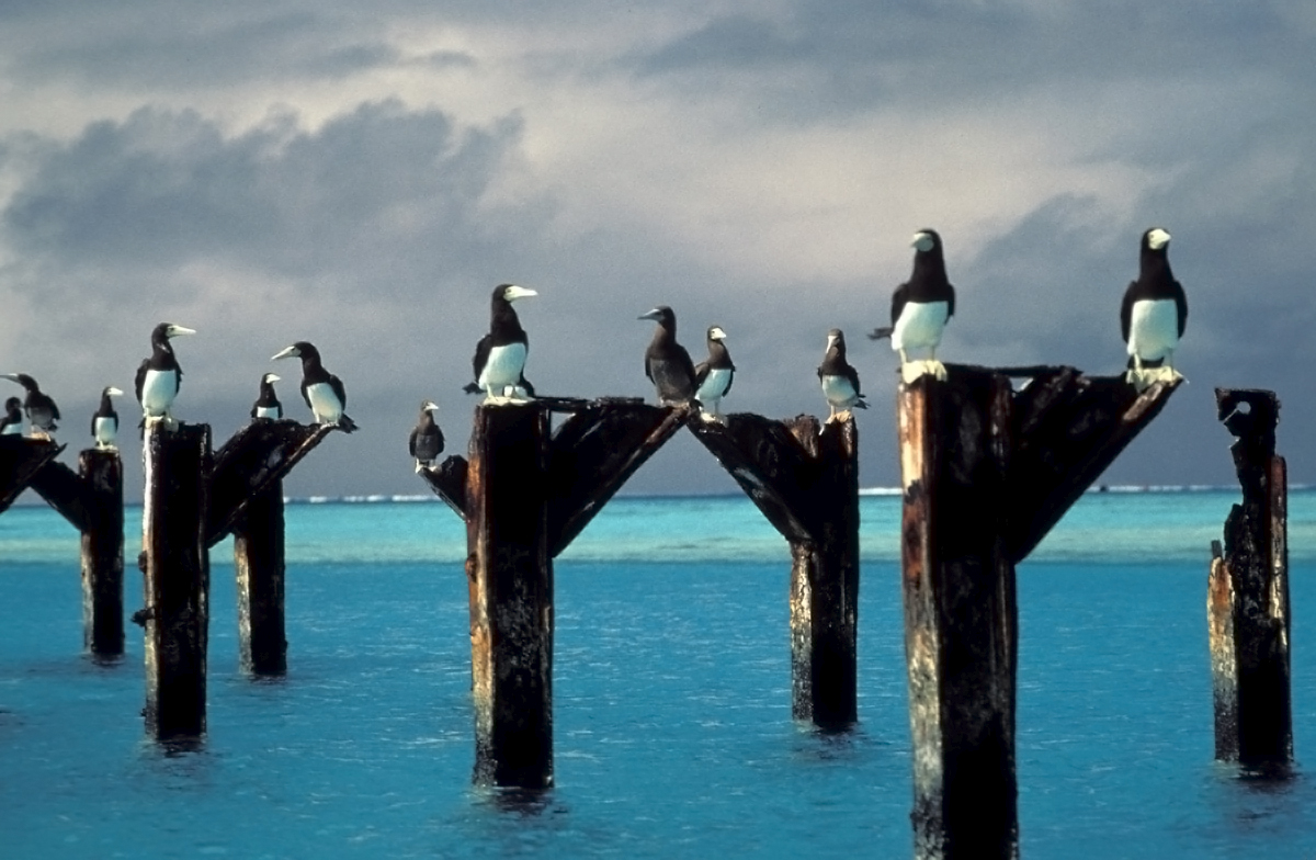
| Property / page banner | |||||||||||||||
| Property / page banner: Brown boobies atop pier posts at Johnston Atoll NWR.jpg / rank | |||||||||||||||
Normal rank | |||||||||||||||
Latest revision as of 10:15, 29 October 2024
statistical designation of small islands of the United States
- um
- US Minor Outlying Islands
- U.S. Minor Outlying Islands
- 🇺🇲
- US-UM
- USMOI
| Language | Label | Description | Also known as |
|---|---|---|---|
| English | United States Minor Outlying Islands |
statistical designation of small islands of the United States |
|
Statements
3 references
United States Minor Outlying Islands
0 references
316
193
1,082
🇺🇲
0 references
0
0 references
United States Minor Outlying Island in Oceania (small islands magnified).svg
1,181 × 1,013; 2.86 MB
1,181 × 1,013; 2.86 MB
0 references
United States Minor Outlying Islands (American English)
Identifiers
UMI
0 references
581
0 references
US-UM
0 references
1878752
0 references
UM
0 references
74
0 references
3 references
1454
0 references
node/9757963802
0 references
geo/17798F3E-4421-4CC8-BBEC-A9FCE771EAEB
0 references
Q2642712
0 references
9757963802
0 references
581
0 references
Q50105
0 references


