Suffolk (Q2549791): Difference between revisions
Jump to navigation
Jump to search
(Changed an Item: Adding this statements since they where added in Wikidata) |
(Removed claim: Store norske leksikon ID (P320): Suffolk_-_grevskap_i_England, Removing this statements since they changed in Wikidata) |
||||||||||||||
| (38 intermediate revisions by 2 users not shown) | |||||||||||||||
| label / el | label / el | ||||||||||||||
Σάφoκ | |||||||||||||||
| aliases / en / 0 | aliases / en / 0 | ||||||||||||||
Suffolk County, England | |||||||||||||||
| aliases / el / 0 | aliases / el / 0 | ||||||||||||||
Σάφεκ | |||||||||||||||
| aliases / lv / 0 | aliases / lv / 0 | ||||||||||||||
Safolkas grāfiste | |||||||||||||||
| description / el | description / el | ||||||||||||||
κομητεία της Αγγλίας | |||||||||||||||
| description / sv | description / sv | ||||||||||||||
ceremoniellt och administrativt grevskap i England, Storbritannien | |||||||||||||||
| description / sl | description / sl | ||||||||||||||
ceremonialna grofija Anglije | |||||||||||||||
| Property / coordinate location | |||||||||||||||
| |||||||||||||||
| Property / coordinate location: 52°N, 1°E / rank | |||||||||||||||
| Property / coordinate location: 52°N, 1°E / reference | |||||||||||||||
| Property / instance of: 2016 NUTS 3 statistical territorial entity / rank | Property / instance of: 2016 NUTS 3 statistical territorial entity / rank | ||||||||||||||
Normal rank | |||||||||||||||
| Property / GeoNames ID | |||||||||||||||
| Property / GeoNames ID: 2636561 / rank | |||||||||||||||
| Property / GeoNames ID: 2636561 / reference | |||||||||||||||
| Property / Encyclopædia Britannica Online ID | |||||||||||||||
| Property / Encyclopædia Britannica Online ID: place/Suffolk-county-England / rank | |||||||||||||||
| Property / NKCR AUT ID | |||||||||||||||
| Property / NKCR AUT ID: ge765335 / rank | |||||||||||||||
| Property / legislative body | |||||||||||||||
| Property / legislative body: Suffolk County Council / rank | |||||||||||||||
| Property / UK Parliament thesaurus ID | |||||||||||||||
| Property / UK Parliament thesaurus ID: 13108 / rank | |||||||||||||||
| Property / instance of | |||||||||||||||
| Property / instance of: 2021 NUTS 3 statistical territorial entity / rank | |||||||||||||||
Preferred rank | |||||||||||||||
| Property / population | |||||||||||||||
732,300
| |||||||||||||||
| Property / population: 732,300 / rank | |||||||||||||||
Normal rank | |||||||||||||||
| Property / population: 732,300 / qualifier | |||||||||||||||
point in time: 2012
| |||||||||||||||
| Property / population: 732,300 / qualifier | |||||||||||||||
| Property / population: 732,300 / reference | |||||||||||||||
| Property / population | |||||||||||||||
768,555
| |||||||||||||||
| Property / population: 768,555 / rank | |||||||||||||||
Normal rank | |||||||||||||||
| Property / population: 768,555 / qualifier | |||||||||||||||
point in time: 2022
| |||||||||||||||
| Property / population: 768,555 / qualifier | |||||||||||||||
| Property / population: 768,555 / reference | |||||||||||||||
| Property / described by source | |||||||||||||||
| Property / described by source: Encyclopædia Britannica 11th edition / rank | |||||||||||||||
Normal rank | |||||||||||||||
| Property / described by source: Encyclopædia Britannica 11th edition / qualifier | |||||||||||||||
| Property / described by source | |||||||||||||||
| Property / described by source: Small Brockhaus and Efron Encyclopedic Dictionary / rank | |||||||||||||||
Normal rank | |||||||||||||||
| Property / described by source: Small Brockhaus and Efron Encyclopedic Dictionary / qualifier | |||||||||||||||
| Property / GeoNames ID | |||||||||||||||
| Property / GeoNames ID: 2636561 / rank | |||||||||||||||
Normal rank | |||||||||||||||
| Property / GeoNames ID: 2636561 / qualifier | |||||||||||||||
| Property / GeoNames ID | |||||||||||||||
| Property / GeoNames ID: 11609019 / rank | |||||||||||||||
Normal rank | |||||||||||||||
| Property / GeoNames ID: 11609019 / qualifier | |||||||||||||||
| Property / UK Parliament thesaurus ID | |||||||||||||||
| Property / UK Parliament thesaurus ID: 13108 / rank | |||||||||||||||
Normal rank | |||||||||||||||
| Property / UK Parliament thesaurus ID: 13108 / qualifier | |||||||||||||||
named as: Suffolk | |||||||||||||||
| Property / iNaturalist place ID | |||||||||||||||
| Property / iNaturalist place ID: 30407 / rank | |||||||||||||||
Normal rank | |||||||||||||||
| Property / iNaturalist place ID: 30407 / reference | |||||||||||||||
| Property / iNaturalist place ID: 30407 / reference | |||||||||||||||
retrieved: 25 April 2021
| |||||||||||||||
| Property / iNaturalist place ID: 30407 / reference | |||||||||||||||
| Property / Quora topic ID | |||||||||||||||
| Property / Quora topic ID: Suffolk-1 / rank | |||||||||||||||
Normal rank | |||||||||||||||
| Property / Store norske leksikon ID | |||||||||||||||
| Property / Store norske leksikon ID: Suffolk_-_fylke_i_England / rank | |||||||||||||||
Normal rank | |||||||||||||||
| Property / museum-digital place ID | |||||||||||||||
12961 | |||||||||||||||
| Property / museum-digital place ID: 12961 / rank | |||||||||||||||
Normal rank | |||||||||||||||
| Property / museum-digital place ID: 12961 / reference | |||||||||||||||
| Property / subreddit | |||||||||||||||
| Property / subreddit: suffolk / rank | |||||||||||||||
Normal rank | |||||||||||||||
| Property / Den Store Danske ID | |||||||||||||||
Suffolk | |||||||||||||||
| Property / Den Store Danske ID: Suffolk / rank | |||||||||||||||
Normal rank | |||||||||||||||
| Property / said to be the same as | |||||||||||||||
| Property / said to be the same as: Suffolk (historic county) / rank | |||||||||||||||
Normal rank | |||||||||||||||
| Property / said to be the same as: Suffolk (historic county) / qualifier | |||||||||||||||
point in time: 1844
| |||||||||||||||
| Property / said to be the same as: Suffolk (historic county) / qualifier | |||||||||||||||
| Property / said to be the same as: Suffolk (historic county) / qualifier | |||||||||||||||
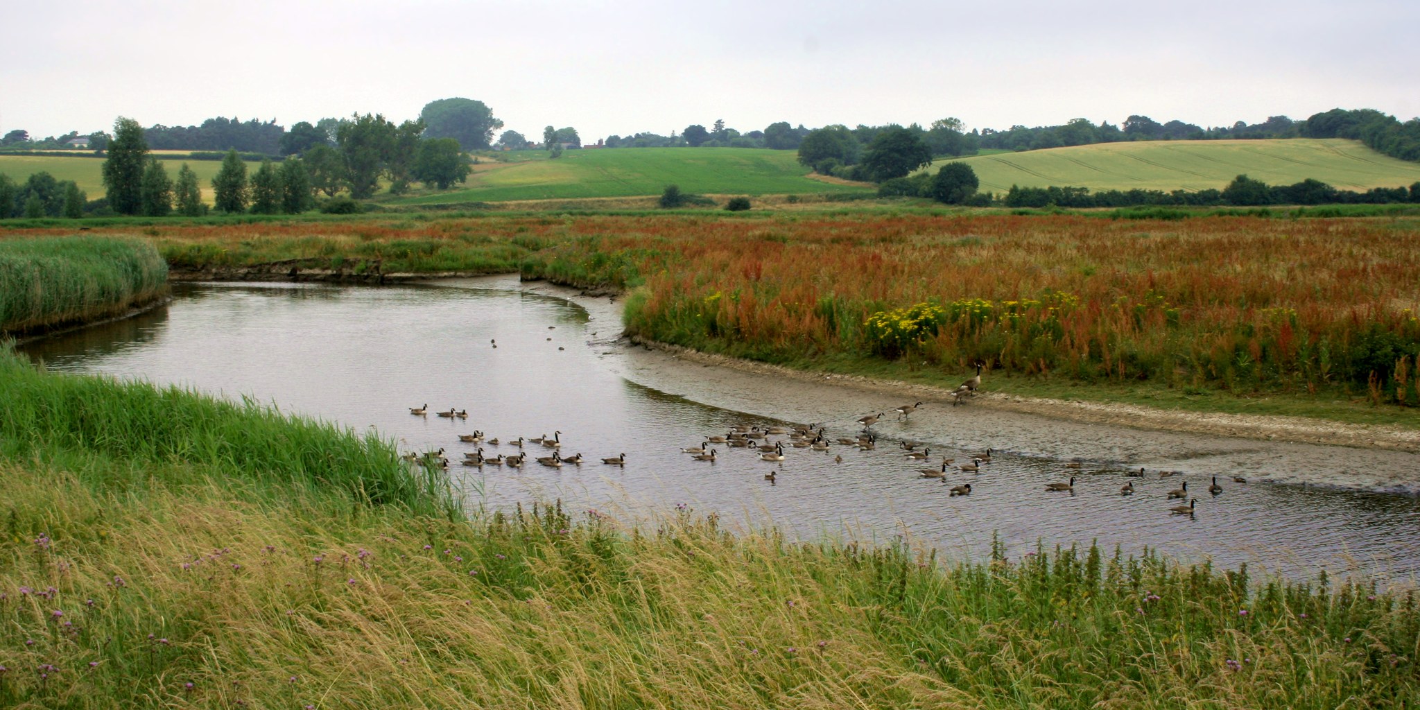
| Property / image | |||||||||||||||
| Property / image: Cmglee Manningtree River Stour.jpg / rank | |||||||||||||||
Normal rank | |||||||||||||||
| Property / image: Cmglee Manningtree River Stour.jpg / reference | |||||||||||||||
| Property / Online PWN Encyclopedia | |||||||||||||||
3981106 | |||||||||||||||
| Property / Online PWN Encyclopedia: 3981106 / rank | |||||||||||||||
Normal rank | |||||||||||||||
| Property / NKCR AUT ID | |||||||||||||||
| Property / NKCR AUT ID: ge765335 / rank | |||||||||||||||
Normal rank | |||||||||||||||
| Property / NKCR AUT ID: ge765335 / qualifier | |||||||||||||||
named as: Suffolk (Anglie : hrabství) | |||||||||||||||
| Property / native label | |||||||||||||||
Suffolk (English) | |||||||||||||||
| Property / native label: Suffolk (English) / rank | |||||||||||||||
Normal rank | |||||||||||||||
| Property / native label: Suffolk (English) / reference | |||||||||||||||
| Property / native label: Suffolk (English) / reference | |||||||||||||||
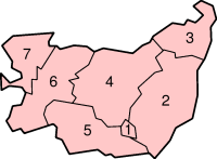
| Property / detail map | |||||||||||||||
| Property / detail map: SuffolkNumbered.png / rank | |||||||||||||||
Normal rank | |||||||||||||||
| Property / detail map: SuffolkNumbered.png / reference | |||||||||||||||
| Property / detail map: SuffolkNumbered.png / reference | |||||||||||||||
| Property / EU Knowledge Graph item ID | |||||||||||||||
Q2549791 | |||||||||||||||
| Property / EU Knowledge Graph item ID: Q2549791 / rank | |||||||||||||||
Normal rank | |||||||||||||||
| Property / OpenWeatherMap city ID | |||||||||||||||
| Property / OpenWeatherMap city ID: 2636561 / rank | |||||||||||||||
Normal rank | |||||||||||||||
| Property / coordinate location | |||||||||||||||
52°12'N, 1°0'E
| |||||||||||||||
| Property / coordinate location: 52°12'N, 1°0'E / rank | |||||||||||||||
Normal rank | |||||||||||||||
| Property / coordinate location: 52°12'N, 1°0'E / reference | |||||||||||||||
| Property / Encyclopædia Britannica Online ID | |||||||||||||||
| Property / Encyclopædia Britannica Online ID: place/Suffolk-county-England / rank | |||||||||||||||
Normal rank | |||||||||||||||
| Property / Encyclopædia Britannica Online ID: place/Suffolk-county-England / qualifier | |||||||||||||||
named as: Suffolk | |||||||||||||||
| Property / legislative body | |||||||||||||||
| Property / legislative body: council of Suffolk County Council / rank | |||||||||||||||
Normal rank | |||||||||||||||
| Property / authority | |||||||||||||||
| Property / authority: Suffolk County Council / rank | |||||||||||||||
Normal rank | |||||||||||||||
Latest revision as of 09:15, 29 December 2024
county of England
- SFK
- Suffolk County, England
| Language | Label | Description | Also known as |
|---|---|---|---|
| English | Suffolk |
county of England |
|
Statements
3 references
Suffolk
0 references
3,800.9523 square kilometre
2016
758,556
3 references
Estimates of the population for the UK, England and Wales, Scotland and Northern Ireland (English)
732,300
Suffolk
0 references
0 references
0 references
Suffolk (English)
SuffolkNumbered.png
200 × 147; 13 KB
200 × 147; 13 KB
Identifiers
UKN5
5 references
30 December 2013
List of FIPS region codes (S-U) (English)
7000000000015934
0 references
3 references
5475
0 references
GB.SF
0 references
3 references
Suffolk
0 references
3981106
0 references
Q2549791
0 references


