Avola (Q268765): Difference between revisions
Jump to navigation
Jump to search
(Changed label, description and/or aliases in 1 language: Aliases in wikidata changed) |
(Removed claim: official website (P67): http://www.comune.avola.sr.it, Removing this statements since they changed in Wikidata) |
||||||||||||||
| (35 intermediate revisions by 2 users not shown) | |||||||||||||||
| label / ga | label / ga | ||||||||||||||
Avola | |||||||||||||||
| description / en | description / en | ||||||||||||||
Italian comune | |||||||||||||||
| description / bg | description / bg | ||||||||||||||
италианска община | |||||||||||||||
| description / cs | description / cs | ||||||||||||||
italská obec | |||||||||||||||
| description / de | description / de | ||||||||||||||
italienische Gemeinde | |||||||||||||||
| description / el | description / el | ||||||||||||||
ιταλικός δήμος | |||||||||||||||
| description / es | description / es | ||||||||||||||
comuna italiana | |||||||||||||||
| description / fi | description / fi | ||||||||||||||
kunta Italiassa | |||||||||||||||
| description / fr | description / fr | ||||||||||||||
commune italienne | |||||||||||||||
| description / hr | description / hr | ||||||||||||||
Talijanske općine | |||||||||||||||
| description / it | description / it | ||||||||||||||
comune italiano | |||||||||||||||
| description / lt | description / lt | ||||||||||||||
komuna Italijoje | |||||||||||||||
| description / nl | description / nl | ||||||||||||||
Italiaanse gemeente | |||||||||||||||
| description / pl | description / pl | ||||||||||||||
włoska gmina | |||||||||||||||
| description / pt | description / pt | ||||||||||||||
comuna italiana | |||||||||||||||
| description / sv | description / sv | ||||||||||||||
kommun i Italien | |||||||||||||||
| description / tr | description / tr | ||||||||||||||
İtalya'nın Sicilya bölgesinde, Siracusa iline bağlı ilçe (komün) | |||||||||||||||
| description / hu | description / hu | ||||||||||||||
település Olaszországban | |||||||||||||||
| description / ro | description / ro | ||||||||||||||
comună din Italia | |||||||||||||||
| description / da | description / da | ||||||||||||||
kommune i Italien | |||||||||||||||
| Property / country | |||||||||||||||
| Property / country: Italy / rank | |||||||||||||||
| Property / instance of | |||||||||||||||
| Property / instance of: beneficiary / rank | |||||||||||||||
| Property / instance of | |||||||||||||||
| Property / instance of: commune of Italy / rank | |||||||||||||||
Normal rank | |||||||||||||||
| Property / instance of | |||||||||||||||
| Property / instance of: beneficiary / rank | |||||||||||||||
Preferred rank | |||||||||||||||
| Property / instance of | |||||||||||||||
| Property / instance of: public beneficiary / rank | |||||||||||||||
Normal rank | |||||||||||||||
| Property / instance of: public beneficiary / qualifier | |||||||||||||||
| Property / postal code | |||||||||||||||
96012 | |||||||||||||||
| Property / postal code: 96012 / rank | |||||||||||||||
Normal rank | |||||||||||||||
| Property / postal code: 96012 / reference | |||||||||||||||
| Property / shares border with | |||||||||||||||
| Property / shares border with: Syracuse / rank | |||||||||||||||
Normal rank | |||||||||||||||
| Property / shares border with: Syracuse / reference | |||||||||||||||
| Property / shares border with | |||||||||||||||
| Property / shares border with: Noto / rank | |||||||||||||||
Normal rank | |||||||||||||||
| Property / located in time zone | |||||||||||||||
| Property / located in time zone: UTC+01:00 / rank | |||||||||||||||
Normal rank | |||||||||||||||
| Property / located in time zone: UTC+01:00 / qualifier | |||||||||||||||
| Property / located in time zone: UTC+01:00 / reference | |||||||||||||||
| Property / located in time zone | |||||||||||||||
| Property / located in time zone: UTC+02:00 / rank | |||||||||||||||
Normal rank | |||||||||||||||
| Property / located in time zone: UTC+02:00 / qualifier | |||||||||||||||
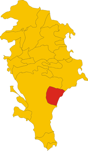
| Property / locator map image | |||||||||||||||
| Property / locator map image: Map of comune of Avola (province of Syracuse, region Sicily, Italy).svg / rank | |||||||||||||||
Normal rank | |||||||||||||||
| Property / locator map image: Map of comune of Avola (province of Syracuse, region Sicily, Italy).svg / reference | |||||||||||||||
| Property / Commons category | |||||||||||||||
Avola | |||||||||||||||
| Property / Commons category: Avola / rank | |||||||||||||||
Normal rank | |||||||||||||||
| Property / Commons category: Avola / reference | |||||||||||||||
| Property / local dialing code | |||||||||||||||
0931 | |||||||||||||||
| Property / local dialing code: 0931 / rank | |||||||||||||||
Normal rank | |||||||||||||||
| Property / image | |||||||||||||||
| Property / image: Panorama di Avola (Sicilia) - panoramio.jpg / rank | |||||||||||||||
Normal rank | |||||||||||||||
| Property / ISTAT ID | |||||||||||||||
089002 | |||||||||||||||
| Property / ISTAT ID: 089002 / rank | |||||||||||||||
Normal rank | |||||||||||||||
| Property / ISTAT ID: 089002 / reference | |||||||||||||||
| Property / coordinate location | |||||||||||||||
36°55'0"N, 15°8'0"E
| |||||||||||||||
| Property / coordinate location: 36°55'0"N, 15°8'0"E / rank | |||||||||||||||
Normal rank | |||||||||||||||
| Property / coordinate location: 36°55'0"N, 15°8'0"E / reference | |||||||||||||||
| Property / country | |||||||||||||||
| Property / country: Italy / rank | |||||||||||||||
Normal rank | |||||||||||||||
| Property / country: Italy / reference | |||||||||||||||
| Property / Italian cadastre code | |||||||||||||||
A522 | |||||||||||||||
| Property / Italian cadastre code: A522 / rank | |||||||||||||||
Normal rank | |||||||||||||||
| Property / Italian cadastre code: A522 / reference | |||||||||||||||
| Property / Freebase ID | |||||||||||||||
| Property / Freebase ID: /m/0dgtd0 / rank | |||||||||||||||
Normal rank | |||||||||||||||
| Property / Freebase ID: /m/0dgtd0 / reference | |||||||||||||||
| Property / Freebase ID: /m/0dgtd0 / reference | |||||||||||||||
publication date: 28 October 2013
| |||||||||||||||
| Property / GeoNames ID | |||||||||||||||
| Property / GeoNames ID: 6540854 / rank | |||||||||||||||
Normal rank | |||||||||||||||
| Property / GeoNames ID: 6540854 / reference | |||||||||||||||
| Property / Digital Atlas of the Roman Empire ID | |||||||||||||||
| Property / Digital Atlas of the Roman Empire ID: 30500 / rank | |||||||||||||||
Normal rank | |||||||||||||||
| Property / VIAF ID | |||||||||||||||
| Property / VIAF ID: 127118667 / rank | |||||||||||||||
Normal rank | |||||||||||||||
| Property / VIAF ID: 127118667 / reference | |||||||||||||||
| Property / VIAF ID: 127118667 / reference | |||||||||||||||
retrieved: 3 August 2015
| |||||||||||||||
| Property / elevation above sea level | |||||||||||||||
40±1 metre
| |||||||||||||||
| Property / elevation above sea level: 40±1 metre / rank | |||||||||||||||
Normal rank | |||||||||||||||
| Property / elevation above sea level: 40±1 metre / reference | |||||||||||||||
| Property / Commons gallery | |||||||||||||||
Avola | |||||||||||||||
| Property / Commons gallery: Avola / rank | |||||||||||||||
Normal rank | |||||||||||||||
| Property / GND ID | |||||||||||||||
| Property / GND ID: 4394529-6 / rank | |||||||||||||||
Normal rank | |||||||||||||||
| Property / GND ID: 4394529-6 / reference | |||||||||||||||
| Property / population | |||||||||||||||
31,729
| |||||||||||||||
| Property / population: 31,729 / rank | |||||||||||||||
Normal rank | |||||||||||||||
| Property / population: 31,729 / qualifier | |||||||||||||||
point in time: 31 December 2013
| |||||||||||||||
| Property / population | |||||||||||||||
31,408
| |||||||||||||||
| Property / population: 31,408 / rank | |||||||||||||||
Preferred rank | |||||||||||||||
| Property / population: 31,408 / qualifier | |||||||||||||||
point in time: 1 January 2018
| |||||||||||||||
| Property / population: 31,408 / qualifier | |||||||||||||||
| Property / population: 31,408 / reference | |||||||||||||||
| Property / population: 31,408 / reference | |||||||||||||||
title: Popolazione Residente al 1° Gennaio 2018 (Italian) | |||||||||||||||
| Property / population: 31,408 / reference | |||||||||||||||
retrieved: 16 March 2019
| |||||||||||||||
| Property / population: 31,408 / reference | |||||||||||||||
| Property / population | |||||||||||||||
31,408
| |||||||||||||||
| Property / population: 31,408 / rank | |||||||||||||||
Normal rank | |||||||||||||||
| Property / population: 31,408 / qualifier | |||||||||||||||
point in time: 1 January 2018
| |||||||||||||||
| Property / population: 31,408 / qualifier | |||||||||||||||
| Property / population: 31,408 / reference | |||||||||||||||
| Property / population: 31,408 / reference | |||||||||||||||
title: Popolazione Residente al 1° Gennaio 2018 (Italian) | |||||||||||||||
| Property / population: 31,408 / reference | |||||||||||||||
retrieved: 16 March 2019
| |||||||||||||||
| Property / population: 31,408 / reference | |||||||||||||||
| Property / population | |||||||||||||||
30,392
| |||||||||||||||
| Property / population: 30,392 / rank | |||||||||||||||
Preferred rank | |||||||||||||||
| Property / population: 30,392 / qualifier | |||||||||||||||
point in time: 1 January 2023
| |||||||||||||||
| Property / population: 30,392 / reference | |||||||||||||||
| Property / licence plate code | |||||||||||||||
SR | |||||||||||||||
| Property / licence plate code: SR / rank | |||||||||||||||
Normal rank | |||||||||||||||
| Property / coordinates of northernmost point | |||||||||||||||
36°58'25.298"N, 15°5'32.496"E
| |||||||||||||||
| Property / coordinates of northernmost point: 36°58'25.298"N, 15°5'32.496"E / rank | |||||||||||||||
Normal rank | |||||||||||||||
| Property / coordinates of northernmost point: 36°58'25.298"N, 15°5'32.496"E / reference | |||||||||||||||
| Property / coordinates of southernmost point | |||||||||||||||
36°52'29.338"N, 15°7'58.649"E
| |||||||||||||||
| Property / coordinates of southernmost point: 36°52'29.338"N, 15°7'58.649"E / rank | |||||||||||||||
Normal rank | |||||||||||||||
| Property / coordinates of southernmost point: 36°52'29.338"N, 15°7'58.649"E / reference | |||||||||||||||
| Property / coordinates of easternmost point | |||||||||||||||
36°56'51.817"N, 15°11'24.767"E
| |||||||||||||||
| Property / coordinates of easternmost point: 36°56'51.817"N, 15°11'24.767"E / rank | |||||||||||||||
Normal rank | |||||||||||||||
| Property / coordinates of easternmost point: 36°56'51.817"N, 15°11'24.767"E / reference | |||||||||||||||
| Property / coordinates of westernmost point | |||||||||||||||
36°54'56.160"N, 15°4'0.660"E
| |||||||||||||||
| Property / coordinates of westernmost point: 36°54'56.160"N, 15°4'0.660"E / rank | |||||||||||||||
Normal rank | |||||||||||||||
| Property / coordinates of westernmost point: 36°54'56.160"N, 15°4'0.660"E / reference | |||||||||||||||
| Property / OSM relation ID | |||||||||||||||
| Property / OSM relation ID: 39168 / rank | |||||||||||||||
Normal rank | |||||||||||||||
| Property / Gran Enciclopèdia Catalana ID | |||||||||||||||
| Property / Gran Enciclopèdia Catalana ID: 0006312 / rank | |||||||||||||||
Normal rank | |||||||||||||||
| Property / capital | |||||||||||||||
| Property / capital: Avola / rank | |||||||||||||||
Normal rank | |||||||||||||||
| Property / area | |||||||||||||||
74.59 square kilometre
| |||||||||||||||
| Property / area: 74.59 square kilometre / rank | |||||||||||||||
Normal rank | |||||||||||||||
| Property / area: 74.59 square kilometre / qualifier | |||||||||||||||
point in time: 9 October 2011
| |||||||||||||||
| Property / area: 74.59 square kilometre / reference | |||||||||||||||
| Property / area: 74.59 square kilometre / reference | |||||||||||||||
| Property / area: 74.59 square kilometre / reference | |||||||||||||||
title: Superficie di Comuni Province e Regioni italiane al 9 ottobre 2011 (Italian) | |||||||||||||||
| Property / area: 74.59 square kilometre / reference | |||||||||||||||
retrieved: 16 March 2019
| |||||||||||||||
| Property / area: 74.59 square kilometre / reference | |||||||||||||||
| Property / UN/LOCODE | |||||||||||||||
| Property / UN/LOCODE: ITAVO / rank | |||||||||||||||
Normal rank | |||||||||||||||
| Property / twinned administrative body | |||||||||||||||
| Property / twinned administrative body: Trakai / rank | |||||||||||||||
Normal rank | |||||||||||||||
| Property / twinned administrative body: Trakai / qualifier | |||||||||||||||
start time: 2015
| |||||||||||||||
| Property / twinned administrative body: Trakai / reference | |||||||||||||||
| Property / twinned administrative body: Trakai / reference | |||||||||||||||
| Property / IndicePA ID | |||||||||||||||
| Property / IndicePA ID: c_a522 / rank | |||||||||||||||
Normal rank | |||||||||||||||
| Property / located in the administrative territorial entity | |||||||||||||||
| Property / located in the administrative territorial entity: Province of Syracuse / rank | |||||||||||||||
Normal rank | |||||||||||||||
| Property / located in the administrative territorial entity | |||||||||||||||
| Property / located in the administrative territorial entity: Free Community Consortium Siracusa / rank | |||||||||||||||
Preferred rank | |||||||||||||||
| Property / Who's on First ID | |||||||||||||||
| Property / Who's on First ID: 101805301 / rank | |||||||||||||||
Normal rank | |||||||||||||||
| Property / described by source | |||||||||||||||
| Property / described by source: The Nuttall Encyclopædia / rank | |||||||||||||||
Normal rank | |||||||||||||||
| Property / described by source: The Nuttall Encyclopædia / qualifier | |||||||||||||||
stated as: Av′ola | |||||||||||||||
| Property / described by source | |||||||||||||||
| Property / described by source: The Nuttall Encyclopædia / rank | |||||||||||||||
Normal rank | |||||||||||||||
| Property / described by source: The Nuttall Encyclopædia / qualifier | |||||||||||||||
named as: Av′ola | |||||||||||||||
| Property / described by source | |||||||||||||||
| Property / described by source: Encyclopædia Britannica Ninth Edition / rank | |||||||||||||||
Normal rank | |||||||||||||||
| Property / described by source: Encyclopædia Britannica Ninth Edition / qualifier | |||||||||||||||
| Property / page banner | |||||||||||||||
| Property / page banner: Avola banner.jpg / rank | |||||||||||||||
Normal rank | |||||||||||||||
| Property / WorldCat Identities ID | |||||||||||||||
lccn-nr95000757 | |||||||||||||||
| Property / WorldCat Identities ID: lccn-nr95000757 / rank | |||||||||||||||
Normal rank | |||||||||||||||
| Property / WorldCat Identities ID: lccn-nr95000757 / reference | |||||||||||||||
| Property / Wiki Loves Monuments ID | |||||||||||||||
19A5220000 | |||||||||||||||
| Property / Wiki Loves Monuments ID: 19A5220000 / rank | |||||||||||||||
Normal rank | |||||||||||||||
| Property / Wiki Loves Monuments ID: 19A5220000 / qualifier | |||||||||||||||
start time: 1 September 2020
| |||||||||||||||
| Property / Wiki Loves Monuments ID: 19A5220000 / reference | |||||||||||||||
| Property / topic's main category | |||||||||||||||
| Property / topic's main category: Category:Avola / rank | |||||||||||||||
Normal rank | |||||||||||||||
| Property / topic's main category: Category:Avola / reference | |||||||||||||||
| Property / category for people born here | |||||||||||||||
| Property / category for people born here: Category:Births in Avola / rank | |||||||||||||||
Normal rank | |||||||||||||||
| Property / category for people born here: Category:Births in Avola / reference | |||||||||||||||
| Property / category of associated people | |||||||||||||||
| Property / category of associated people: Category:People from Avola / rank | |||||||||||||||
Normal rank | |||||||||||||||
| Property / category of associated people: Category:People from Avola / reference | |||||||||||||||
| Property / category for people who died here | |||||||||||||||
| Property / category for people who died here: Q2618095 / rank | |||||||||||||||
Normal rank | |||||||||||||||
| Property / category for people who died here: Q2618095 / reference | |||||||||||||||
| Property / De Agostini ID | |||||||||||||||
| Property / De Agostini ID: Àvola / rank | |||||||||||||||
Normal rank | |||||||||||||||
| Property / De Agostini ID: Àvola / qualifier | |||||||||||||||
named as: Àvola | |||||||||||||||
| Property / patron saint | |||||||||||||||
| Property / patron saint: Saint Veneranda / rank | |||||||||||||||
Normal rank | |||||||||||||||
| Property / patron saint: Saint Veneranda / reference | |||||||||||||||
| Property / patron saint: Saint Veneranda / reference | |||||||||||||||
| Property / museum-digital place ID | |||||||||||||||
11184 | |||||||||||||||
| Property / museum-digital place ID: 11184 / rank | |||||||||||||||
Normal rank | |||||||||||||||
| Property / museum-digital place ID: 11184 / reference | |||||||||||||||
| Property / SBN place ID | |||||||||||||||
LEKL000066 | |||||||||||||||
| Property / SBN place ID: LEKL000066 / rank | |||||||||||||||
Normal rank | |||||||||||||||
| Property / ToposText place ID | |||||||||||||||
369151UAbo | |||||||||||||||
| Property / ToposText place ID: 369151UAbo / rank | |||||||||||||||
Normal rank | |||||||||||||||
| Property / coat of arms image | |||||||||||||||
| Property / coat of arms image: Coat of arms of Avola.svg / rank | |||||||||||||||
Normal rank | |||||||||||||||
| Property / coat of arms image: Coat of arms of Avola.svg / reference | |||||||||||||||
| Property / coat of arms image: Coat of arms of Avola.svg / reference | |||||||||||||||
| Property / seismic classification | |||||||||||||||
| Property / seismic classification: 2 / rank | |||||||||||||||
Normal rank | |||||||||||||||
| Property / seismic classification: 2 / reference | |||||||||||||||
| Property / seismic classification: 2 / reference | |||||||||||||||
| Property / seismic classification: 2 / reference | |||||||||||||||
retrieved: 27 August 2022
| |||||||||||||||
| Property / Pleiades ID | |||||||||||||||
| Property / Pleiades ID: 462063 / rank | |||||||||||||||
Normal rank | |||||||||||||||
| Property / EU Knowledge Graph item ID | |||||||||||||||
Q268765 | |||||||||||||||
| Property / EU Knowledge Graph item ID: Q268765 / rank | |||||||||||||||
Normal rank | |||||||||||||||
| links / bgwiki / name | links / bgwiki / name | ||||||||||||||
| links / dewiki / name | links / dewiki / name | ||||||||||||||
| links / elwiki / name | links / elwiki / name | ||||||||||||||
| links / enwiki / name | links / enwiki / name | ||||||||||||||
| links / eswiki / name | links / eswiki / name | ||||||||||||||
| links / fiwiki / name | links / fiwiki / name | ||||||||||||||
| links / frwiki / name | links / frwiki / name | ||||||||||||||
| links / huwiki / name | links / huwiki / name | ||||||||||||||
| links / itwiki / name | links / itwiki / name | ||||||||||||||
| links / ltwiki / name | links / ltwiki / name | ||||||||||||||
| links / nlwiki / name | links / nlwiki / name | ||||||||||||||
| links / plwiki / name | links / plwiki / name | ||||||||||||||
| links / ptwiki / name | links / ptwiki / name | ||||||||||||||
| links / rowiki / name | links / rowiki / name | ||||||||||||||
| links / svwiki / name | links / svwiki / name | ||||||||||||||
| links / trwiki / name | links / trwiki / name | ||||||||||||||
| links / dawiki / name | links / dawiki / name | ||||||||||||||
Latest revision as of 17:31, 16 November 2024
Italian comune
| Language | Label | Description | Also known as |
|---|---|---|---|
| English | Avola |
Italian comune |
Statements

.svg)
Map of comune of Avola (province of Syracuse, region Sicily, Italy).svg
2,323 × 3,964; 65 KB
2,323 × 3,964; 65 KB
1 reference
0931
0 references
_-_panoramio.jpg)
Avola
0 references
31,408
1 January 2018
4 references
Popolazione Residente al 1° Gennaio 2018 (Italian)
16 March 2019
31,408
1 January 2018
4 references
Popolazione Residente al 1° Gennaio 2018 (Italian)
16 March 2019
SR
0 references


74.59 square kilometre
9 October 2011
5 references
Superficie di Comuni Province e Regioni italiane al 9 ottobre 2011 (Italian)
16 March 2019

.svg)
_-_panoramio.jpg)
Identifiers
90570896
0 references
LEKL000066
0 references
369151UAbo
0 references
Q268765
0 references