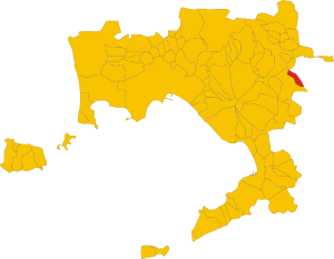
Carbonara di Nola (Q278889): Difference between revisions
Jump to navigation
Jump to search
(Changed label, description and/or aliases in it, en) |
(Changed an Item: Adding these statements since they where added in Wikidata) |
||||||||||||||
| (11 intermediate revisions by the same user not shown) | |||||||||||||||
| label / ga | label / ga | ||||||||||||||
Carbonara di Nola | |||||||||||||||
| label / el | label / el | ||||||||||||||
Καρμπονάρα ντι Νόλα | |||||||||||||||
| description / en | description / en | ||||||||||||||
Italian comune | |||||||||||||||
| description / tr | description / tr | ||||||||||||||
İtalya'nın | İtalya'nın Campania bölgesinde, Napoli iline bağlı ilçe (komün) | ||||||||||||||
| description / hu | description / hu | ||||||||||||||
község Olaszország Campania régiójában, Nápoly megyében | |||||||||||||||
| Property / located in the administrative territorial entity | |||||||||||||||
| Property / located in the administrative territorial entity: Metropolitan City of Naples / rank | |||||||||||||||
| Property / located in the administrative territorial entity: Metropolitan City of Naples / qualifier | |||||||||||||||
| |||||||||||||||
| Property / coordinate location | |||||||||||||||
| |||||||||||||||
| Property / coordinate location: 40°53'0"N, 14°35'0"E / rank | |||||||||||||||
| Property / coordinate location: 40°53'0"N, 14°35'0"E / reference | |||||||||||||||
| Property / located in the administrative territorial entity | |||||||||||||||
| Property / located in the administrative territorial entity: Metropolitan City of Naples / rank | |||||||||||||||
Preferred rank | |||||||||||||||
| Property / located in the administrative territorial entity: Metropolitan City of Naples / qualifier | |||||||||||||||
start time: 1 January 2015
| |||||||||||||||
| Property / located in the administrative territorial entity: Metropolitan City of Naples / qualifier | |||||||||||||||
| Property / coordinate location | |||||||||||||||
40°52'24.557"N, 14°34'34.223"E
| |||||||||||||||
| Property / coordinate location: 40°52'24.557"N, 14°34'34.223"E / rank | |||||||||||||||
Normal rank | |||||||||||||||
| Property / population | |||||||||||||||
2,437
| |||||||||||||||
| Property / population: 2,437 / rank | |||||||||||||||
Normal rank | |||||||||||||||
| Property / population: 2,437 / qualifier | |||||||||||||||
point in time: 1 January 2018
| |||||||||||||||
| Property / population: 2,437 / qualifier | |||||||||||||||
| Property / population: 2,437 / reference | |||||||||||||||
| Property / population: 2,437 / reference | |||||||||||||||
title: Popolazione Residente al 1° Gennaio 2018 (Italian) | |||||||||||||||
| Property / population: 2,437 / reference | |||||||||||||||
retrieved: 16 March 2019
| |||||||||||||||
| Property / population: 2,437 / reference | |||||||||||||||
| Property / population | |||||||||||||||
2,459
| |||||||||||||||
| Property / population: 2,459 / rank | |||||||||||||||
Preferred rank | |||||||||||||||
| Property / population: 2,459 / qualifier | |||||||||||||||
point in time: 1 January 2023
| |||||||||||||||
| Property / population: 2,459 / reference | |||||||||||||||
| Property / seismic classification | |||||||||||||||
| Property / seismic classification: 2 / rank | |||||||||||||||
Normal rank | |||||||||||||||
| Property / seismic classification: 2 / reference | |||||||||||||||
| Property / seismic classification: 2 / reference | |||||||||||||||
| Property / seismic classification: 2 / reference | |||||||||||||||
retrieved: 27 August 2022
| |||||||||||||||
| Property / EU Knowledge Graph item ID | |||||||||||||||
Q278889 | |||||||||||||||
| Property / EU Knowledge Graph item ID: Q278889 / rank | |||||||||||||||
Normal rank | |||||||||||||||
| Property / demonym | |||||||||||||||
carbonaresi (Italian) | |||||||||||||||
| Property / demonym: carbonaresi (Italian) / rank | |||||||||||||||
Normal rank | |||||||||||||||
| Property / demonym: carbonaresi (Italian) / qualifier | |||||||||||||||
| Property / demonym: carbonaresi (Italian) / reference | |||||||||||||||
Latest revision as of 18:48, 18 July 2024
Italian comune
| Language | Label | Description | Also known as |
|---|---|---|---|
| English | Carbonara di Nola |
Italian comune |
Statements
80030
0 references
Carbonara di Nola
0 references
31 December 2014
1 reference
1 January 2015
0 references
081
0 references
0 references
NA
0 references
3.65 square kilometre
9 October 2011
5 references
Superficie di Comuni Province e Regioni italiane al 9 ottobre 2011 (Italian)
16 March 2019
2,436
1 January 2017
1 reference
2,437
1 January 2018
4 references
Popolazione Residente al 1° Gennaio 2018 (Italian)
16 March 2019
2,437
1 January 2018
4 references
Popolazione Residente al 1° Gennaio 2018 (Italian)
16 March 2019
carbonaresi (Italian)
1 reference
Identifiers
1353300633
0 references
Q278889
0 references


