Dolus-d'Oléron (Q2545709): Difference between revisions
Jump to navigation
Jump to search
(Removed claim: country (P32): France (Q20), Removing this statements since they changed in Wikidata) |
(Changed an Item: Adding these statements since they where added in Wikidata) |
||||||||||||||
| Property / instance of | |||||||||||||||
| Property / instance of: commune of France / rank | |||||||||||||||
Normal rank | |||||||||||||||
| Property / Commons category | |||||||||||||||
Dolus-d'Oléron | |||||||||||||||
| Property / Commons category: Dolus-d'Oléron / rank | |||||||||||||||
Normal rank | |||||||||||||||
| Property / INSEE municipality code | |||||||||||||||
| Property / INSEE municipality code: 17140 / rank | |||||||||||||||
Normal rank | |||||||||||||||
| Property / INSEE municipality code: 17140 / reference | |||||||||||||||
| Property / INSEE municipality code: 17140 / reference | |||||||||||||||
| Property / country | |||||||||||||||
| Property / country: France / rank | |||||||||||||||
Normal rank | |||||||||||||||
| Property / country: France / reference | |||||||||||||||
| Property / postal code | |||||||||||||||
17550 | |||||||||||||||
| Property / postal code: 17550 / rank | |||||||||||||||
Normal rank | |||||||||||||||
| Property / postal code: 17550 / reference | |||||||||||||||
| Property / postal code: 17550 / reference | |||||||||||||||
publication date: 1 October 2018
| |||||||||||||||
| Property / located in time zone | |||||||||||||||
| Property / located in time zone: UTC+01:00 / rank | |||||||||||||||
Normal rank | |||||||||||||||
| Property / located in time zone: UTC+01:00 / qualifier | |||||||||||||||
| Property / located in time zone: UTC+01:00 / reference | |||||||||||||||
| Property / located in time zone: UTC+01:00 / reference | |||||||||||||||
| Property / located in time zone | |||||||||||||||
| Property / located in time zone: UTC+02:00 / rank | |||||||||||||||
Normal rank | |||||||||||||||
| Property / located in time zone: UTC+02:00 / qualifier | |||||||||||||||
| Property / located in the administrative territorial entity | |||||||||||||||
| Property / located in the administrative territorial entity: canton of Le Château-d'Oléron / rank | |||||||||||||||
Normal rank | |||||||||||||||
| Property / located in the administrative territorial entity: canton of Le Château-d'Oléron / reference | |||||||||||||||
| Property / located in the administrative territorial entity | |||||||||||||||
| Property / located in the administrative territorial entity: Charente-Maritime / rank | |||||||||||||||
Normal rank | |||||||||||||||
| Property / located in the administrative territorial entity | |||||||||||||||
| Property / located in the administrative territorial entity: Arrondissement of Rochefort / rank | |||||||||||||||
Normal rank | |||||||||||||||
| Property / coordinate location | |||||||||||||||
45°54'40"N, 1°15'39"W
| |||||||||||||||
| Property / coordinate location: 45°54'40"N, 1°15'39"W / rank | |||||||||||||||
Normal rank | |||||||||||||||
| Property / coordinate location: 45°54'40"N, 1°15'39"W / reference | |||||||||||||||
| Property / coordinate location: 45°54'40"N, 1°15'39"W / reference | |||||||||||||||
retrieved: 26 October 2015
| |||||||||||||||
| Property / Freebase ID | |||||||||||||||
| Property / Freebase ID: /m/03mch0j / rank | |||||||||||||||
Normal rank | |||||||||||||||
| Property / Freebase ID: /m/03mch0j / reference | |||||||||||||||
| Property / Freebase ID: /m/03mch0j / reference | |||||||||||||||
publication date: 28 October 2013
| |||||||||||||||
| Property / shares border with | |||||||||||||||
| Property / shares border with: Le Château-d'Oléron / rank | |||||||||||||||
Normal rank | |||||||||||||||
| Property / shares border with: Le Château-d'Oléron / reference | |||||||||||||||
| Property / shares border with | |||||||||||||||
| Property / shares border with: Saint-Pierre-d'Oléron / rank | |||||||||||||||
Normal rank | |||||||||||||||
| Property / shares border with: Saint-Pierre-d'Oléron / reference | |||||||||||||||
| Property / shares border with | |||||||||||||||
| Property / shares border with: Le Grand-Village-Plage / rank | |||||||||||||||
Normal rank | |||||||||||||||
| Property / shares border with: Le Grand-Village-Plage / reference | |||||||||||||||
| Property / GeoNames ID | |||||||||||||||
| Property / GeoNames ID: 6616008 / rank | |||||||||||||||
Normal rank | |||||||||||||||
| Property / GeoNames ID: 6616008 / reference | |||||||||||||||
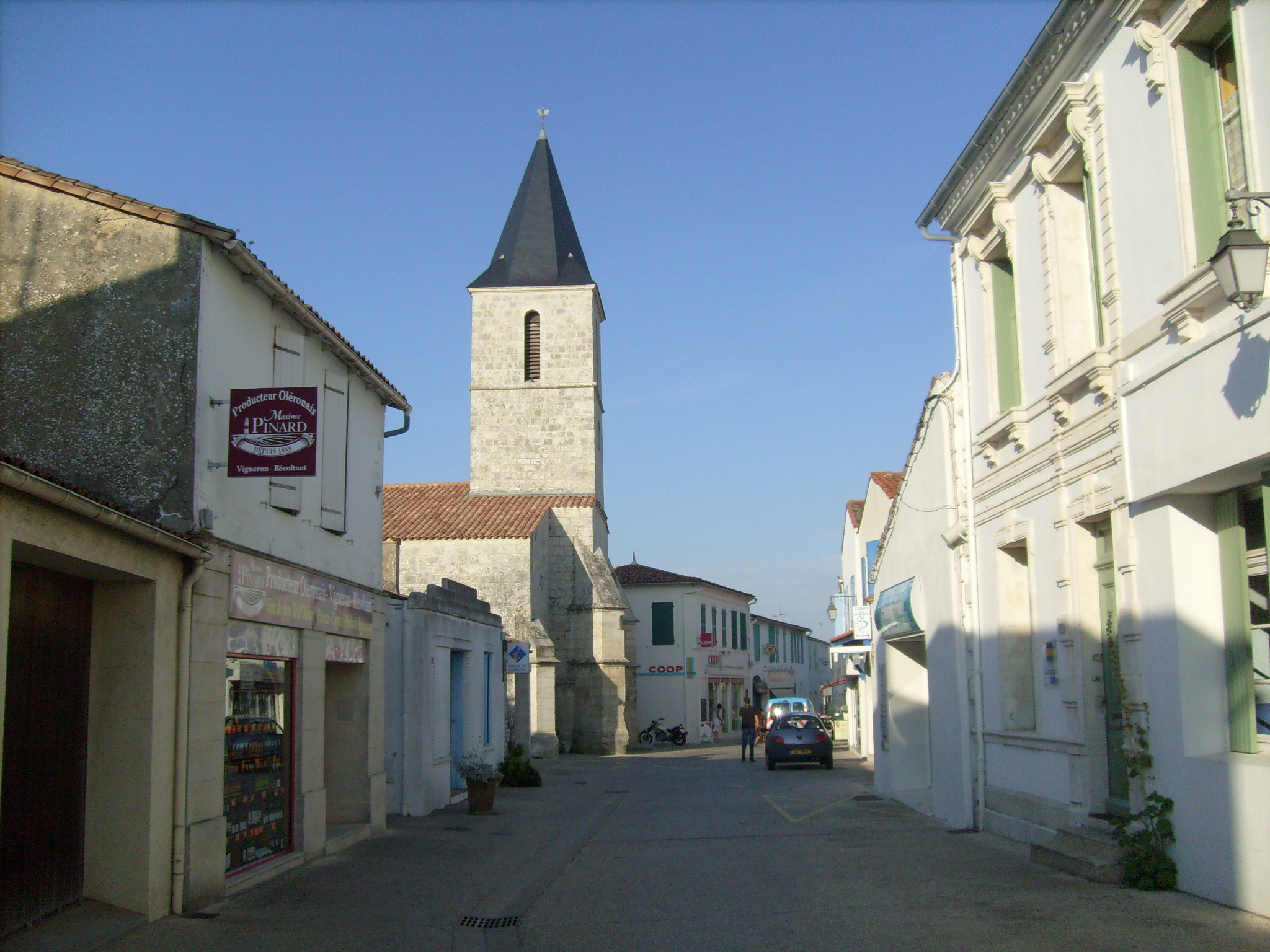
| Property / image | |||||||||||||||
| Property / image: Centre-ville de Dolus.jpg / rank | |||||||||||||||
Normal rank | |||||||||||||||
| Property / official website | |||||||||||||||
| Property / official website: http://www.ville-dolus-oleron.fr / rank | |||||||||||||||
Normal rank | |||||||||||||||
| Property / coat of arms image | |||||||||||||||
| Property / coat of arms image: Blason ville fr Dolus-d'Oléron (Charente-Maritime).svg / rank | |||||||||||||||
Normal rank | |||||||||||||||
| Property / coat of arms image: Blason ville fr Dolus-d'Oléron (Charente-Maritime).svg / reference | |||||||||||||||
| Property / area | |||||||||||||||
29.02 square kilometre
| |||||||||||||||
| Property / area: 29.02 square kilometre / rank | |||||||||||||||
Normal rank | |||||||||||||||
| Property / area: 29.02 square kilometre / reference | |||||||||||||||
| Property / area: 29.02 square kilometre / reference | |||||||||||||||
retrieved: 26 October 2015
| |||||||||||||||
Revision as of 17:16, 30 December 2020
commune in Charente-Maritime, France
| Language | Label | Description | Also known as |
|---|---|---|---|
| English | Dolus-d'Oléron |
commune in Charente-Maritime, France |
Statements
2 references
26 October 2015
Dolus-d'Oléron
0 references
29.02 square kilometre
2 references
26 October 2015


