Bonnanaro (Q289339): Difference between revisions
Jump to navigation
Jump to search
(Changed an Item: Adding this statements since they where added in Wikidata) |
(Changed an Item: Adding this statements since they where added in Wikidata) |
||||||||||||||
| Property / category for people born here | |||||||||||||||
| Property / category for people born here: Q2605850 / rank | |||||||||||||||
Normal rank | |||||||||||||||
| Property / category for people born here: Q2605850 / reference | |||||||||||||||
| Property / topic's main category | |||||||||||||||
| Property / topic's main category: Category:Bonnanaro / rank | |||||||||||||||
Normal rank | |||||||||||||||
| Property / topic's main category: Category:Bonnanaro / reference | |||||||||||||||
| Property / official website | |||||||||||||||
| Property / official website: http://www.comune.bonnanaro.ss.it / rank | |||||||||||||||
Normal rank | |||||||||||||||
| Property / official website: http://www.comune.bonnanaro.ss.it / reference | |||||||||||||||
| Property / VIAF ID | |||||||||||||||
| Property / VIAF ID: 237035781 / rank | |||||||||||||||
Normal rank | |||||||||||||||
| Property / VIAF ID: 237035781 / reference | |||||||||||||||
| Property / VIAF ID: 237035781 / reference | |||||||||||||||
retrieved: 3 August 2015
| |||||||||||||||
| Property / elevation above sea level | |||||||||||||||
405±1 metre
| |||||||||||||||
| Property / elevation above sea level: 405±1 metre / rank | |||||||||||||||
Normal rank | |||||||||||||||
| Property / elevation above sea level: 405±1 metre / reference | |||||||||||||||
| Property / coordinate location | |||||||||||||||
40°32'0.4920"N, 8°45'43.6021"E
| |||||||||||||||
| Property / coordinate location: 40°32'0.4920"N, 8°45'43.6021"E / rank | |||||||||||||||
Normal rank | |||||||||||||||
| Property / coordinate location: 40°32'0.4920"N, 8°45'43.6021"E / reference | |||||||||||||||
| Property / coordinates of northernmost point | |||||||||||||||
40°34'16.043"N, 8°45'36.922"E
| |||||||||||||||
| Property / coordinates of northernmost point: 40°34'16.043"N, 8°45'36.922"E / rank | |||||||||||||||
Normal rank | |||||||||||||||
| Property / coordinates of northernmost point: 40°34'16.043"N, 8°45'36.922"E / reference | |||||||||||||||
| Property / coordinates of southernmost point | |||||||||||||||
40°31'3.342"N, 8°47'21.044"E
| |||||||||||||||
| Property / coordinates of southernmost point: 40°31'3.342"N, 8°47'21.044"E / rank | |||||||||||||||
Normal rank | |||||||||||||||
| Property / coordinates of southernmost point: 40°31'3.342"N, 8°47'21.044"E / reference | |||||||||||||||
| Property / coordinates of easternmost point | |||||||||||||||
40°31'15.596"N, 8°48'53.780"E
| |||||||||||||||
| Property / coordinates of easternmost point: 40°31'15.596"N, 8°48'53.780"E / rank | |||||||||||||||
Normal rank | |||||||||||||||
| Property / coordinates of easternmost point: 40°31'15.596"N, 8°48'53.780"E / reference | |||||||||||||||
| Property / coordinates of westernmost point | |||||||||||||||
40°33'25.988"N, 8°44'45.694"E
| |||||||||||||||
| Property / coordinates of westernmost point: 40°33'25.988"N, 8°44'45.694"E / rank | |||||||||||||||
Normal rank | |||||||||||||||
| Property / coordinates of westernmost point: 40°33'25.988"N, 8°44'45.694"E / reference | |||||||||||||||
| Property / OSM relation ID | |||||||||||||||
| Property / OSM relation ID: 40580 / rank | |||||||||||||||
Normal rank | |||||||||||||||
| Property / capital | |||||||||||||||
| Property / capital: Bonnanaro / rank | |||||||||||||||
Normal rank | |||||||||||||||
| Property / area | |||||||||||||||
21.84 square kilometre
| |||||||||||||||
| Property / area: 21.84 square kilometre / rank | |||||||||||||||
Normal rank | |||||||||||||||
| Property / area: 21.84 square kilometre / qualifier | |||||||||||||||
point in time: 9 October 2011
| |||||||||||||||
| Property / area: 21.84 square kilometre / reference | |||||||||||||||
| Property / area: 21.84 square kilometre / reference | |||||||||||||||
| Property / area: 21.84 square kilometre / reference | |||||||||||||||
title: Superficie di Comuni Province e Regioni italiane al 9 ottobre 2011 (Italian) | |||||||||||||||
| Property / area: 21.84 square kilometre / reference | |||||||||||||||
retrieved: 16 March 2019
| |||||||||||||||
| Property / area: 21.84 square kilometre / reference | |||||||||||||||
| Property / population | |||||||||||||||
977
| |||||||||||||||
| Property / population: 977 / rank | |||||||||||||||
Normal rank | |||||||||||||||
| Property / population: 977 / qualifier | |||||||||||||||
point in time: 1 January 2017
| |||||||||||||||
| Property / population: 977 / qualifier | |||||||||||||||
| Property / population: 977 / reference | |||||||||||||||
| Property / population | |||||||||||||||
973
| |||||||||||||||
| Property / population: 973 / rank | |||||||||||||||
Preferred rank | |||||||||||||||
| Property / population: 973 / qualifier | |||||||||||||||
point in time: 1 January 2018
| |||||||||||||||
| Property / population: 973 / qualifier | |||||||||||||||
| Property / population: 973 / reference | |||||||||||||||
| Property / population: 973 / reference | |||||||||||||||
title: Popolazione Residente al 1° Gennaio 2018 (Italian) | |||||||||||||||
| Property / population: 973 / reference | |||||||||||||||
retrieved: 16 March 2019
| |||||||||||||||
| Property / population: 973 / reference | |||||||||||||||
| Property / UN/LOCODE | |||||||||||||||
| Property / UN/LOCODE: ITNNB / rank | |||||||||||||||
Normal rank | |||||||||||||||
| Property / licence plate code | |||||||||||||||
SS | |||||||||||||||
| Property / licence plate code: SS / rank | |||||||||||||||
Normal rank | |||||||||||||||
| Property / coat of arms image | |||||||||||||||
| Property / coat of arms image: Bonnanaro-Stemma.svg / rank | |||||||||||||||
Normal rank | |||||||||||||||
| Property / IndicePA ID | |||||||||||||||
| Property / IndicePA ID: c_a976 / rank | |||||||||||||||
Normal rank | |||||||||||||||
| Property / Who's on First ID | |||||||||||||||
| Property / Who's on First ID: 101777441 / rank | |||||||||||||||
Normal rank | |||||||||||||||
Revision as of 22:51, 5 August 2020
Italian comune
| Language | Label | Description | Also known as |
|---|---|---|---|
| English | Bonnanaro |
Italian comune |
Statements

Bonnanaro
0 references
_-_2016.svg)
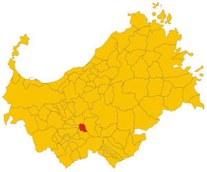
Map of comune of Bonnanaro (province of Sassari, region Sardinia, Italy) - 2016.svg
8,800 × 7,300; 248 KB
8,800 × 7,300; 248 KB
1 reference
079
0 references
.JPG)


21.84 square kilometre
9 October 2011
5 references
Superficie di Comuni Province e Regioni italiane al 9 ottobre 2011 (Italian)
16 March 2019
977
1 January 2017
1 reference
973
1 January 2018
4 references
Popolazione Residente al 1° Gennaio 2018 (Italian)
16 March 2019
SS
0 references

Identifiers
237080908
0 references