Craco (Q296007): Difference between revisions
Jump to navigation
Jump to search
(Changed an Item: Adding this statements since they where added in Wikidata) |
(Changed an Item: Adding this statements since they where added in Wikidata) |
||||||||||||||
| Property / GeoNames ID | |||||||||||||||
| Property / GeoNames ID: 6537645 / rank | |||||||||||||||
Normal rank | |||||||||||||||
| Property / GeoNames ID: 6537645 / reference | |||||||||||||||
| Property / Digital Atlas of the Roman Empire ID | |||||||||||||||
| Property / Digital Atlas of the Roman Empire ID: 29205 / rank | |||||||||||||||
Normal rank | |||||||||||||||
| Property / VIAF ID | |||||||||||||||
| Property / VIAF ID: 242806563 / rank | |||||||||||||||
Normal rank | |||||||||||||||
| Property / VIAF ID: 242806563 / reference | |||||||||||||||
| Property / VIAF ID: 242806563 / reference | |||||||||||||||
retrieved: 2 August 2015
| |||||||||||||||
| Property / VIAF ID | |||||||||||||||
| Property / VIAF ID: 14148704172236931503 / rank | |||||||||||||||
Normal rank | |||||||||||||||
| Property / elevation above sea level | |||||||||||||||
391±1 metre
| |||||||||||||||
| Property / elevation above sea level: 391±1 metre / rank | |||||||||||||||
Normal rank | |||||||||||||||
| Property / elevation above sea level: 391±1 metre / reference | |||||||||||||||
| Property / official website | |||||||||||||||
| Property / official website: http://www.comune.craco.mt.it / rank | |||||||||||||||
Normal rank | |||||||||||||||
| Property / official website: http://www.comune.craco.mt.it / reference | |||||||||||||||
| Property / Commons gallery | |||||||||||||||
Craco | |||||||||||||||
| Property / Commons gallery: Craco / rank | |||||||||||||||
Normal rank | |||||||||||||||
| Property / licence plate code | |||||||||||||||
MT | |||||||||||||||
| Property / licence plate code: MT / rank | |||||||||||||||
Normal rank | |||||||||||||||
| Property / coordinates of northernmost point | |||||||||||||||
40°25'17.029"N, 16°22'44.224"E
| |||||||||||||||
| Property / coordinates of northernmost point: 40°25'17.029"N, 16°22'44.224"E / rank | |||||||||||||||
Normal rank | |||||||||||||||
| Property / coordinates of northernmost point: 40°25'17.029"N, 16°22'44.224"E / reference | |||||||||||||||
| Property / coordinates of southernmost point | |||||||||||||||
40°19'2.039"N, 16°28'38.914"E
| |||||||||||||||
| Property / coordinates of southernmost point: 40°19'2.039"N, 16°28'38.914"E / rank | |||||||||||||||
Normal rank | |||||||||||||||
| Property / coordinates of southernmost point: 40°19'2.039"N, 16°28'38.914"E / reference | |||||||||||||||
| Property / coordinates of easternmost point | |||||||||||||||
40°21'58.835"N, 16°31'12.493"E
| |||||||||||||||
| Property / coordinates of easternmost point: 40°21'58.835"N, 16°31'12.493"E / rank | |||||||||||||||
Normal rank | |||||||||||||||
| Property / coordinates of easternmost point: 40°21'58.835"N, 16°31'12.493"E / reference | |||||||||||||||
| Property / coordinates of westernmost point | |||||||||||||||
40°22'36.242"N, 16°22'10.448"E
| |||||||||||||||
| Property / coordinates of westernmost point: 40°22'36.242"N, 16°22'10.448"E / rank | |||||||||||||||
Normal rank | |||||||||||||||
| Property / coordinates of westernmost point: 40°22'36.242"N, 16°22'10.448"E / reference | |||||||||||||||
| Property / OSM relation ID | |||||||||||||||
| Property / OSM relation ID: 40462 / rank | |||||||||||||||
Normal rank | |||||||||||||||
| Property / native label | |||||||||||||||
Craco (Italian) | |||||||||||||||
| Property / native label: Craco (Italian) / rank | |||||||||||||||
Normal rank | |||||||||||||||
| Property / native label: Craco (Italian) / reference | |||||||||||||||
| Property / official name | |||||||||||||||
Craco (Italian) | |||||||||||||||
| Property / official name: Craco (Italian) / rank | |||||||||||||||
Normal rank | |||||||||||||||
| Property / official name: Craco (Italian) / reference | |||||||||||||||
| Property / area | |||||||||||||||
77.04 square kilometre
| |||||||||||||||
| Property / area: 77.04 square kilometre / rank | |||||||||||||||
Normal rank | |||||||||||||||
| Property / area: 77.04 square kilometre / qualifier | |||||||||||||||
point in time: 9 October 2011
| |||||||||||||||
| Property / area: 77.04 square kilometre / reference | |||||||||||||||
| Property / area: 77.04 square kilometre / reference | |||||||||||||||
| Property / area: 77.04 square kilometre / reference | |||||||||||||||
title: Superficie di Comuni Province e Regioni italiane al 9 ottobre 2011 (Italian) | |||||||||||||||
| Property / area: 77.04 square kilometre / reference | |||||||||||||||
retrieved: 16 March 2019
| |||||||||||||||
| Property / area: 77.04 square kilometre / reference | |||||||||||||||
| Property / population | |||||||||||||||
726
| |||||||||||||||
| Property / population: 726 / rank | |||||||||||||||
Normal rank | |||||||||||||||
| Property / population: 726 / qualifier | |||||||||||||||
point in time: 1 January 2017
| |||||||||||||||
| Property / population: 726 / qualifier | |||||||||||||||
| Property / population: 726 / reference | |||||||||||||||
| Property / population | |||||||||||||||
725
| |||||||||||||||
| Property / population: 725 / rank | |||||||||||||||
Preferred rank | |||||||||||||||
| Property / population: 725 / qualifier | |||||||||||||||
point in time: 1 January 2018
| |||||||||||||||
| Property / population: 725 / qualifier | |||||||||||||||
| Property / population: 725 / reference | |||||||||||||||
| Property / population: 725 / reference | |||||||||||||||
title: Popolazione Residente al 1° Gennaio 2018 (Italian) | |||||||||||||||
| Property / population: 725 / reference | |||||||||||||||
retrieved: 16 March 2019
| |||||||||||||||
| Property / population: 725 / reference | |||||||||||||||
| Property / member of | |||||||||||||||
| Property / member of: Climate Alliance / rank | |||||||||||||||
Normal rank | |||||||||||||||
| Property / member of: Climate Alliance / qualifier | |||||||||||||||
start time: 2015
| |||||||||||||||
| Property / member of: Climate Alliance / reference | |||||||||||||||
| Property / topic's main category | |||||||||||||||
| Property / topic's main category: Category:Craco / rank | |||||||||||||||
Normal rank | |||||||||||||||
Revision as of 17:31, 5 August 2020
Italian comune
| Language | Label | Description | Also known as |
|---|---|---|---|
| English | Craco |
Italian comune |
Statements

Craco
0 references
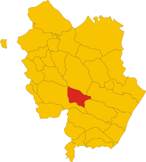
.svg)
Map of comune of Craco (province of Matera, region Basilicata, Italy).svg
2,355 × 2,616; 92 KB
2,355 × 2,616; 92 KB
1 reference

Craco
0 references
MT
0 references


77.04 square kilometre
9 October 2011
5 references
Superficie di Comuni Province e Regioni italiane al 9 ottobre 2011 (Italian)
16 March 2019
726
1 January 2017
1 reference
725
1 January 2018
4 references
Popolazione Residente al 1° Gennaio 2018 (Italian)
16 March 2019
Identifiers
81001170778
0 references