Cerenzia (Q275949): Difference between revisions
Jump to navigation
Jump to search
(Changed an Item: Adding this statements since they where added in Wikidata) |
(Changed an Item: Adding this statements since they where added in Wikidata) |
||||||||||||||
| Property / elevation above sea level | |||||||||||||||
900±1 metre
| |||||||||||||||
| Property / elevation above sea level: 900±1 metre / rank | |||||||||||||||
Normal rank | |||||||||||||||
| Property / elevation above sea level: 900±1 metre / reference | |||||||||||||||
| Property / TGN ID | |||||||||||||||
| Property / TGN ID: 7024893 / rank | |||||||||||||||
Normal rank | |||||||||||||||
| Property / licence plate code | |||||||||||||||
KR | |||||||||||||||
| Property / licence plate code: KR / rank | |||||||||||||||
Normal rank | |||||||||||||||
| Property / official website | |||||||||||||||
| Property / official website: http://cerenzia.asmenet.it/ / rank | |||||||||||||||
Normal rank | |||||||||||||||
| Property / official website: http://cerenzia.asmenet.it/ / reference | |||||||||||||||
| Property / coordinates of northernmost point | |||||||||||||||
39°16'48.994"N, 16°50'16.192"E
| |||||||||||||||
| Property / coordinates of northernmost point: 39°16'48.994"N, 16°50'16.192"E / rank | |||||||||||||||
Normal rank | |||||||||||||||
| Property / coordinates of northernmost point: 39°16'48.994"N, 16°50'16.192"E / reference | |||||||||||||||
| Property / coordinates of southernmost point | |||||||||||||||
39°14'0.413"N, 16°49'3.184"E
| |||||||||||||||
| Property / coordinates of southernmost point: 39°14'0.413"N, 16°49'3.184"E / rank | |||||||||||||||
Normal rank | |||||||||||||||
| Property / coordinates of southernmost point: 39°14'0.413"N, 16°49'3.184"E / reference | |||||||||||||||
| Property / coordinates of easternmost point | |||||||||||||||
39°15'51.944"N, 16°51'21.337"E
| |||||||||||||||
| Property / coordinates of easternmost point: 39°15'51.944"N, 16°51'21.337"E / rank | |||||||||||||||
Normal rank | |||||||||||||||
| Property / coordinates of easternmost point: 39°15'51.944"N, 16°51'21.337"E / reference | |||||||||||||||
| Property / coordinates of westernmost point | |||||||||||||||
39°14'53.639"N, 16°46'4.577"E
| |||||||||||||||
| Property / coordinates of westernmost point: 39°14'53.639"N, 16°46'4.577"E / rank | |||||||||||||||
Normal rank | |||||||||||||||
| Property / coordinates of westernmost point: 39°14'53.639"N, 16°46'4.577"E / reference | |||||||||||||||
| Property / OSM relation ID | |||||||||||||||
| Property / OSM relation ID: 39862 / rank | |||||||||||||||
Normal rank | |||||||||||||||
| Property / image | |||||||||||||||
| Property / image: Cerenzia Resti San Teodoro.jpg / rank | |||||||||||||||
Normal rank | |||||||||||||||
| Property / image: Cerenzia Resti San Teodoro.jpg / reference | |||||||||||||||
| Property / capital | |||||||||||||||
| Property / capital: Cerenzia / rank | |||||||||||||||
Normal rank | |||||||||||||||
| Property / area | |||||||||||||||
21.97 square kilometre
| |||||||||||||||
| Property / area: 21.97 square kilometre / rank | |||||||||||||||
Normal rank | |||||||||||||||
| Property / area: 21.97 square kilometre / qualifier | |||||||||||||||
point in time: 9 October 2011
| |||||||||||||||
| Property / area: 21.97 square kilometre / reference | |||||||||||||||
| Property / area: 21.97 square kilometre / reference | |||||||||||||||
| Property / area: 21.97 square kilometre / reference | |||||||||||||||
title: Superficie di Comuni Province e Regioni italiane al 9 ottobre 2011 (Italian) | |||||||||||||||
| Property / area: 21.97 square kilometre / reference | |||||||||||||||
retrieved: 16 March 2019
| |||||||||||||||
| Property / area: 21.97 square kilometre / reference | |||||||||||||||
| Property / population | |||||||||||||||
1,147
| |||||||||||||||
| Property / population: 1,147 / rank | |||||||||||||||
Normal rank | |||||||||||||||
| Property / population: 1,147 / qualifier | |||||||||||||||
point in time: 1 January 2017
| |||||||||||||||
| Property / population: 1,147 / qualifier | |||||||||||||||
| Property / population: 1,147 / reference | |||||||||||||||
| Property / population | |||||||||||||||
1,123
| |||||||||||||||
| Property / population: 1,123 / rank | |||||||||||||||
Preferred rank | |||||||||||||||
| Property / population: 1,123 / qualifier | |||||||||||||||
point in time: 1 January 2018
| |||||||||||||||
| Property / population: 1,123 / qualifier | |||||||||||||||
| Property / population: 1,123 / reference | |||||||||||||||
| Property / population: 1,123 / reference | |||||||||||||||
title: Popolazione Residente al 1° Gennaio 2018 (Italian) | |||||||||||||||
| Property / population: 1,123 / reference | |||||||||||||||
retrieved: 16 March 2019
| |||||||||||||||
| Property / population: 1,123 / reference | |||||||||||||||
| Property / IndicePA ID | |||||||||||||||
| Property / IndicePA ID: c_c501 / rank | |||||||||||||||
Normal rank | |||||||||||||||
| Property / Who's on First ID | |||||||||||||||
| Property / Who's on First ID: 101801441 / rank | |||||||||||||||
Normal rank | |||||||||||||||
| Property / De Agostini ID | |||||||||||||||
| Property / De Agostini ID: Cerenzìa / rank | |||||||||||||||
Normal rank | |||||||||||||||
Revision as of 10:18, 29 July 2020
Italian comune
| Language | Label | Description | Also known as |
|---|---|---|---|
| English | Cerenzia |
Italian comune |
Statements

Cerenzia
0 references
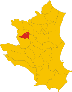
.svg)
Map of comune of Cerenzia (province of Crotone, region Calabria, Italy).svg
1,082 × 1,382; 75 KB
1,082 × 1,382; 75 KB
1 reference
KR
0 references


21.97 square kilometre
9 October 2011
5 references
Superficie di Comuni Province e Regioni italiane al 9 ottobre 2011 (Italian)
16 March 2019
1,147
1 January 2017
1 reference
1,123
1 January 2018
4 references
Popolazione Residente al 1° Gennaio 2018 (Italian)
16 March 2019
Identifiers
315660795
0 references