Agerola (Q267628): Difference between revisions
Jump to navigation
Jump to search
(Changed an Item: Adding this statements since they where added in Wikidata) |
(Changed an Item: Adding this statements since they where added in Wikidata) |
||||||||||||||
| Property / instance of | |||||||||||||||
| Property / instance of: sparse municipality / rank | |||||||||||||||
Normal rank | |||||||||||||||
| Property / Freebase ID | |||||||||||||||
| Property / Freebase ID: /m/0gn2s3 / rank | |||||||||||||||
Normal rank | |||||||||||||||
| Property / Freebase ID: /m/0gn2s3 / reference | |||||||||||||||
| Property / Freebase ID: /m/0gn2s3 / reference | |||||||||||||||
publication date: 28 October 2013
| |||||||||||||||
| Property / GeoNames ID | |||||||||||||||
| Property / GeoNames ID: 6536385 / rank | |||||||||||||||
Normal rank | |||||||||||||||
| Property / GeoNames ID: 6536385 / reference | |||||||||||||||
| Property / image | |||||||||||||||
| Property / image: Agerola.jpg / rank | |||||||||||||||
Normal rank | |||||||||||||||
| Property / topic's main category | |||||||||||||||
| Property / topic's main category: Category:Agerola / rank | |||||||||||||||
Normal rank | |||||||||||||||
| Property / topic's main category: Category:Agerola / reference | |||||||||||||||
| Property / VIAF ID | |||||||||||||||
| Property / VIAF ID: 143514483 / rank | |||||||||||||||
Normal rank | |||||||||||||||
| Property / VIAF ID: 143514483 / reference | |||||||||||||||
| Property / VIAF ID: 143514483 / reference | |||||||||||||||
retrieved: 2 August 2015
| |||||||||||||||
| Property / elevation above sea level | |||||||||||||||
630±1 metre
| |||||||||||||||
| Property / elevation above sea level: 630±1 metre / rank | |||||||||||||||
Normal rank | |||||||||||||||
| Property / elevation above sea level: 630±1 metre / reference | |||||||||||||||
| Property / WOEID | |||||||||||||||
| Property / WOEID: 709833 / rank | |||||||||||||||
Normal rank | |||||||||||||||
| Property / WOEID: 709833 / reference | |||||||||||||||
| Property / licence plate code | |||||||||||||||
NA | |||||||||||||||
| Property / licence plate code: NA / rank | |||||||||||||||
Normal rank | |||||||||||||||
| Property / coordinates of northernmost point | |||||||||||||||
40°40'23.340"N, 14°32'20.515"E
| |||||||||||||||
| Property / coordinates of northernmost point: 40°40'23.340"N, 14°32'20.515"E / rank | |||||||||||||||
Normal rank | |||||||||||||||
| Property / coordinates of northernmost point: 40°40'23.340"N, 14°32'20.515"E / reference | |||||||||||||||
| Property / coordinates of southernmost point | |||||||||||||||
40°37'14.952"N, 14°31'27.610"E
| |||||||||||||||
| Property / coordinates of southernmost point: 40°37'14.952"N, 14°31'27.610"E / rank | |||||||||||||||
Normal rank | |||||||||||||||
| Property / coordinates of southernmost point: 40°37'14.952"N, 14°31'27.610"E / reference | |||||||||||||||
| Property / coordinates of easternmost point | |||||||||||||||
40°38'10.176"N, 14°34'49.768"E
| |||||||||||||||
| Property / coordinates of easternmost point: 40°38'10.176"N, 14°34'49.768"E / rank | |||||||||||||||
Normal rank | |||||||||||||||
| Property / coordinates of easternmost point: 40°38'10.176"N, 14°34'49.768"E / reference | |||||||||||||||
| Property / coordinates of westernmost point | |||||||||||||||
40°38'44.502"N, 14°30'33.941"E
| |||||||||||||||
| Property / coordinates of westernmost point: 40°38'44.502"N, 14°30'33.941"E / rank | |||||||||||||||
Normal rank | |||||||||||||||
| Property / coordinates of westernmost point: 40°38'44.502"N, 14°30'33.941"E / reference | |||||||||||||||
| Property / OSM relation ID | |||||||||||||||
| Property / OSM relation ID: 40646 / rank | |||||||||||||||
Normal rank | |||||||||||||||
| Property / capital | |||||||||||||||
| Property / capital: Agerola / rank | |||||||||||||||
Normal rank | |||||||||||||||
| Property / area | |||||||||||||||
19.83 square kilometre
| |||||||||||||||
| Property / area: 19.83 square kilometre / rank | |||||||||||||||
Normal rank | |||||||||||||||
| Property / area: 19.83 square kilometre / qualifier | |||||||||||||||
point in time: 9 October 2011
| |||||||||||||||
| Property / area: 19.83 square kilometre / reference | |||||||||||||||
| Property / area: 19.83 square kilometre / reference | |||||||||||||||
| Property / area: 19.83 square kilometre / reference | |||||||||||||||
title: Superficie di Comuni Province e Regioni italiane al 9 ottobre 2011 (Italian) | |||||||||||||||
| Property / area: 19.83 square kilometre / reference | |||||||||||||||
retrieved: 16 March 2019
| |||||||||||||||
| Property / area: 19.83 square kilometre / reference | |||||||||||||||
| Property / UN/LOCODE | |||||||||||||||
| Property / UN/LOCODE: ITAG3 / rank | |||||||||||||||
Normal rank | |||||||||||||||
| Property / population | |||||||||||||||
7,697
| |||||||||||||||
| Property / population: 7,697 / rank | |||||||||||||||
Normal rank | |||||||||||||||
| Property / population: 7,697 / qualifier | |||||||||||||||
point in time: 1 January 2017
| |||||||||||||||
| Property / population: 7,697 / qualifier | |||||||||||||||
| Property / population: 7,697 / reference | |||||||||||||||
| Property / population | |||||||||||||||
7,695
| |||||||||||||||
| Property / population: 7,695 / rank | |||||||||||||||
Preferred rank | |||||||||||||||
| Property / population: 7,695 / qualifier | |||||||||||||||
point in time: 1 January 2018
| |||||||||||||||
| Property / population: 7,695 / qualifier | |||||||||||||||
| Property / population: 7,695 / reference | |||||||||||||||
| Property / population: 7,695 / reference | |||||||||||||||
title: Popolazione Residente al 1° Gennaio 2018 (Italian) | |||||||||||||||
| Property / population: 7,695 / reference | |||||||||||||||
retrieved: 16 March 2019
| |||||||||||||||
| Property / population: 7,695 / reference | |||||||||||||||
| Property / TGN ID | |||||||||||||||
| Property / TGN ID: 7056611 / rank | |||||||||||||||
Normal rank | |||||||||||||||
Revision as of 15:39, 28 July 2020
Italian comune
| Language | Label | Description | Also known as |
|---|---|---|---|
| English | Agerola |
Italian comune |
Statements

80051
0 references
Agerola
0 references
1 January 2015
1 reference
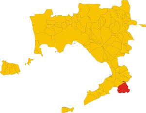
.svg)
Map of comune of Agerola (Metropolitan City of Naples, region Campania, Italy).svg
3,334 × 2,585; 112 KB
3,334 × 2,585; 112 KB
0 references
081
0 references

NA
0 references


19.83 square kilometre
9 October 2011
5 references
Superficie di Comuni Province e Regioni italiane al 9 ottobre 2011 (Italian)
16 March 2019
7,697
1 January 2017
1 reference
7,695
1 January 2018
4 references
Popolazione Residente al 1° Gennaio 2018 (Italian)
16 March 2019
Identifiers
559860630
0 references