Gabrovo Province (Q9524): Difference between revisions
Jump to navigation
Jump to search
(Changed an Item: Adding this statements since they where added in Wikidata) |
(Changed an Item: Adding this statements since they where added in Wikidata) |
||||||||||||||
| Property / official website | |||||||||||||||
| Property / official website: http://www.gb.government.bg/ / rank | |||||||||||||||
Normal rank | |||||||||||||||
| Property / official website: http://www.gb.government.bg/ / reference | |||||||||||||||
| Property / licence plate code | |||||||||||||||
EB | |||||||||||||||
| Property / licence plate code: EB / rank | |||||||||||||||
Normal rank | |||||||||||||||
| Property / licence plate code: EB / reference | |||||||||||||||
| Property / population | |||||||||||||||
122,702
| |||||||||||||||
| Property / population: 122,702 / rank | |||||||||||||||
Normal rank | |||||||||||||||
| Property / population: 122,702 / qualifier | |||||||||||||||
point in time: 2011
| |||||||||||||||
| Property / population: 122,702 / reference | |||||||||||||||
| Property / area | |||||||||||||||
2,023 square kilometre
| |||||||||||||||
| Property / area: 2,023 square kilometre / rank | |||||||||||||||
Normal rank | |||||||||||||||
| Property / area: 2,023 square kilometre / reference | |||||||||||||||
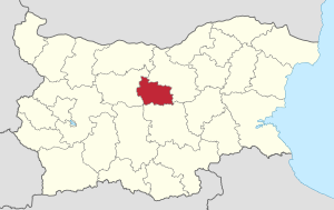
| Property / locator map image | |||||||||||||||
| Property / locator map image: Gabrovo in Bulgaria.svg / rank | |||||||||||||||
Normal rank | |||||||||||||||
| Property / locator map image: Gabrovo in Bulgaria.svg / reference | |||||||||||||||
| Property / located in time zone | |||||||||||||||
| Property / located in time zone: Eastern European Time / rank | |||||||||||||||
Normal rank | |||||||||||||||
| Property / located in time zone: Eastern European Time / reference | |||||||||||||||
| Property / BG EKATTE place ID | |||||||||||||||
GAB | |||||||||||||||
| Property / BG EKATTE place ID: GAB / rank | |||||||||||||||
Normal rank | |||||||||||||||
| Property / BG EKATTE place ID: GAB / qualifier | |||||||||||||||
| Property / archINFORM location ID | |||||||||||||||
| Property / archINFORM location ID: 42693 / rank | |||||||||||||||
Normal rank | |||||||||||||||
| Property / archINFORM location ID: 42693 / reference | |||||||||||||||
| Property / archINFORM location ID: 42693 / reference | |||||||||||||||
| Property / archINFORM location ID: 42693 / reference | |||||||||||||||
retrieved: 5 August 2018
| |||||||||||||||
| Property / image | |||||||||||||||
| Property / image: Architectural-Ethnographic Complex Etar2.jpg / rank | |||||||||||||||
Normal rank | |||||||||||||||
| Property / image: Architectural-Ethnographic Complex Etar2.jpg / reference | |||||||||||||||
| Property / image: Architectural-Ethnographic Complex Etar2.jpg / reference | |||||||||||||||
| Property / geoshape | |||||||||||||||
| Property / geoshape: Data:Bulgaria/Gabrovo.map / rank | |||||||||||||||
Normal rank | |||||||||||||||
| Property / Who's on First ID | |||||||||||||||
| Property / Who's on First ID: 85681797 / rank | |||||||||||||||
Normal rank | |||||||||||||||
| Property / OSM relation ID | |||||||||||||||
| Property / OSM relation ID: 1739527 / rank | |||||||||||||||
Normal rank | |||||||||||||||
| Property / OSM relation ID: 1739527 / reference | |||||||||||||||
| Property / category for maps | |||||||||||||||
| Property / category for maps: Category:Maps of Gabrovo Province / rank | |||||||||||||||
Normal rank | |||||||||||||||
| Property / associated electoral district | |||||||||||||||
| Property / associated electoral district: 7th MMC – Gabrovo / rank | |||||||||||||||
Normal rank | |||||||||||||||
| Property / located in the statistical territorial entity | |||||||||||||||
| Property / located in the statistical territorial entity: Severen Tsentralen Planning Region / rank | |||||||||||||||
Normal rank | |||||||||||||||
| Property / EuroVoc ID | |||||||||||||||
| Property / EuroVoc ID: 8312 / rank | |||||||||||||||
Normal rank | |||||||||||||||
Revision as of 19:42, 3 July 2020
oblast of Bulgaria
- Gabrovo Oblast
| Language | Label | Description | Also known as |
|---|---|---|---|
| English | Gabrovo Province |
oblast of Bulgaria |
|
Statements
P169 (Deleted Property)
2--4992 Property P169 not found, cannot determine the data type to use.
0 references
Identifiers
3 references


