Uckermark District (Q2501989): Difference between revisions
Jump to navigation
Jump to search
(Changed an Item: Sitelinks in wikidata changed) |
(Changed an Item: Adding this statements since they where added in Wikidata) |
||||||||||||||
| Property / P169 (Deleted Property) | |||||||||||||||
2--431538 Property P169 not found, cannot determine the data type to use. | |||||||||||||||
| Property / P169 (Deleted Property): 2--431538 Property P169 not found, cannot determine the data type to use. / rank | |||||||||||||||
Normal rank | |||||||||||||||
| Property / Commons category | |||||||||||||||
Landkreis Uckermark | |||||||||||||||
| Property / Commons category: Landkreis Uckermark / rank | |||||||||||||||
Normal rank | |||||||||||||||
| Property / Commons category: Landkreis Uckermark / reference | |||||||||||||||
| Property / German district key | |||||||||||||||
12073 | |||||||||||||||
| Property / German district key: 12073 / rank | |||||||||||||||
Normal rank | |||||||||||||||
| Property / German district key: 12073 / reference | |||||||||||||||
| Property / located in the administrative territorial entity | |||||||||||||||
| Property / located in the administrative territorial entity: Brandenburg / rank | |||||||||||||||
Normal rank | |||||||||||||||
| Property / coordinate location | |||||||||||||||
53°N, 14°E
| |||||||||||||||
| Property / coordinate location: 53°N, 14°E / rank | |||||||||||||||
Normal rank | |||||||||||||||
| Property / coordinate location: 53°N, 14°E / reference | |||||||||||||||
| Property / country | |||||||||||||||
| Property / country: Germany / rank | |||||||||||||||
Normal rank | |||||||||||||||
| Property / country: Germany / reference | |||||||||||||||
| Property / topic's main category | |||||||||||||||
| Property / topic's main category: Category:Uckermark (district) / rank | |||||||||||||||
Normal rank | |||||||||||||||
| Property / GND ID | |||||||||||||||
| Property / GND ID: 4061353-7 / rank | |||||||||||||||
Normal rank | |||||||||||||||
| Property / GND ID: 4061353-7 / reference | |||||||||||||||
| Property / instance of | |||||||||||||||
| Property / instance of: rural district of Brandenburg / rank | |||||||||||||||
Normal rank | |||||||||||||||
| Property / Freebase ID | |||||||||||||||
| Property / Freebase ID: /m/015xdx / rank | |||||||||||||||
Normal rank | |||||||||||||||
| Property / Freebase ID: /m/015xdx / reference | |||||||||||||||
| Property / Freebase ID: /m/015xdx / reference | |||||||||||||||
publication date: 28 October 2013
| |||||||||||||||
| Property / licence plate code | |||||||||||||||
UM | |||||||||||||||
| Property / licence plate code: UM / rank | |||||||||||||||
Normal rank | |||||||||||||||
| Property / licence plate code: UM / reference | |||||||||||||||
| Property / licence plate code | |||||||||||||||
TP | |||||||||||||||
| Property / licence plate code: TP / rank | |||||||||||||||
Normal rank | |||||||||||||||
| Property / licence plate code | |||||||||||||||
SDT | |||||||||||||||
| Property / licence plate code: SDT / rank | |||||||||||||||
Normal rank | |||||||||||||||
| Property / licence plate code | |||||||||||||||
PZ | |||||||||||||||
| Property / licence plate code: PZ / rank | |||||||||||||||
Normal rank | |||||||||||||||
| Property / licence plate code | |||||||||||||||
ANG | |||||||||||||||
| Property / licence plate code: ANG / rank | |||||||||||||||
Normal rank | |||||||||||||||
| Property / GeoNames ID | |||||||||||||||
| Property / GeoNames ID: 3249091 / rank | |||||||||||||||
Normal rank | |||||||||||||||
| Property / GeoNames ID: 3249091 / reference | |||||||||||||||
| Property / coat of arms image | |||||||||||||||
| Property / coat of arms image: DEU Landkreis Uckermark COA.svg / rank | |||||||||||||||
Normal rank | |||||||||||||||
| Property / image | |||||||||||||||
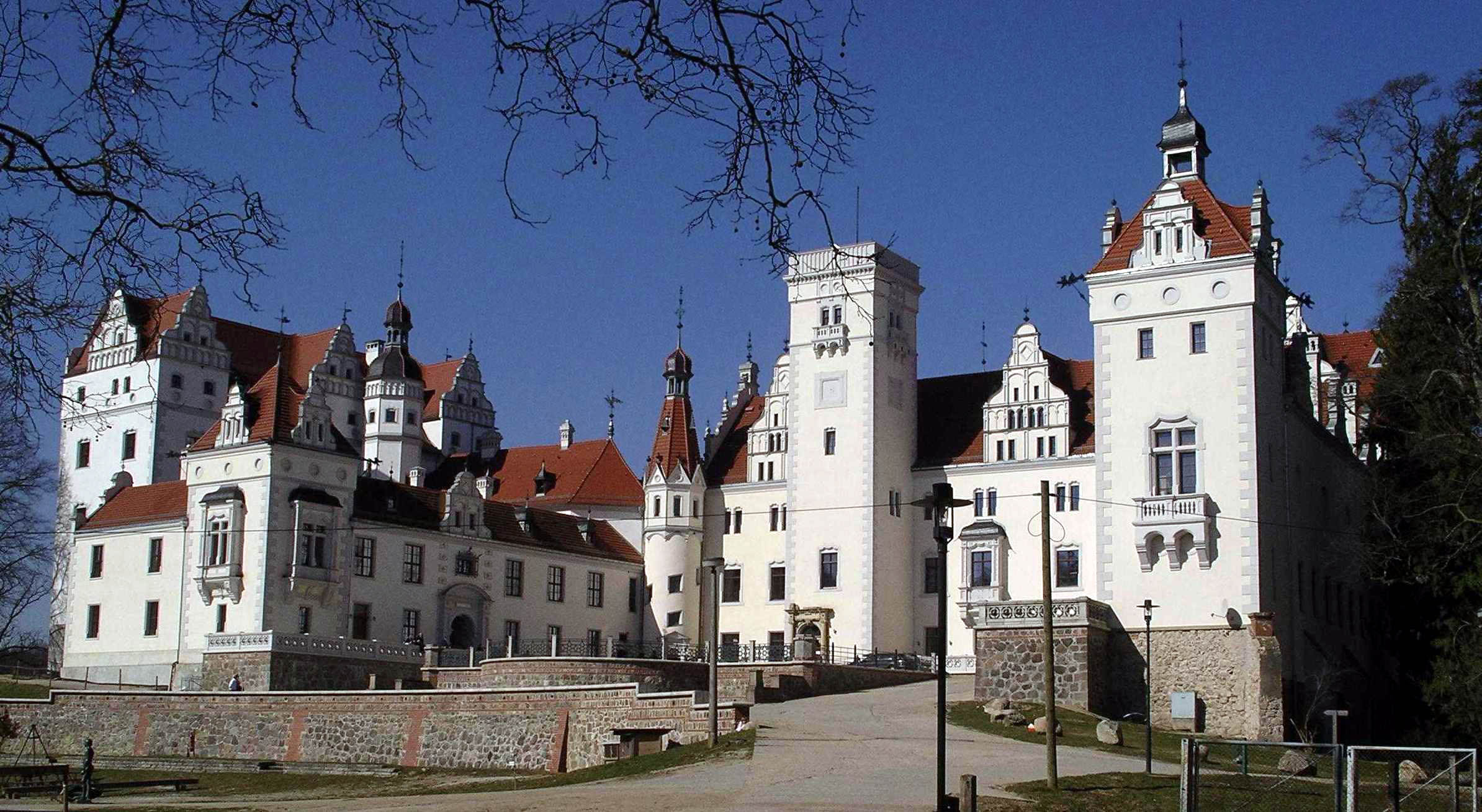
| Property / image: Schloss Boitzenburg Vorderseite.jpg / rank | |||||||||||||||
Normal rank | |||||||||||||||
| Property / population | |||||||||||||||
121,326
| |||||||||||||||
| Property / population: 121,326 / rank | |||||||||||||||
Normal rank | |||||||||||||||
| Property / population: 121,326 / qualifier | |||||||||||||||
point in time: 31 December 2013
| |||||||||||||||
| Property / population | |||||||||||||||
122,484
| |||||||||||||||
| Property / population: 122,484 / rank | |||||||||||||||
Normal rank | |||||||||||||||
| Property / population: 122,484 / qualifier | |||||||||||||||
point in time: 31 December 2012
| |||||||||||||||
Revision as of 11:43, 3 July 2020
District in Brandenburg state, Germany
| Language | Label | Description | Also known as |
|---|---|---|---|
| English | Uckermark District |
District in Brandenburg state, Germany |
Statements
P169 (Deleted Property)
2--431538 Property P169 not found, cannot determine the data type to use.
0 references
TP
0 references
SDT
0 references
PZ
0 references
ANG
0 references


