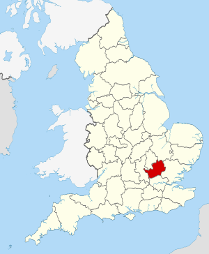
Hertfordshire (Q2549772): Difference between revisions
Jump to navigation
Jump to search
(Changed an Item: Adding this statements since they where added in Wikidata) |
(Changed an Item: Adding this statements since they where added in Wikidata) |
||||||||||||||
| Property / page banner | |||||||||||||||
| Property / page banner: WV banner Hertfordshire Verulamium wall ruins.jpg / rank | |||||||||||||||
Normal rank | |||||||||||||||
| Property / Vision of Britain place ID | |||||||||||||||
| Property / Vision of Britain place ID: 17451 / rank | |||||||||||||||
Normal rank | |||||||||||||||
| Property / Vision of Britain place ID: 17451 / qualifier | |||||||||||||||
named as: Hertfordshire, England | |||||||||||||||
| Property / Vision of Britain place ID: 17451 / reference | |||||||||||||||
retrieved: 1 March 2017
| |||||||||||||||
| Property / TOID | |||||||||||||||
7000000000003909 | |||||||||||||||
| Property / TOID: 7000000000003909 / rank | |||||||||||||||
Normal rank | |||||||||||||||
| Property / area | |||||||||||||||
1,643.0648 square kilometre
| |||||||||||||||
| Property / area: 1,643.0648 square kilometre / rank | |||||||||||||||
Normal rank | |||||||||||||||
| Property / area: 1,643.0648 square kilometre / qualifier | |||||||||||||||
point in time: 2016
| |||||||||||||||
| Property / area: 1,643.0648 square kilometre / reference | |||||||||||||||
| Property / history of topic | |||||||||||||||
| Property / history of topic: history of Hertfordshire / rank | |||||||||||||||
Normal rank | |||||||||||||||
| Property / history of topic: history of Hertfordshire / reference | |||||||||||||||
| Property / BabelNet ID | |||||||||||||||
| Property / BabelNet ID: 00043901n / rank | |||||||||||||||
Normal rank | |||||||||||||||
| Property / BabelNet ID: 00043901n / reference | |||||||||||||||
| Property / different from | |||||||||||||||
| Property / different from: Hertfordshire / rank | |||||||||||||||
Normal rank | |||||||||||||||
| Property / different from: Hertfordshire / qualifier | |||||||||||||||
| Property / category of people buried here | |||||||||||||||
| Property / category of people buried here: Category:Burials in Hertfordshire / rank | |||||||||||||||
Normal rank | |||||||||||||||
| Property / archINFORM location ID | |||||||||||||||
| Property / archINFORM location ID: 2456 / rank | |||||||||||||||
Normal rank | |||||||||||||||
| Property / archINFORM location ID: 2456 / reference | |||||||||||||||
| Property / archINFORM location ID: 2456 / reference | |||||||||||||||
| Property / archINFORM location ID: 2456 / reference | |||||||||||||||
retrieved: 5 August 2018
| |||||||||||||||
| Property / geoshape | |||||||||||||||
| Property / geoshape: Data:Hertfordshire.map / rank | |||||||||||||||
Normal rank | |||||||||||||||
| Property / Encyclopædia Britannica Online ID | |||||||||||||||
| Property / Encyclopædia Britannica Online ID: place/Hertfordshire / rank | |||||||||||||||
Normal rank | |||||||||||||||
| Property / PACTOLS thesaurus ID | |||||||||||||||
| Property / PACTOLS thesaurus ID: pcrtnlFQROFFSo / rank | |||||||||||||||
Normal rank | |||||||||||||||
| Property / Library of Congress authority ID | |||||||||||||||
| Property / Library of Congress authority ID: n80040162 / rank | |||||||||||||||
Normal rank | |||||||||||||||
| Property / Library of Congress authority ID: n80040162 / reference | |||||||||||||||
| Property / Library of Congress authority ID: n80040162 / reference | |||||||||||||||
retrieved: 3 April 2019
| |||||||||||||||
| Property / GND ID | |||||||||||||||
| Property / GND ID: 4024615-2 / rank | |||||||||||||||
Normal rank | |||||||||||||||
| Property / GND ID: 4024615-2 / reference | |||||||||||||||
| Property / GND ID: 4024615-2 / reference | |||||||||||||||
| Property / VIAF ID | |||||||||||||||
| Property / VIAF ID: 140715260 / rank | |||||||||||||||
Normal rank | |||||||||||||||
| Property / VIAF ID: 140715260 / reference | |||||||||||||||
| Property / VIAF ID: 140715260 / reference | |||||||||||||||
| Property / Who's on First ID | |||||||||||||||
| Property / Who's on First ID: 85684331 / rank | |||||||||||||||
Normal rank | |||||||||||||||
| Property / Gran Enciclopèdia Catalana ID | |||||||||||||||
| Property / Gran Enciclopèdia Catalana ID: 0032555 / rank | |||||||||||||||
Normal rank | |||||||||||||||
| Property / described by source | |||||||||||||||
| Property / described by source: Brockhaus and Efron Encyclopedic Dictionary (Russian Transl.) / rank | |||||||||||||||
Normal rank | |||||||||||||||
| Property / described by source: Brockhaus and Efron Encyclopedic Dictionary (Russian Transl.) / qualifier | |||||||||||||||
| Property / described by source | |||||||||||||||
| Property / described by source: Small Brockhaus and Efron Encyclopedic Dictionary / rank | |||||||||||||||
Normal rank | |||||||||||||||
| Property / described by source: Small Brockhaus and Efron Encyclopedic Dictionary / qualifier | |||||||||||||||
| Property / legislative body | |||||||||||||||
| Property / legislative body: Hertfordshire County Council / rank | |||||||||||||||
Normal rank | |||||||||||||||
Revision as of 20:45, 2 July 2020
non-metropolitan county in England
- Herts
| Language | Label | Description | Also known as |
|---|---|---|---|
| English | Hertfordshire |
non-metropolitan county in England |
|
Statements
3 references
1 April 1994
1,643.0648 square kilometre
2016
Identifiers
GB-HRT
0 references
UKF8
5 references
30 December 2013
List of FIPS region codes (S-U) (English)
7000000000003909
0 references
3 references
2 references


