Ortueri (Q289598): Difference between revisions
Jump to navigation
Jump to search
(Changed label, description and/or aliases in 17 languages: Label in wikidata changed) |
(Changed an Item: Adding these statements since they where added in Wikidata) |
||||||||||||||
| (17 intermediate revisions by 2 users not shown) | |||||||||||||||
| label / ga | label / ga | ||||||||||||||
Ortueri | |||||||||||||||
| description / en | description / en | ||||||||||||||
Italian comune | |||||||||||||||
| description / bg | description / bg | ||||||||||||||
италианска община | |||||||||||||||
| description / cs | description / cs | ||||||||||||||
italská obec | |||||||||||||||
| description / de | description / de | ||||||||||||||
italienische Gemeinde | |||||||||||||||
| description / el | description / el | ||||||||||||||
δήμος της Ιταλίας | |||||||||||||||
| description / es | description / es | ||||||||||||||
comuna italiana | |||||||||||||||
| description / fi | description / fi | ||||||||||||||
kunta Italiassa | |||||||||||||||
| description / fr | description / fr | ||||||||||||||
commune italienne | |||||||||||||||
| description / hr | description / hr | ||||||||||||||
Talijanske općine | |||||||||||||||
| description / it | description / it | ||||||||||||||
comune italiano | |||||||||||||||
| description / lt | description / lt | ||||||||||||||
komuna Italijoje | |||||||||||||||
| description / nl | description / nl | ||||||||||||||
Italiaanse gemeente | |||||||||||||||
| description / pl | description / pl | ||||||||||||||
włoska gmina | |||||||||||||||
| description / pt | description / pt | ||||||||||||||
comuna italiana | |||||||||||||||
| description / sv | description / sv | ||||||||||||||
kommun i Italien | |||||||||||||||
| description / tr | description / tr | ||||||||||||||
İtalya'nın Sardinya bölgesinde, Nuoro iline bağlı ilçe (komün) | |||||||||||||||
| description / hu | description / hu | ||||||||||||||
település Olaszországban | |||||||||||||||
| description / ro | description / ro | ||||||||||||||
comună din Italia | |||||||||||||||
| Property / country | |||||||||||||||
| Property / country: Italy / rank | |||||||||||||||
| Property / instance of | |||||||||||||||
| Property / instance of: beneficiary / rank | |||||||||||||||
| Property / instance of | |||||||||||||||
| Property / instance of: commune of Italy / rank | |||||||||||||||
Normal rank | |||||||||||||||
| Property / Commons category | |||||||||||||||
Ortueri | |||||||||||||||
| Property / Commons category: Ortueri / rank | |||||||||||||||
Normal rank | |||||||||||||||
| Property / located in the administrative territorial entity | |||||||||||||||
| Property / located in the administrative territorial entity: Province of Nuoro / rank | |||||||||||||||
Normal rank | |||||||||||||||
| Property / located in the administrative territorial entity: Province of Nuoro / qualifier | |||||||||||||||
start time: 2 January 1927Gregorian
| |||||||||||||||
| Property / located in the administrative territorial entity: Province of Nuoro / reference | |||||||||||||||
| Property / postal code | |||||||||||||||
08036 | |||||||||||||||
| Property / postal code: 08036 / rank | |||||||||||||||
Normal rank | |||||||||||||||
| Property / postal code: 08036 / reference | |||||||||||||||
| Property / shares border with | |||||||||||||||
| Property / shares border with: Austis / rank | |||||||||||||||
Normal rank | |||||||||||||||
| Property / shares border with | |||||||||||||||
| Property / shares border with: Busachi / rank | |||||||||||||||
Normal rank | |||||||||||||||
| Property / shares border with: Busachi / reference | |||||||||||||||
| Property / shares border with | |||||||||||||||
| Property / shares border with: Samugheo / rank | |||||||||||||||
Normal rank | |||||||||||||||
| Property / shares border with | |||||||||||||||
| Property / shares border with: Sorgono / rank | |||||||||||||||
Normal rank | |||||||||||||||
| Property / shares border with: Sorgono / reference | |||||||||||||||
| Property / shares border with | |||||||||||||||
| Property / shares border with: Ula Tirso / rank | |||||||||||||||
Normal rank | |||||||||||||||
| Property / shares border with | |||||||||||||||
| Property / shares border with: Neoneli / rank | |||||||||||||||
Normal rank | |||||||||||||||
| Property / shares border with: Neoneli / reference | |||||||||||||||
| Property / located in time zone | |||||||||||||||
| Property / located in time zone: UTC+01:00 / rank | |||||||||||||||
Normal rank | |||||||||||||||
| Property / located in time zone: UTC+01:00 / qualifier | |||||||||||||||
| Property / located in time zone: UTC+01:00 / reference | |||||||||||||||
| Property / located in time zone | |||||||||||||||
| Property / located in time zone: UTC+02:00 / rank | |||||||||||||||
Normal rank | |||||||||||||||
| Property / located in time zone: UTC+02:00 / qualifier | |||||||||||||||
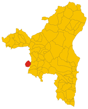
| Property / locator map image | |||||||||||||||
| Property / locator map image: Map of comune of Ortueri (province of Nuoro, region Sardinia, Italy) - 2016.svg / rank | |||||||||||||||
Normal rank | |||||||||||||||
| Property / locator map image: Map of comune of Ortueri (province of Nuoro, region Sardinia, Italy) - 2016.svg / reference | |||||||||||||||
| Property / local dialing code | |||||||||||||||
0784 | |||||||||||||||
| Property / local dialing code: 0784 / rank | |||||||||||||||
Normal rank | |||||||||||||||
| Property / local dialing code: 0784 / reference | |||||||||||||||
| Property / ISTAT ID | |||||||||||||||
091066 | |||||||||||||||
| Property / ISTAT ID: 091066 / rank | |||||||||||||||
Normal rank | |||||||||||||||
| Property / ISTAT ID: 091066 / reference | |||||||||||||||
| Property / coordinate location | |||||||||||||||
40°2'7.3298"N, 8°59'10.0673"E
| |||||||||||||||
| Property / coordinate location: 40°2'7.3298"N, 8°59'10.0673"E / rank | |||||||||||||||
Normal rank | |||||||||||||||
| Property / coordinate location: 40°2'7.3298"N, 8°59'10.0673"E / reference | |||||||||||||||
| Property / country | |||||||||||||||
| Property / country: Italy / rank | |||||||||||||||
Normal rank | |||||||||||||||
| Property / country: Italy / reference | |||||||||||||||
| Property / Italian cadastre code | |||||||||||||||
G146 | |||||||||||||||
| Property / Italian cadastre code: G146 / rank | |||||||||||||||
Normal rank | |||||||||||||||
| Property / Italian cadastre code: G146 / reference | |||||||||||||||
| Property / Freebase ID | |||||||||||||||
| Property / Freebase ID: /m/0gqw9n / rank | |||||||||||||||
Normal rank | |||||||||||||||
| Property / Freebase ID: /m/0gqw9n / reference | |||||||||||||||
| Property / Freebase ID: /m/0gqw9n / reference | |||||||||||||||
publication date: 28 October 2013
| |||||||||||||||
| Property / GeoNames ID | |||||||||||||||
| Property / GeoNames ID: 6537870 / rank | |||||||||||||||
Normal rank | |||||||||||||||
| Property / GeoNames ID: 6537870 / reference | |||||||||||||||
| Property / image | |||||||||||||||
| Property / image: Campanile di Ortueri.JPG / rank | |||||||||||||||
Normal rank | |||||||||||||||
| Property / topic's main category | |||||||||||||||
| Property / topic's main category: Category:Ortueri / rank | |||||||||||||||
Normal rank | |||||||||||||||
| Property / topic's main category: Category:Ortueri / reference | |||||||||||||||
| Property / official website | |||||||||||||||
| Property / official website: http://www.comune-ortueri.it / rank | |||||||||||||||
Normal rank | |||||||||||||||
| Property / official website: http://www.comune-ortueri.it / reference | |||||||||||||||
| Property / VIAF ID | |||||||||||||||
| Property / VIAF ID: 240123265 / rank | |||||||||||||||
Normal rank | |||||||||||||||
| Property / VIAF ID: 240123265 / reference | |||||||||||||||
| Property / VIAF ID: 240123265 / reference | |||||||||||||||
retrieved: 3 August 2015
| |||||||||||||||
| Property / elevation above sea level | |||||||||||||||
584±1 metre
| |||||||||||||||
| Property / elevation above sea level: 584±1 metre / rank | |||||||||||||||
Normal rank | |||||||||||||||
| Property / elevation above sea level: 584±1 metre / reference | |||||||||||||||
| Property / coordinates of northernmost point | |||||||||||||||
40°3'27.950"N, 8°59'32.010"E
| |||||||||||||||
| Property / coordinates of northernmost point: 40°3'27.950"N, 8°59'32.010"E / rank | |||||||||||||||
Normal rank | |||||||||||||||
| Property / coordinates of northernmost point: 40°3'27.950"N, 8°59'32.010"E / reference | |||||||||||||||
| Property / coordinates of southernmost point | |||||||||||||||
39°59'11.944"N, 8°59'29.886"E
| |||||||||||||||
| Property / coordinates of southernmost point: 39°59'11.944"N, 8°59'29.886"E / rank | |||||||||||||||
Normal rank | |||||||||||||||
| Property / coordinates of southernmost point: 39°59'11.944"N, 8°59'29.886"E / reference | |||||||||||||||
| Property / coordinates of easternmost point | |||||||||||||||
40°1'22.253"N, 9°1'53.735"E
| |||||||||||||||
| Property / coordinates of easternmost point: 40°1'22.253"N, 9°1'53.735"E / rank | |||||||||||||||
Normal rank | |||||||||||||||
| Property / coordinates of easternmost point: 40°1'22.253"N, 9°1'53.735"E / reference | |||||||||||||||
| Property / coordinates of westernmost point | |||||||||||||||
40°1'7.302"N, 8°56'42.313"E
| |||||||||||||||
| Property / coordinates of westernmost point: 40°1'7.302"N, 8°56'42.313"E / rank | |||||||||||||||
Normal rank | |||||||||||||||
| Property / coordinates of westernmost point: 40°1'7.302"N, 8°56'42.313"E / reference | |||||||||||||||
| Property / OSM relation ID | |||||||||||||||
| Property / OSM relation ID: 40195 / rank | |||||||||||||||
Normal rank | |||||||||||||||
| Property / capital | |||||||||||||||
| Property / capital: Ortueri / rank | |||||||||||||||
Normal rank | |||||||||||||||
| Property / area | |||||||||||||||
38.83 square kilometre
| |||||||||||||||
| Property / area: 38.83 square kilometre / rank | |||||||||||||||
Normal rank | |||||||||||||||
| Property / area: 38.83 square kilometre / qualifier | |||||||||||||||
point in time: 9 October 2011
| |||||||||||||||
| Property / area: 38.83 square kilometre / reference | |||||||||||||||
| Property / area: 38.83 square kilometre / reference | |||||||||||||||
| Property / area: 38.83 square kilometre / reference | |||||||||||||||
title: Superficie di Comuni Province e Regioni italiane al 9 ottobre 2011 (Italian) | |||||||||||||||
| Property / area: 38.83 square kilometre / reference | |||||||||||||||
retrieved: 16 March 2019
| |||||||||||||||
| Property / area: 38.83 square kilometre / reference | |||||||||||||||
| Property / population | |||||||||||||||
1,151
| |||||||||||||||
| Property / population: 1,151 / rank | |||||||||||||||
Normal rank | |||||||||||||||
| Property / population: 1,151 / qualifier | |||||||||||||||
point in time: 1 January 2017
| |||||||||||||||
| Property / population: 1,151 / qualifier | |||||||||||||||
| Property / population: 1,151 / reference | |||||||||||||||
| Property / population | |||||||||||||||
1,135
| |||||||||||||||
| Property / population: 1,135 / rank | |||||||||||||||
Preferred rank | |||||||||||||||
| Property / population: 1,135 / qualifier | |||||||||||||||
point in time: 1 January 2018
| |||||||||||||||
| Property / population: 1,135 / qualifier | |||||||||||||||
| Property / population: 1,135 / reference | |||||||||||||||
| Property / population: 1,135 / reference | |||||||||||||||
title: Popolazione Residente al 1° Gennaio 2018 (Italian) | |||||||||||||||
| Property / population: 1,135 / reference | |||||||||||||||
retrieved: 16 March 2019
| |||||||||||||||
| Property / population: 1,135 / reference | |||||||||||||||
| Property / population | |||||||||||||||
1,135
| |||||||||||||||
| Property / population: 1,135 / rank | |||||||||||||||
Normal rank | |||||||||||||||
| Property / population: 1,135 / qualifier | |||||||||||||||
point in time: 1 January 2018
| |||||||||||||||
| Property / population: 1,135 / qualifier | |||||||||||||||
| Property / population: 1,135 / reference | |||||||||||||||
| Property / population: 1,135 / reference | |||||||||||||||
title: Popolazione Residente al 1° Gennaio 2018 (Italian) | |||||||||||||||
| Property / population: 1,135 / reference | |||||||||||||||
retrieved: 16 March 2019
| |||||||||||||||
| Property / population: 1,135 / reference | |||||||||||||||
| Property / population | |||||||||||||||
1,025
| |||||||||||||||
| Property / population: 1,025 / rank | |||||||||||||||
Preferred rank | |||||||||||||||
| Property / population: 1,025 / qualifier | |||||||||||||||
point in time: 1 January 2023
| |||||||||||||||
| Property / population: 1,025 / reference | |||||||||||||||
| Property / licence plate code | |||||||||||||||
NU | |||||||||||||||
| Property / licence plate code: NU / rank | |||||||||||||||
Normal rank | |||||||||||||||
| Property / IndicePA ID | |||||||||||||||
| Property / IndicePA ID: c_g146 / rank | |||||||||||||||
Normal rank | |||||||||||||||
| Property / Who's on First ID | |||||||||||||||
| Property / Who's on First ID: 101778623 / rank | |||||||||||||||
Normal rank | |||||||||||||||
| Property / Wiki Loves Monuments ID | |||||||||||||||
20G1460000 | |||||||||||||||
| Property / Wiki Loves Monuments ID: 20G1460000 / rank | |||||||||||||||
Normal rank | |||||||||||||||
| Property / Wiki Loves Monuments ID: 20G1460000 / qualifier | |||||||||||||||
start time: 1 September 2020
| |||||||||||||||
| Property / Wiki Loves Monuments ID: 20G1460000 / reference | |||||||||||||||
| Property / patron saint | |||||||||||||||
| Property / patron saint: Saint Nicholas / rank | |||||||||||||||
Normal rank | |||||||||||||||
| Property / patron saint: Saint Nicholas / reference | |||||||||||||||
| Property / patron saint: Saint Nicholas / reference | |||||||||||||||
| Property / seismic classification | |||||||||||||||
| Property / seismic classification: 4 / rank | |||||||||||||||
Normal rank | |||||||||||||||
| Property / seismic classification: 4 / reference | |||||||||||||||
| Property / seismic classification: 4 / reference | |||||||||||||||
| Property / seismic classification: 4 / reference | |||||||||||||||
retrieved: 27 August 2022
| |||||||||||||||
| Property / EU Knowledge Graph item ID | |||||||||||||||
Q289598 | |||||||||||||||
| Property / EU Knowledge Graph item ID: Q289598 / rank | |||||||||||||||
Normal rank | |||||||||||||||
| links / bgwiki / name | links / bgwiki / name | ||||||||||||||
| links / cswiki / name | links / cswiki / name | ||||||||||||||
| links / dawiki / name | links / dawiki / name | ||||||||||||||
| links / dewiki / name | links / dewiki / name | ||||||||||||||
| links / enwiki / name | links / enwiki / name | ||||||||||||||
| links / eswiki / name | links / eswiki / name | ||||||||||||||
| links / fiwiki / name | links / fiwiki / name | ||||||||||||||
| links / frwiki / name | links / frwiki / name | ||||||||||||||
| links / hrwiki / name | links / hrwiki / name | ||||||||||||||
| links / huwiki / name | links / huwiki / name | ||||||||||||||
| links / itwiki / name | links / itwiki / name | ||||||||||||||
| links / nlwiki / name | links / nlwiki / name | ||||||||||||||
| links / plwiki / name | links / plwiki / name | ||||||||||||||
| links / ptwiki / name | links / ptwiki / name | ||||||||||||||
| links / rowiki / name | links / rowiki / name | ||||||||||||||
| links / svwiki / name | links / svwiki / name | ||||||||||||||
| links / trwiki / name | links / trwiki / name | ||||||||||||||
Latest revision as of 12:00, 7 August 2024
Italian comune
| Language | Label | Description | Also known as |
|---|---|---|---|
| English | Ortueri |
Italian comune |
Statements

Ortueri
0 references
2 January 1927Gregorian
1 reference
_-_2016.svg)
Map of comune of Ortueri (province of Nuoro, region Sardinia, Italy) - 2016.svg
6,700 × 8,300; 168 KB
6,700 × 8,300; 168 KB
1 reference


_-_2016.svg)
38.83 square kilometre
9 October 2011
5 references
Superficie di Comuni Province e Regioni italiane al 9 ottobre 2011 (Italian)
16 March 2019
1,151
1 January 2017
1 reference
1,135
1 January 2018
4 references
Popolazione Residente al 1° Gennaio 2018 (Italian)
16 March 2019
1,135
1 January 2018
4 references
Popolazione Residente al 1° Gennaio 2018 (Italian)
16 March 2019
NU
0 references
Identifiers
177790912
0 references
Q289598
0 references