Pallagorio (Q252909): Difference between revisions
Jump to navigation
Jump to search
(Changed an Item: Adding this statements since they where added in Wikidata) |
(Removed claim: Italian Registration ID (P1358): 02205340793) |
||||||||||||||
| (205 intermediate revisions by 3 users not shown) | |||||||||||||||
| label / tr | label / tr | ||||||||||||||
Pallagorio | |||||||||||||||
| label / ga | label / ga | ||||||||||||||
Pallagorio | |||||||||||||||
| description / tr | description / tr | ||||||||||||||
İtalya'nın | İtalya'nın Calabria bölgesinde, Crotone iline bağlı ilçe (komün) | ||||||||||||||
| description / hu | description / hu | ||||||||||||||
község Olaszországban | |||||||||||||||
| Property / Italian Registration ID | |||||||||||||||
| Property / Italian Registration ID: 02205340793 / rank | |||||||||||||||
| Property / instance of | |||||||||||||||
| Property / instance of: beneficiary / rank | |||||||||||||||
| Property / image | |||||||||||||||
| Property / image: Pallagorio Retro Chiesa Madre.jpg / rank | |||||||||||||||
| Property / image: Pallagorio Retro Chiesa Madre.jpg / reference | |||||||||||||||
| Property / instance of | |||||||||||||||
| Property / instance of: beneficiary / rank | |||||||||||||||
Preferred rank | |||||||||||||||
| Property / instance of | |||||||||||||||
| Property / instance of: public beneficiary / rank | |||||||||||||||
Normal rank | |||||||||||||||
| Property / instance of: public beneficiary / qualifier | |||||||||||||||
| Property / GeoNames ID | |||||||||||||||
| Property / GeoNames ID: 6541395 / rank | |||||||||||||||
Normal rank | |||||||||||||||
| Property / GeoNames ID: 6541395 / reference | |||||||||||||||
| Property / category for people born here | |||||||||||||||
| Property / category for people born here: Category:Births in Pallagorio / rank | |||||||||||||||
Normal rank | |||||||||||||||
| Property / category for people born here: Category:Births in Pallagorio / reference | |||||||||||||||
| Property / official website | |||||||||||||||
| Property / official website: http://www.comune.pallagorio.kr.it / rank | |||||||||||||||
Normal rank | |||||||||||||||
| Property / official website: http://www.comune.pallagorio.kr.it / reference | |||||||||||||||
| Property / VIAF ID | |||||||||||||||
| Property / VIAF ID: 259205277 / rank | |||||||||||||||
Normal rank | |||||||||||||||
| Property / VIAF ID: 259205277 / reference | |||||||||||||||
| Property / VIAF ID: 259205277 / reference | |||||||||||||||
retrieved: 2 August 2015
| |||||||||||||||
| Property / topic's main category | |||||||||||||||
| Property / topic's main category: Category:Pallagorio / rank | |||||||||||||||
Normal rank | |||||||||||||||
| Property / licence plate code | |||||||||||||||
KR | |||||||||||||||
| Property / licence plate code: KR / rank | |||||||||||||||
Normal rank | |||||||||||||||
| Property / coordinates of northernmost point | |||||||||||||||
39°21'35.723"N, 16°52'12.086"E
| |||||||||||||||
| Property / coordinates of northernmost point: 39°21'35.723"N, 16°52'12.086"E / rank | |||||||||||||||
Normal rank | |||||||||||||||
| Property / coordinates of northernmost point: 39°21'35.723"N, 16°52'12.086"E / reference | |||||||||||||||
| Property / coordinates of southernmost point | |||||||||||||||
39°15'59.112"N, 16°56'38.609"E
| |||||||||||||||
| Property / coordinates of southernmost point: 39°15'59.112"N, 16°56'38.609"E / rank | |||||||||||||||
Normal rank | |||||||||||||||
| Property / coordinates of southernmost point: 39°15'59.112"N, 16°56'38.609"E / reference | |||||||||||||||
| Property / coordinates of easternmost point | |||||||||||||||
39°18'9.295"N, 16°57'36.900"E
| |||||||||||||||
| Property / coordinates of easternmost point: 39°18'9.295"N, 16°57'36.900"E / rank | |||||||||||||||
Normal rank | |||||||||||||||
| Property / coordinates of easternmost point: 39°18'9.295"N, 16°57'36.900"E / reference | |||||||||||||||
| Property / coordinates of westernmost point | |||||||||||||||
39°20'54.384"N, 16°50'16.807"E
| |||||||||||||||
| Property / coordinates of westernmost point: 39°20'54.384"N, 16°50'16.807"E / rank | |||||||||||||||
Normal rank | |||||||||||||||
| Property / coordinates of westernmost point: 39°20'54.384"N, 16°50'16.807"E / reference | |||||||||||||||
| Property / OSM relation ID | |||||||||||||||
| Property / OSM relation ID: 39878 / rank | |||||||||||||||
Normal rank | |||||||||||||||
| Property / elevation above sea level | |||||||||||||||
554 metre
| |||||||||||||||
| Property / elevation above sea level: 554 metre / rank | |||||||||||||||
Normal rank | |||||||||||||||
| Property / elevation above sea level: 554 metre / reference | |||||||||||||||
| Property / capital | |||||||||||||||
| Property / capital: Pallagorio / rank | |||||||||||||||
Normal rank | |||||||||||||||
| Property / area | |||||||||||||||
44.48 square kilometre
| |||||||||||||||
| Property / area: 44.48 square kilometre / rank | |||||||||||||||
Normal rank | |||||||||||||||
| Property / area: 44.48 square kilometre / qualifier | |||||||||||||||
point in time: 9 October 2011
| |||||||||||||||
| Property / area: 44.48 square kilometre / reference | |||||||||||||||
| Property / area: 44.48 square kilometre / reference | |||||||||||||||
| Property / area: 44.48 square kilometre / reference | |||||||||||||||
title: Superficie di Comuni Province e Regioni italiane al 9 ottobre 2011 (Italian) | |||||||||||||||
| Property / area: 44.48 square kilometre / reference | |||||||||||||||
retrieved: 16 March 2019
| |||||||||||||||
| Property / area: 44.48 square kilometre / reference | |||||||||||||||
| Property / population | |||||||||||||||
1,211
| |||||||||||||||
| Property / population: 1,211 / rank | |||||||||||||||
Normal rank | |||||||||||||||
| Property / population: 1,211 / qualifier | |||||||||||||||
point in time: 1 January 2017
| |||||||||||||||
| Property / population: 1,211 / qualifier | |||||||||||||||
| Property / population: 1,211 / reference | |||||||||||||||
| Property / population | |||||||||||||||
1,164
| |||||||||||||||
| Property / population: 1,164 / rank | |||||||||||||||
Preferred rank | |||||||||||||||
| Property / population: 1,164 / qualifier | |||||||||||||||
point in time: 1 January 2018
| |||||||||||||||
| Property / population: 1,164 / qualifier | |||||||||||||||
| Property / population: 1,164 / reference | |||||||||||||||
| Property / population: 1,164 / reference | |||||||||||||||
title: Popolazione Residente al 1° Gennaio 2018 (Italian) | |||||||||||||||
| Property / population: 1,164 / reference | |||||||||||||||
retrieved: 16 March 2019
| |||||||||||||||
| Property / population: 1,164 / reference | |||||||||||||||
| Property / GND ID | |||||||||||||||
| Property / GND ID: 1024823407 / rank | |||||||||||||||
Normal rank | |||||||||||||||
| Property / GND ID: 1024823407 / reference | |||||||||||||||
| Property / twinned administrative body | |||||||||||||||
| Property / twinned administrative body: Campi Bisenzio / rank | |||||||||||||||
Normal rank | |||||||||||||||
| Property / twinned administrative body: Campi Bisenzio / reference | |||||||||||||||
| Property / IndicePA ID | |||||||||||||||
| Property / IndicePA ID: c_g278 / rank | |||||||||||||||
Normal rank | |||||||||||||||
| Property / Who's on First ID | |||||||||||||||
| Property / Who's on First ID: 101801417 / rank | |||||||||||||||
Normal rank | |||||||||||||||
| Property / Wiki Loves Monuments ID | |||||||||||||||
18G2780000 | |||||||||||||||
| Property / Wiki Loves Monuments ID: 18G2780000 / rank | |||||||||||||||
Normal rank | |||||||||||||||
| Property / Wiki Loves Monuments ID: 18G2780000 / qualifier | |||||||||||||||
start time: 1 September 2020
| |||||||||||||||
| Property / Wiki Loves Monuments ID: 18G2780000 / reference | |||||||||||||||
| Property / MusicBrainz area ID | |||||||||||||||
| Property / MusicBrainz area ID: ef23de45-8c15-4371-b43b-b0ef7e8e8421 / rank | |||||||||||||||
Normal rank | |||||||||||||||
| Property / MusicBrainz area ID: ef23de45-8c15-4371-b43b-b0ef7e8e8421 / reference | |||||||||||||||
| Property / MusicBrainz area ID: ef23de45-8c15-4371-b43b-b0ef7e8e8421 / reference | |||||||||||||||
retrieved: 17 May 2021
| |||||||||||||||
| Property / patron saint | |||||||||||||||
| Property / patron saint: John the Baptist / rank | |||||||||||||||
Normal rank | |||||||||||||||
| Property / patron saint: John the Baptist / reference | |||||||||||||||
| Property / patron saint: John the Baptist / reference | |||||||||||||||
| Property / TGN ID | |||||||||||||||
| Property / TGN ID: 1045857 / rank | |||||||||||||||
Normal rank | |||||||||||||||
| Property / image | |||||||||||||||
| Property / image: Pallagorio.png / rank | |||||||||||||||
Normal rank | |||||||||||||||
| Property / image: Pallagorio.png / reference | |||||||||||||||
| Property / seismic classification | |||||||||||||||
| Property / seismic classification: 2 / rank | |||||||||||||||
Normal rank | |||||||||||||||
| Property / seismic classification: 2 / reference | |||||||||||||||
| Property / seismic classification: 2 / reference | |||||||||||||||
| Property / seismic classification: 2 / reference | |||||||||||||||
retrieved: 27 August 2022
| |||||||||||||||
| Property / EU Knowledge Graph item ID | |||||||||||||||
Q252909 | |||||||||||||||
| Property / EU Knowledge Graph item ID: Q252909 / rank | |||||||||||||||
Normal rank | |||||||||||||||
| links / trwiki / name | links / trwiki / name | ||||||||||||||
Latest revision as of 18:55, 18 February 2024
Italian comune
| Language | Label | Description | Also known as |
|---|---|---|---|
| English | Pallagorio |
Italian comune |
Statements

Pallagorio
0 references
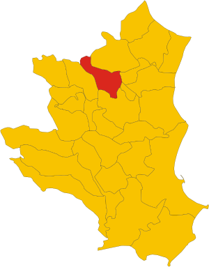
.svg)
Map of comune of Pallagorio (province of Crotone, region Calabria, Italy).svg
1,082 × 1,382; 75 KB
1,082 × 1,382; 75 KB
1 reference
KR
0 references


44.48 square kilometre
9 October 2011
5 references
Superficie di Comuni Province e Regioni italiane al 9 ottobre 2011 (Italian)
16 March 2019
1,211
1 January 2017
1 reference
1,164
1 January 2018
4 references
Popolazione Residente al 1° Gennaio 2018 (Italian)
16 March 2019

Identifiers
Q252909
0 references