Santo Stefano Roero (Q288135): Difference between revisions
Jump to navigation
Jump to search
(Removed claim: locator map image (P55): Mappa provincia IT-CN Santo Stefano Roero.png, Removing this statements since they changed in Wikidata) |
(Changed an Item: Adding these statements since they where added in Wikidata) |
||
| Property / locator map image | |||
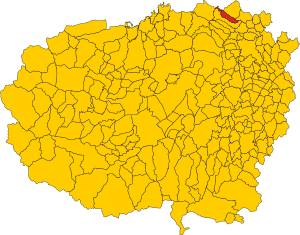
| Property / locator map image: Map of comune of Santo Stefano Roero (province of Cuneo, region Piedmont, Italy).svg / rank | |||
Normal rank | |||
Revision as of 22:40, 27 February 2023
Italian comune
| Language | Label | Description | Also known as |
|---|---|---|---|
| English | Santo Stefano Roero |
Italian comune |
Statements
CN
0 references
13.11 square kilometre
9 October 2011
5 references
Superficie di Comuni Province e Regioni italiane al 9 ottobre 2011 (Italian)
16 March 2019
1,380
1 January 2017
1,387
1 January 2018
4 references
Popolazione Residente al 1° Gennaio 2018 (Italian)
16 March 2019
1,380
1 January 2017
4 references
Popolazione Residente al 1° Gennaio 2017 (Italian)
9 September 2017
0 references
Identifiers
81000550046
0 references
Q288135
0 references


