Cinigiano (Q262962): Difference between revisions
Jump to navigation
Jump to search
(Changed an Item: updated beneficiary) |
(Changed label, description and/or aliases in el: The description in Wikidata changed) |
||||||||||||||
| (11 intermediate revisions by 2 users not shown) | |||||||||||||||
| label / ga | label / ga | ||||||||||||||
Cinigiano | |||||||||||||||
| label / el | label / el | ||||||||||||||
Τσινιτζάνο | |||||||||||||||
| description / el | description / el | ||||||||||||||
δήμος | ιταλικός δήμος στην Επαρχία του Γκροσσέτο | ||||||||||||||
| Property / located in the administrative territorial entity | Property / located in the administrative territorial entity | ||||||||||||||
| Property / instance of | |||||||||||||||
| Property / instance of: public beneficiary / rank | |||||||||||||||
Normal rank | |||||||||||||||
| Property / instance of: public beneficiary / qualifier | |||||||||||||||
| Property / patron saint | |||||||||||||||
| Property / patron saint: Michael / rank | |||||||||||||||
Normal rank | |||||||||||||||
| Property / patron saint: Michael / reference | |||||||||||||||
| Property / patron saint: Michael / reference | |||||||||||||||
| Property / twinned administrative body | |||||||||||||||
| Property / twinned administrative body: Montcuq-en-Quercy-Blanc / rank | |||||||||||||||
Normal rank | |||||||||||||||
| Property / Repetti on-line ID | |||||||||||||||
1315 | |||||||||||||||
| Property / Repetti on-line ID: 1315 / rank | |||||||||||||||
Normal rank | |||||||||||||||
| Property / office held by head of government | |||||||||||||||
| Property / office held by head of government: mayor of Cinigiano / rank | |||||||||||||||
Normal rank | |||||||||||||||
| Property / seismic classification | |||||||||||||||
| Property / seismic classification: 3 / rank | |||||||||||||||
Normal rank | |||||||||||||||
| Property / seismic classification: 3 / reference | |||||||||||||||
| Property / seismic classification: 3 / reference | |||||||||||||||
| Property / seismic classification: 3 / reference | |||||||||||||||
retrieved: 27 August 2022
| |||||||||||||||
| Property / EU Knowledge Graph item ID | |||||||||||||||
Q262962 | |||||||||||||||
| Property / EU Knowledge Graph item ID: Q262962 / rank | |||||||||||||||
Normal rank | |||||||||||||||
Latest revision as of 22:29, 7 February 2023
Italian comune
| Language | Label | Description | Also known as |
|---|---|---|---|
| English | Cinigiano |
Italian comune |
Statements
Cinigiano
0 references
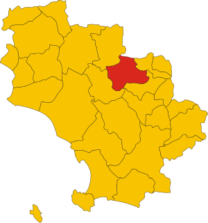
Map of comune of Cinigiano (province of Grosseto, region Tuscany, Italy).svg
3,918 × 4,187; 97 KB
3,918 × 4,187; 97 KB
1 reference
GR
0 references
161.55 square kilometre
9 October 2011
5 references
Superficie di Comuni Province e Regioni italiane al 9 ottobre 2011 (Italian)
16 March 2019
2,580
1 January 2017
1 reference
2,536
1 January 2018
4 references
Popolazione Residente al 1° Gennaio 2018 (Italian)
16 March 2019
Identifiers
117340539
0 references
1315
0 references
Q262962
0 references


