Fara San Martino (Q278064): Difference between revisions
Jump to navigation
Jump to search
(Removed claim: country (P32): Italy (Q15), Removing this statements since they changed in Wikidata) |
(Changed label, description and/or aliases in hu: The description in Wikidata changed) |
||||||||||||||
| (20 intermediate revisions by 2 users not shown) | |||||||||||||||
| label / it | label / it | ||||||||||||||
FARA SAN MARTINO | |||||||||||||||
| label / tr | label / tr | ||||||||||||||
Fara San Martino | |||||||||||||||
| label / da | label / da | ||||||||||||||
Fara San Martino | |||||||||||||||
| label / ga | label / ga | ||||||||||||||
Fara San Martino | |||||||||||||||
| description / da | description / da | ||||||||||||||
Kommune i Italien | |||||||||||||||
| description / hu | description / hu | ||||||||||||||
község Olaszországban | |||||||||||||||
| Property / instance of | |||||||||||||||
| Property / instance of: beneficiary / rank | |||||||||||||||
| Property / instance of | |||||||||||||||
| Property / instance of: commune of Italy / rank | |||||||||||||||
Normal rank | |||||||||||||||
| Property / instance of | |||||||||||||||
| Property / instance of: beneficiary / rank | |||||||||||||||
Preferred rank | |||||||||||||||
| Property / instance of | |||||||||||||||
| Property / instance of: public beneficiary / rank | |||||||||||||||
Normal rank | |||||||||||||||
| Property / instance of: public beneficiary / qualifier | |||||||||||||||
| Property / Commons category | |||||||||||||||
Fara San Martino | |||||||||||||||
| Property / Commons category: Fara San Martino / rank | |||||||||||||||
Normal rank | |||||||||||||||
| Property / located in the administrative territorial entity | |||||||||||||||
| Property / located in the administrative territorial entity: Province of Chieti / rank | |||||||||||||||
Normal rank | |||||||||||||||
| Property / located in the administrative territorial entity: Province of Chieti / reference | |||||||||||||||
| Property / shares border with | |||||||||||||||
| Property / shares border with: Caramanico Terme / rank | |||||||||||||||
Normal rank | |||||||||||||||
| Property / shares border with: Caramanico Terme / reference | |||||||||||||||
| Property / shares border with | |||||||||||||||
| Property / shares border with: Lama dei Peligni / rank | |||||||||||||||
Normal rank | |||||||||||||||
| Property / shares border with: Lama dei Peligni / reference | |||||||||||||||
| Property / shares border with | |||||||||||||||
| Property / shares border with: Palombaro / rank | |||||||||||||||
Normal rank | |||||||||||||||
| Property / shares border with: Palombaro / reference | |||||||||||||||
| Property / shares border with | |||||||||||||||
| Property / shares border with: Pennapiedimonte / rank | |||||||||||||||
Normal rank | |||||||||||||||
| Property / shares border with: Pennapiedimonte / reference | |||||||||||||||
| Property / shares border with | |||||||||||||||
| Property / shares border with: Sant'Eufemia a Maiella / rank | |||||||||||||||
Normal rank | |||||||||||||||
| Property / shares border with: Sant'Eufemia a Maiella / reference | |||||||||||||||
| Property / shares border with | |||||||||||||||
| Property / shares border with: Civitella Messer Raimondo / rank | |||||||||||||||
Normal rank | |||||||||||||||
| Property / shares border with | |||||||||||||||
| Property / shares border with: Pacentro / rank | |||||||||||||||
Normal rank | |||||||||||||||
| Property / shares border with: Pacentro / reference | |||||||||||||||
| Property / located in time zone | |||||||||||||||
| Property / located in time zone: UTC+01:00 / rank | |||||||||||||||
Normal rank | |||||||||||||||
| Property / located in time zone: UTC+01:00 / qualifier | |||||||||||||||
| Property / located in time zone: UTC+01:00 / reference | |||||||||||||||
| Property / located in time zone | |||||||||||||||
| Property / located in time zone: UTC+02:00 / rank | |||||||||||||||
Normal rank | |||||||||||||||
| Property / located in time zone: UTC+02:00 / qualifier | |||||||||||||||
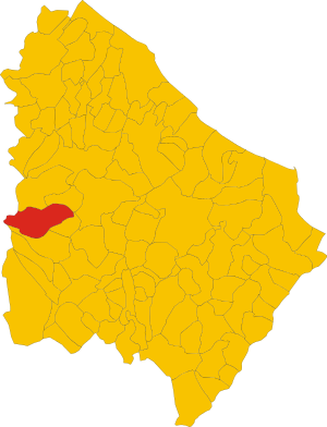
| Property / locator map image | |||||||||||||||
| Property / locator map image: Map of comune of Fara San Martino (province of Chieti, region Abruzzo, Italy).svg / rank | |||||||||||||||
Normal rank | |||||||||||||||
| Property / locator map image: Map of comune of Fara San Martino (province of Chieti, region Abruzzo, Italy).svg / reference | |||||||||||||||
| Property / postal code | |||||||||||||||
66015 | |||||||||||||||
| Property / postal code: 66015 / rank | |||||||||||||||
Normal rank | |||||||||||||||
| Property / postal code: 66015 / reference | |||||||||||||||
| Property / image | |||||||||||||||
| Property / image: Fara San Martino.jpg / rank | |||||||||||||||
Normal rank | |||||||||||||||
| Property / image: Fara San Martino.jpg / reference | |||||||||||||||
| Property / image | |||||||||||||||
| Property / image: Santissima Annunziata, Fara San Martino.JPG / rank | |||||||||||||||
Normal rank | |||||||||||||||
| Property / local dialing code | |||||||||||||||
0872 | |||||||||||||||
| Property / local dialing code: 0872 / rank | |||||||||||||||
Normal rank | |||||||||||||||
| Property / local dialing code: 0872 / reference | |||||||||||||||
| Property / ISTAT ID | |||||||||||||||
069031 | |||||||||||||||
| Property / ISTAT ID: 069031 / rank | |||||||||||||||
Normal rank | |||||||||||||||
| Property / ISTAT ID: 069031 / reference | |||||||||||||||
| Property / country | |||||||||||||||
| Property / country: Italy / rank | |||||||||||||||
Normal rank | |||||||||||||||
| Property / country: Italy / reference | |||||||||||||||
| Property / Italian cadastre code | |||||||||||||||
D495 | |||||||||||||||
| Property / Italian cadastre code: D495 / rank | |||||||||||||||
Normal rank | |||||||||||||||
| Property / Italian cadastre code: D495 / reference | |||||||||||||||
| Property / Freebase ID | |||||||||||||||
| Property / Freebase ID: /m/0fg2_7 / rank | |||||||||||||||
Normal rank | |||||||||||||||
| Property / Freebase ID: /m/0fg2_7 / reference | |||||||||||||||
| Property / Freebase ID: /m/0fg2_7 / reference | |||||||||||||||
publication date: 28 October 2013
| |||||||||||||||
| Property / GeoNames ID | |||||||||||||||
| Property / GeoNames ID: 6537478 / rank | |||||||||||||||
Normal rank | |||||||||||||||
| Property / GeoNames ID: 6537478 / reference | |||||||||||||||
| Property / topic's main category | |||||||||||||||
| Property / topic's main category: Category:Fara San Martino / rank | |||||||||||||||
Normal rank | |||||||||||||||
| Property / topic's main category: Category:Fara San Martino / reference | |||||||||||||||
| Property / official website | |||||||||||||||
| Property / official website: http://www.comune.faranovarese.no.it / rank | |||||||||||||||
Normal rank | |||||||||||||||
| Property / official website: http://www.comune.faranovarese.no.it / reference | |||||||||||||||
| Property / VIAF ID | |||||||||||||||
| Property / VIAF ID: 233950645 / rank | |||||||||||||||
Normal rank | |||||||||||||||
| Property / VIAF ID: 233950645 / reference | |||||||||||||||
| Property / VIAF ID: 233950645 / reference | |||||||||||||||
retrieved: 2 August 2015
| |||||||||||||||
| Property / elevation above sea level | |||||||||||||||
440±1 metre
| |||||||||||||||
| Property / elevation above sea level: 440±1 metre / rank | |||||||||||||||
Normal rank | |||||||||||||||
| Property / elevation above sea level: 440±1 metre / reference | |||||||||||||||
| Property / coordinate location | |||||||||||||||
42°5'27.60"N, 14°12'22.32"E
| |||||||||||||||
| Property / coordinate location: 42°5'27.60"N, 14°12'22.32"E / rank | |||||||||||||||
Normal rank | |||||||||||||||
| Property / coordinate location: 42°5'27.60"N, 14°12'22.32"E / reference | |||||||||||||||
| Property / WOEID | |||||||||||||||
| Property / WOEID: 715293 / rank | |||||||||||||||
Normal rank | |||||||||||||||
| Property / WOEID: 715293 / reference | |||||||||||||||
| Property / licence plate code | |||||||||||||||
CH | |||||||||||||||
| Property / licence plate code: CH / rank | |||||||||||||||
Normal rank | |||||||||||||||
| Property / coordinates of northernmost point | |||||||||||||||
42°7'10.931"N, 14°11'29.911"E
| |||||||||||||||
| Property / coordinates of northernmost point: 42°7'10.931"N, 14°11'29.911"E / rank | |||||||||||||||
Normal rank | |||||||||||||||
| Property / coordinates of northernmost point: 42°7'10.931"N, 14°11'29.911"E / reference | |||||||||||||||
| Property / coordinates of southernmost point | |||||||||||||||
42°3'47.689"N, 14°9'10.915"E
| |||||||||||||||
| Property / coordinates of southernmost point: 42°3'47.689"N, 14°9'10.915"E / rank | |||||||||||||||
Normal rank | |||||||||||||||
| Property / coordinates of southernmost point: 42°3'47.689"N, 14°9'10.915"E / reference | |||||||||||||||
| Property / coordinates of easternmost point | |||||||||||||||
42°5'55.684"N, 14°14'11.249"E
| |||||||||||||||
| Property / coordinates of easternmost point: 42°5'55.684"N, 14°14'11.249"E / rank | |||||||||||||||
Normal rank | |||||||||||||||
| Property / coordinates of easternmost point: 42°5'55.684"N, 14°14'11.249"E / reference | |||||||||||||||
| Property / coordinates of westernmost point | |||||||||||||||
42°5'27.845"N, 14°5'2.814"E
| |||||||||||||||
| Property / coordinates of westernmost point: 42°5'27.845"N, 14°5'2.814"E / rank | |||||||||||||||
Normal rank | |||||||||||||||
| Property / coordinates of westernmost point: 42°5'27.845"N, 14°5'2.814"E / reference | |||||||||||||||
| Property / OSM relation ID | |||||||||||||||
| Property / OSM relation ID: 41766 / rank | |||||||||||||||
Normal rank | |||||||||||||||
| Property / UN/LOCODE | |||||||||||||||
| Property / UN/LOCODE: ITZJB / rank | |||||||||||||||
Normal rank | |||||||||||||||
| Property / capital | |||||||||||||||
| Property / capital: Fara San Martino / rank | |||||||||||||||
Normal rank | |||||||||||||||
| Property / area | |||||||||||||||
44.69 square kilometre
| |||||||||||||||
| Property / area: 44.69 square kilometre / rank | |||||||||||||||
Normal rank | |||||||||||||||
| Property / area: 44.69 square kilometre / qualifier | |||||||||||||||
point in time: 9 October 2011
| |||||||||||||||
| Property / area: 44.69 square kilometre / reference | |||||||||||||||
| Property / area: 44.69 square kilometre / reference | |||||||||||||||
| Property / area: 44.69 square kilometre / reference | |||||||||||||||
title: Superficie di Comuni Province e Regioni italiane al 9 ottobre 2011 (Italian) | |||||||||||||||
| Property / area: 44.69 square kilometre / reference | |||||||||||||||
retrieved: 16 March 2019
| |||||||||||||||
| Property / area: 44.69 square kilometre / reference | |||||||||||||||
| Property / population | |||||||||||||||
1,399
| |||||||||||||||
| Property / population: 1,399 / rank | |||||||||||||||
Normal rank | |||||||||||||||
| Property / population: 1,399 / qualifier | |||||||||||||||
point in time: 1 January 2017
| |||||||||||||||
| Property / population: 1,399 / qualifier | |||||||||||||||
| Property / population: 1,399 / reference | |||||||||||||||
| Property / population | |||||||||||||||
1,379
| |||||||||||||||
| Property / population: 1,379 / rank | |||||||||||||||
Preferred rank | |||||||||||||||
| Property / population: 1,379 / qualifier | |||||||||||||||
point in time: 1 January 2018
| |||||||||||||||
| Property / population: 1,379 / qualifier | |||||||||||||||
| Property / population: 1,379 / reference | |||||||||||||||
| Property / population: 1,379 / reference | |||||||||||||||
title: Popolazione Residente al 1° Gennaio 2018 (Italian) | |||||||||||||||
| Property / population: 1,379 / reference | |||||||||||||||
retrieved: 16 March 2019
| |||||||||||||||
| Property / population: 1,379 / reference | |||||||||||||||
| Property / twinned administrative body | |||||||||||||||
| Property / twinned administrative body: Senglea / rank | |||||||||||||||
Normal rank | |||||||||||||||
| Property / twinned administrative body: Senglea / reference | |||||||||||||||
| Property / IndicePA ID | |||||||||||||||
| Property / IndicePA ID: C_D495 / rank | |||||||||||||||
Normal rank | |||||||||||||||
| Property / Who's on First ID | |||||||||||||||
| Property / Who's on First ID: 101799645 / rank | |||||||||||||||
Normal rank | |||||||||||||||
| Property / Wiki Loves Monuments ID | |||||||||||||||
13D4950000 | |||||||||||||||
| Property / Wiki Loves Monuments ID: 13D4950000 / rank | |||||||||||||||
Normal rank | |||||||||||||||
| Property / Wiki Loves Monuments ID: 13D4950000 / qualifier | |||||||||||||||
start time: 1 September 2020
| |||||||||||||||
| Property / Wiki Loves Monuments ID: 13D4950000 / reference | |||||||||||||||
| Property / patron saint | |||||||||||||||
| Property / patron saint: Anthony of Padua / rank | |||||||||||||||
Normal rank | |||||||||||||||
| Property / patron saint: Anthony of Padua / reference | |||||||||||||||
| Property / patron saint: Anthony of Padua / reference | |||||||||||||||
| Property / De Agostini ID | |||||||||||||||
| Property / De Agostini ID: Fara+San+Martino / rank | |||||||||||||||
Normal rank | |||||||||||||||
| Property / De Agostini ID: Fara+San+Martino / qualifier | |||||||||||||||
named as: Fara San Martino | |||||||||||||||
| Property / page banner | |||||||||||||||
| Property / page banner: Fara San Martino (cropped).jpg / rank | |||||||||||||||
Normal rank | |||||||||||||||
| Property / seismic classification | |||||||||||||||
| Property / seismic classification: 1 / rank | |||||||||||||||
Normal rank | |||||||||||||||
| Property / seismic classification: 1 / reference | |||||||||||||||
| Property / seismic classification: 1 / reference | |||||||||||||||
| Property / seismic classification: 1 / reference | |||||||||||||||
retrieved: 27 August 2022
| |||||||||||||||
| Property / EU Knowledge Graph item ID | |||||||||||||||
Q278064 | |||||||||||||||
| Property / EU Knowledge Graph item ID: Q278064 / rank | |||||||||||||||
Normal rank | |||||||||||||||
| Property / native label | |||||||||||||||
Fara San Martino (Italian) | |||||||||||||||
| Property / native label: Fara San Martino (Italian) / rank | |||||||||||||||
Normal rank | |||||||||||||||
| Property / native label: Fara San Martino (Italian) / reference | |||||||||||||||
| Property / native label: Fara San Martino (Italian) / reference | |||||||||||||||
| Property / official name | |||||||||||||||
Fara San Martino (Italian) | |||||||||||||||
| Property / official name: Fara San Martino (Italian) / rank | |||||||||||||||
Normal rank | |||||||||||||||
| Property / official name: Fara San Martino (Italian) / reference | |||||||||||||||
| Property / official name: Fara San Martino (Italian) / reference | |||||||||||||||
| links / trwiki / name | links / trwiki / name | ||||||||||||||
Latest revision as of 18:06, 18 November 2022
Italian comune
| Language | Label | Description | Also known as |
|---|---|---|---|
| English | Fara San Martino |
Italian comune |
Statements

Fara San Martino
0 references
.svg)
Map of comune of Fara San Martino (province of Chieti, region Abruzzo, Italy).svg
2,502 × 3,273; 158 KB
2,502 × 3,273; 158 KB
1 reference


CH
0 references


.svg)
.jpg)
44.69 square kilometre
9 October 2011
5 references
Superficie di Comuni Province e Regioni italiane al 9 ottobre 2011 (Italian)
16 March 2019
1,399
1 January 2017
1 reference
1,379
1 January 2018
4 references
Popolazione Residente al 1° Gennaio 2018 (Italian)
16 March 2019
.jpg)
Fara San Martino (Italian)
Fara San Martino (Italian)
Identifiers
228320693
0 references
Q278064
0 references