Solihull (Q2549940): Difference between revisions
Jump to navigation
Jump to search

(Changed an Item: Set NUTS as 2021) |
(Removed claims: Removing this statements since they changed in Wikidata) |
||||||||||||||
| Property / population | |||||||||||||||
| |||||||||||||||
| Property / population: 210,400 / rank | |||||||||||||||
| Property / population: 210,400 / qualifier | |||||||||||||||
| |||||||||||||||
| Property / population: 210,400 / qualifier | |||||||||||||||
| Property / population: 210,400 / reference | |||||||||||||||
| Property / population | |||||||||||||||
| |||||||||||||||
| Property / population: 214,909 / rank | |||||||||||||||
| Property / population: 214,909 / qualifier | |||||||||||||||
| |||||||||||||||
| Property / population: 214,909 / qualifier | |||||||||||||||
| Property / population: 214,909 / reference | |||||||||||||||
Revision as of 13:14, 14 August 2022
district in the West Midlands, England
- Metropolitan Borough of Solihull
| Language | Label | Description | Also known as |
|---|---|---|---|
| English | Solihull |
district in the West Midlands, England |
|
Statements


Solihull UK locator map.svg
1,425 × 974; 720 KB
1,425 × 974; 720 KB
Emplacement du district de Solihull dans le comté des West Midlands (French)
1 reference

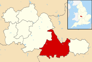
EnglandSolihull.png
200 × 247; 31 KB
200 × 247; 31 KB
Localisation du district métropolitain de Solihull. (French)
0 references
178.2821 square kilometre
2016
Solihull (English)


Identifiers
UKM2
5 references
30 December 2013
List of FIPS region codes (S-U) (English)
7000000000000009
0 references
GB.SI
0 references